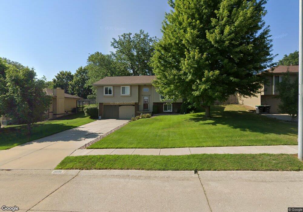
13029 Crown Point Ave Omaha, NE 68164
Standing Bear NeighborhoodEstimated Value: $260,000 - $278,000
3
Beds
3
Baths
1,397
Sq Ft
$193/Sq Ft
Est. Value
About This Home
This home is located at 13029 Crown Point Ave, Omaha, NE 68164 and is currently estimated at $270,102, approximately $193 per square foot. 13029 Crown Point Ave is a home located in Douglas County with nearby schools including Prairie Wind Elementary School, Alfonza W. Davis Middle School, and St Vincent De Paul School.
Ownership History
Date
Name
Owned For
Owner Type
Purchase Details
Closed on
Mar 24, 2021
Sold by
Sneckenberg Amanda Jo and Sneckenberg Ryan Joseph
Bought by
Sneckenberg Amanda Jo and Sneckenberg Ryan Joseph
Current Estimated Value
Home Financials for this Owner
Home Financials are based on the most recent Mortgage that was taken out on this home.
Original Mortgage
$145,000
Outstanding Balance
$107,690
Interest Rate
2.8%
Mortgage Type
New Conventional
Estimated Equity
$162,412
Purchase Details
Closed on
Mar 24, 2010
Sold by
Richardson Heidi M and Farnum Heidi M
Bought by
Backora Amanda
Home Financials for this Owner
Home Financials are based on the most recent Mortgage that was taken out on this home.
Original Mortgage
$127,645
Interest Rate
5.25%
Mortgage Type
FHA
Create a Home Valuation Report for This Property
The Home Valuation Report is an in-depth analysis detailing your home's value as well as a comparison with similar homes in the area
Home Values in the Area
Average Home Value in this Area
Purchase History
| Date | Buyer | Sale Price | Title Company |
|---|---|---|---|
| Sneckenberg Amanda Jo | -- | Charter Title & Escrow | |
| Backora Amanda | $130,000 | None Available |
Source: Public Records
Mortgage History
| Date | Status | Borrower | Loan Amount |
|---|---|---|---|
| Open | Sneckenberg Amanda Jo | $145,000 | |
| Closed | Backora Amanda | $127,645 |
Source: Public Records
Tax History Compared to Growth
Tax History
| Year | Tax Paid | Tax Assessment Tax Assessment Total Assessment is a certain percentage of the fair market value that is determined by local assessors to be the total taxable value of land and additions on the property. | Land | Improvement |
|---|---|---|---|---|
| 2025 | $3,494 | $238,800 | $30,300 | $208,500 |
| 2024 | $4,559 | $216,100 | $30,300 | $185,800 |
| 2023 | $4,559 | $216,100 | $30,300 | $185,800 |
| 2022 | $3,541 | $165,900 | $30,300 | $135,600 |
| 2021 | $3,511 | $165,900 | $30,300 | $135,600 |
| 2020 | $3,207 | $149,800 | $30,300 | $119,500 |
| 2019 | $2,912 | $135,600 | $30,600 | $105,000 |
| 2018 | $2,916 | $135,600 | $30,600 | $105,000 |
| 2017 | $2,918 | $121,100 | $30,600 | $90,500 |
| 2016 | $2,918 | $136,000 | $18,700 | $117,300 |
| 2015 | $2,691 | $127,100 | $17,500 | $109,600 |
| 2014 | $2,691 | $127,100 | $17,500 | $109,600 |
Source: Public Records
Map
Nearby Homes
- 13041 Crown Point Ave
- 12934 Hartman Ave
- 6217 N 131st Ave
- 13222 Ellison Ave
- 6201 N 132nd St
- 5417 N 134th Ave
- 5403 N 134th Ave
- 12630 Park Lane Cir
- 12933 Camden Ave
- 13484 Camden Ave
- 12959 Redman Cir
- 13708 Camden Ave
- 13521 Whitmore St
- 13502 Whitmore St
- Edmon Plan at Westbrook Hills
- Hamilton Plan at Westbrook Hills
- Fremont Plan at Westbrook Hills
- 5121 N 137th St
- 13611 Whitmore St
- 13760 Camden Ave
- 13023 Crown Point Ave
- 13035 Crown Point Ave
- 13024 Laurel Ave
- 13018 Laurel Ave
- 13017 Crown Point Ave
- 13030 Laurel Ave
- 13012 Laurel Ave
- 13011 Crown Point Ave
- 13036 Laurel Ave
- 13006 Laurel Ave
- 13047 Crown Point Ave
- 13005 Crown Point Ave
- 13042 Laurel Ave
- 12948 Laurel Ave
- 13019 Laurel Ave
- 13025 Laurel Ave
- 13013 Laurel Ave
- 13031 Laurel Ave
- 13007 Laurel Ave
- 12947 Crown Point Ave