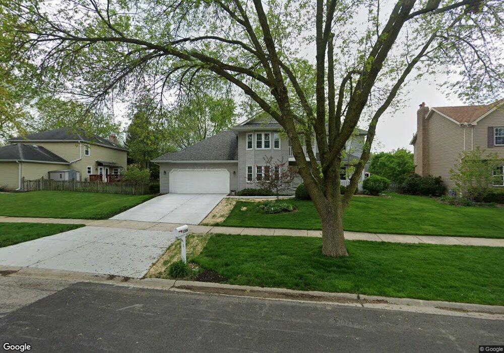
1304 Redfield Rd Naperville, IL 60563
Brookdale NeighborhoodEstimated Value: $650,353 - $675,000
4
Beds
3
Baths
2,562
Sq Ft
$258/Sq Ft
Est. Value
About This Home
This home is located at 1304 Redfield Rd, Naperville, IL 60563 and is currently estimated at $661,838, approximately $258 per square foot. 1304 Redfield Rd is a home located in DuPage County with nearby schools including Brookdale Elementary School, Thayer J. Hill Middle School, and Metea Valley High School.
Ownership History
Date
Name
Owned For
Owner Type
Purchase Details
Closed on
Aug 8, 2024
Sold by
Lin Thomas To and Lin Su-Hwa Chen
Bought by
To Thomas And Suhwa Lin Trust and Lin
Current Estimated Value
Purchase Details
Closed on
Oct 22, 1993
Sold by
Lasalle National Trust
Bought by
Chen Lin Thomas To and Chen Lin Su-Hwa
Home Financials for this Owner
Home Financials are based on the most recent Mortgage that was taken out on this home.
Original Mortgage
$120,000
Interest Rate
7.02%
Create a Home Valuation Report for This Property
The Home Valuation Report is an in-depth analysis detailing your home's value as well as a comparison with similar homes in the area
Home Values in the Area
Average Home Value in this Area
Purchase History
| Date | Buyer | Sale Price | Title Company |
|---|---|---|---|
| To Thomas And Suhwa Lin Trust | -- | None Listed On Document | |
| Chen Lin Thomas To | $193,000 | -- |
Source: Public Records
Mortgage History
| Date | Status | Borrower | Loan Amount |
|---|---|---|---|
| Previous Owner | Chen Lin Thomas To | $120,000 |
Source: Public Records
Tax History Compared to Growth
Tax History
| Year | Tax Paid | Tax Assessment Tax Assessment Total Assessment is a certain percentage of the fair market value that is determined by local assessors to be the total taxable value of land and additions on the property. | Land | Improvement |
|---|---|---|---|---|
| 2024 | $10,720 | $187,746 | $45,184 | $142,562 |
| 2023 | $10,745 | $168,700 | $40,600 | $128,100 |
| 2022 | $10,338 | $157,270 | $37,530 | $119,740 |
| 2021 | $10,012 | $151,660 | $36,190 | $115,470 |
| 2020 | $9,999 | $151,660 | $36,190 | $115,470 |
| 2019 | $9,605 | $144,240 | $34,420 | $109,820 |
| 2018 | $9,730 | $143,450 | $33,550 | $109,900 |
| 2017 | $9,462 | $138,580 | $32,410 | $106,170 |
| 2016 | $9,290 | $132,990 | $31,100 | $101,890 |
| 2015 | $9,203 | $126,270 | $29,530 | $96,740 |
| 2014 | $9,028 | $119,890 | $27,810 | $92,080 |
| 2013 | $9,008 | $120,720 | $28,000 | $92,720 |
Source: Public Records
Map
Nearby Homes
- 5S022 Raymond Dr
- 1106 Langley Cir
- 1887 Paddington Ave Unit 3
- 5S040 Pebblewood Ln Unit E103
- 873 Quin Ct Unit 202
- 2911 Dearborn Ct
- 30W162 Claymore Ln
- 1105 W Bauer Rd
- 1748 Windward Ave Unit 92
- 2805 Bond Cir
- 920 Charlton Ln Unit 5106
- 30W214 Briar Ln
- 1022 Neudearborn Ln Unit 19-1022
- 30W289 Pinehurst Dr Unit 289
- 2084 Maplewood Cir
- 2011 Maplewood Cir
- 1117 Summit Hills Ln
- 1432 Calcutta Ln
- 5S353 Stewart Dr
- 967 W Bauer Rd
- 1601 Trent Ave
- 1308 Redfield Rd
- 1604 Kirby Ct
- 1608 Kirby Ct
- 1312 Redfield Rd
- 1600 Kirby Ct
- 1612 Kirby Ct
- 1268 Redfield Rd
- 1604 Trent Ave
- 1608 Trent Ave
- 1264 Redfield Rd
- 1621 Kirby Ct
- 1605 Kirby Ct
- 1601 Kirby Ct
- 1612 Trent Ave
- 1613 Kirby Ct
- 30W002 Brayman Ct
- 30W030 Brayman Ct
- 1609 Kirby Ct
- 1617 Kirby Ct