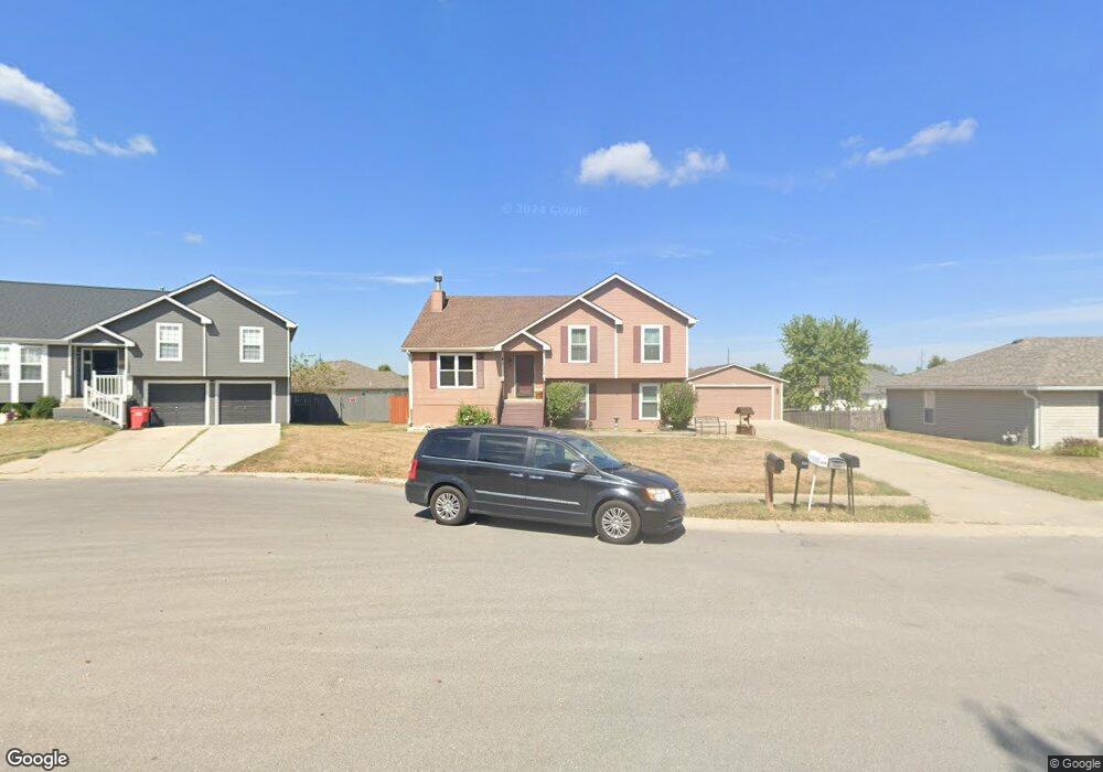
1304 SW Dean Dr Grain Valley, MO 64029
Estimated Value: $287,237 - $312,000
3
Beds
2
Baths
1,342
Sq Ft
$226/Sq Ft
Est. Value
About This Home
This home is located at 1304 SW Dean Dr, Grain Valley, MO 64029 and is currently estimated at $302,809, approximately $225 per square foot. 1304 SW Dean Dr is a home located in Jackson County with nearby schools including Grain Valley High School.
Ownership History
Date
Name
Owned For
Owner Type
Purchase Details
Closed on
May 29, 2021
Sold by
Caldwell Jerrod D and Caldwell Jerrodd D
Bought by
Caldwell Jerrod D
Current Estimated Value
Home Financials for this Owner
Home Financials are based on the most recent Mortgage that was taken out on this home.
Original Mortgage
$153,000
Interest Rate
2.9%
Mortgage Type
New Conventional
Purchase Details
Closed on
Oct 20, 2016
Sold by
Caldwell Jerrodd D and Caldwell Jarrod D
Bought by
Caldwell Jerrodd D
Purchase Details
Closed on
Feb 24, 2012
Sold by
Caldwell Jerrod D and Caldwell Stacie L
Bought by
Caldwell Jerrod D
Home Financials for this Owner
Home Financials are based on the most recent Mortgage that was taken out on this home.
Original Mortgage
$123,573
Interest Rate
3.93%
Mortgage Type
FHA
Create a Home Valuation Report for This Property
The Home Valuation Report is an in-depth analysis detailing your home's value as well as a comparison with similar homes in the area
Home Values in the Area
Average Home Value in this Area
Purchase History
| Date | Buyer | Sale Price | Title Company |
|---|---|---|---|
| Caldwell Jerrod D | -- | None Available | |
| Caldwell Jerrodd D | -- | None Available | |
| Caldwell Jerrod D | -- | Assured Quality Title Co |
Source: Public Records
Mortgage History
| Date | Status | Borrower | Loan Amount |
|---|---|---|---|
| Closed | Caldwell Jerrod D | $153,000 | |
| Closed | Caldwell Jerrod D | $123,573 |
Source: Public Records
Tax History Compared to Growth
Tax History
| Year | Tax Paid | Tax Assessment Tax Assessment Total Assessment is a certain percentage of the fair market value that is determined by local assessors to be the total taxable value of land and additions on the property. | Land | Improvement |
|---|---|---|---|---|
| 2025 | $2,898 | $37,941 | $7,735 | $30,206 |
| 2024 | $2,790 | $35,190 | $3,469 | $31,721 |
| 2023 | $2,790 | $35,190 | $4,123 | $31,067 |
| 2022 | $2,601 | $28,690 | $5,045 | $23,645 |
| 2021 | $2,540 | $28,690 | $5,045 | $23,645 |
| 2020 | $2,565 | $28,580 | $5,045 | $23,535 |
| 2019 | $2,513 | $28,580 | $5,045 | $23,535 |
| 2018 | $1,459,979 | $26,359 | $3,341 | $23,018 |
| 2017 | $2,417 | $26,359 | $3,341 | $23,018 |
| 2016 | $2,417 | $25,697 | $3,537 | $22,160 |
| 2014 | $2,388 | $25,194 | $3,468 | $21,726 |
Source: Public Records
Map
Nearby Homes
- 1418 SW Blue Branch Dr
- 401 S Minter Rd
- 509 SW Joseph Ct
- 1024 Christie Ln
- 1215 SW Lone Star Ct
- 719 S Minter Rd
- 1402 NW Broadway Throughway
- 1214 SW Windcrest Ct
- 636 SW Lakeview Dr
- 1219 SW Windcrest Ct
- 1309 SW Graystone Cir
- 200 Cross Creek Ln
- 209 SW Cross Creek Dr
- 29605 SW Eagles Pkwy
- 6205 Chiles Rd
- 29800 E 65th St
- 1203 SW Lakeview Dr
- 1235 NW Ashley Ln
- 714 SW Brome Dr
- 207 Pebblebrook St
- 1306 SW Dean Dr
- 1302 SW Dean Dr
- 1327 SW Stoneybrooke Dr
- 1325 SW Stoneybrooke Dr
- 1308 SW Dean Dr
- 1300 SW Dean Dr
- 1303 SW Dean Dr
- 1321 SW Stoneybrooke Dr
- 1329 SW Stoneybrooke Dr
- 1305 SW Dean Dr
- 1307 SW Dean Dr
- 1317 SW Stoneybrooke Dr
- 404 SW Joseph Ln
- 1214 SW Dean Dr
- 1333 SW Stoneybrooke Dr
- 1315 SW Stoneybrooke Dr
- 311 S Minter Rd
- 1313 SW Stoneybrooke Dr
- 1337 SW Stoneybrooke Dr
- 1212 SW Dean Dr