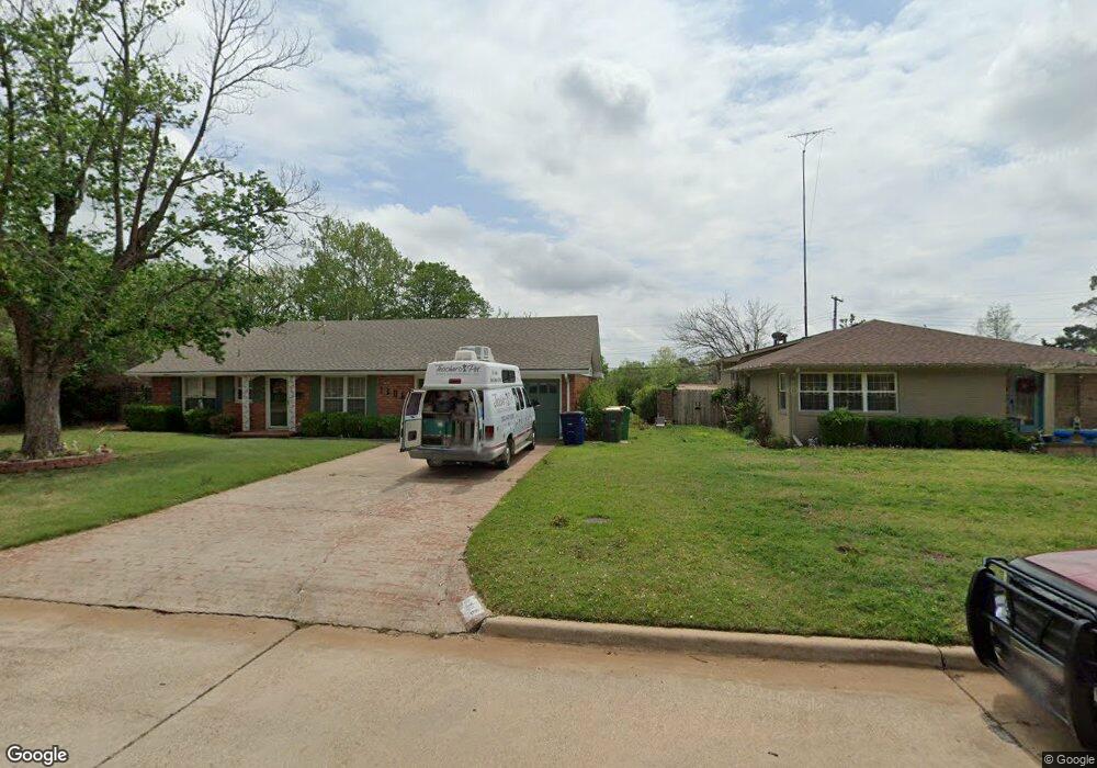
1306 Normandy Rd Duncan, OK 73533
Estimated Value: $144,266 - $218,000
3
Beds
2
Baths
1,385
Sq Ft
$125/Sq Ft
Est. Value
About This Home
This home is located at 1306 Normandy Rd, Duncan, OK 73533 and is currently estimated at $173,317, approximately $125 per square foot. 1306 Normandy Rd is a home located in Stephens County with nearby schools including Emerson Elementary School, Duncan Middle School, and Duncan High School.
Ownership History
Date
Name
Owned For
Owner Type
Purchase Details
Closed on
Jan 21, 2020
Sold by
King Cliff and Adams Fomerly
Bought by
Adams Lanny Don
Current Estimated Value
Purchase Details
Closed on
Jun 6, 2018
Sold by
Adams Larry
Bought by
King Martha Louise and King Cliff
Purchase Details
Closed on
Jul 13, 2017
Sold by
Adams Matha Louise
Bought by
King Martha Louise Adams and King Cliff
Purchase Details
Closed on
Mar 20, 2012
Sold by
Adams Martha Louise
Bought by
Adams Martha Louise
Create a Home Valuation Report for This Property
The Home Valuation Report is an in-depth analysis detailing your home's value as well as a comparison with similar homes in the area
Purchase History
| Date | Buyer | Sale Price | Title Company |
|---|---|---|---|
| Adams Lanny Don | -- | None Available | |
| King Martha Louise | -- | None Available | |
| King Martha Louise | -- | None Available | |
| King Martha Louise Adams | -- | None Available | |
| Adams Martha Louise | -- | -- |
Source: Public Records
Tax History
| Year | Tax Paid | Tax Assessment Tax Assessment Total Assessment is a certain percentage of the fair market value that is determined by local assessors to be the total taxable value of land and additions on the property. | Land | Improvement |
|---|---|---|---|---|
| 2025 | $1,134 | $14,449 | $1,636 | $12,813 |
| 2024 | $1,155 | $14,561 | $1,592 | $12,969 |
| 2023 | $1,155 | $14,560 | $1,341 | $13,219 |
| 2022 | $1,233 | $15,232 | $1,636 | $13,596 |
| 2021 | $1,158 | $13,598 | $1,636 | $11,962 |
| 2020 | $1,021 | $12,822 | $1,636 | $11,186 |
| 2019 | $993 | $12,477 | $1,636 | $10,841 |
| 2018 | $1,022 | $12,479 | $1,636 | $10,843 |
| 2017 | $991 | $12,533 | $1,411 | $11,122 |
| 2016 | $949 | $12,168 | $1,636 | $10,532 |
| 2015 | $873 | $11,989 | $1,636 | $10,353 |
| 2014 | $873 | $11,640 | $1,636 | $10,004 |
Source: Public Records
Map
Nearby Homes
- 1312 Mccasland Pkwy
- 1216 N 8th St
- 1061 N 8th St
- 907 Hillcrest Dr
- 1205 N 11th St
- 1001 W Jones Ave
- 1125 Peck Ave
- 1423 N 7th St
- 1202 N 12th St
- 1112 N 12th St
- 1506 Crescent Dr
- 1112 N 4th St
- 1110 Crescent Dr
- 1606 Indian Terrace
- 905 W Pine Ave
- 1309 W Spruce Ave
- 1275 N 10th St
- 512 W Pine Ave
- 1706 Northridge Dr
- 1449 W Will Rogers Dr
- 1308 Normandy Rd
- 1304 Normandy Rd
- 1312 Normandy Ct
- 1310 Normandy Rd
- 1309 Normandy Rd
- 1311 Normandy Rd
- 1307 Normandy Rd
- 1313 Normandy Rd
- 1314 Normandy Ct
- 1305 Normandy Rd
- 1320 Normandy Ct
- 1315 Normandy Rd
- 1303 Normandy Rd
- 1310 1310 McCasland Pkwy
- 1316 Normandy Ct
- 1317 Normandy Rd
- 1314 Normandy Rd
- 1308 Mccasland Pkwy
- 1444 N 8th St
- 1444 1444 N 8th St
Your Personal Tour Guide
Ask me questions while you tour the home.