Estimated Value: $1,442,000 - $2,804,272
3
Beds
3
Baths
860
Sq Ft
$2,512/Sq Ft
Est. Value
About This Home
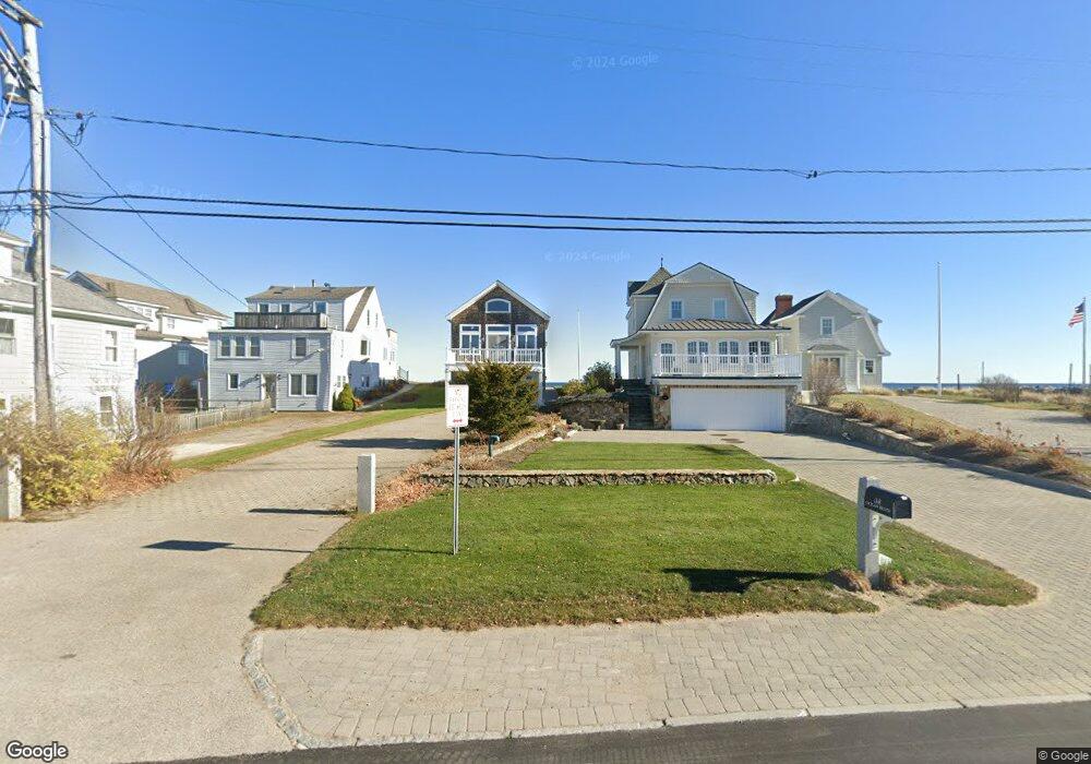
This home is located at 1306 Ocean Blvd, Rye, NH 03870 and is currently estimated at $2,160,091, approximately $2,511 per square foot. 1306 Ocean Blvd is a home located in Rockingham County with nearby schools including Rye Elementary School and Rye Junior High School.
Ownership History
Date
Name
Owned For
Owner Type
Purchase Details
Closed on
Apr 30, 2007
Sold by
Mckenna Daniel J Est
Bought by
Chase Paul R and Chase Martha B
Current Estimated Value
Purchase Details
Closed on
Jun 21, 1999
Sold by
Clark John R
Bought by
Mckenna Daniel J and Mckenna Mamcy E
Home Financials for this Owner
Home Financials are based on the most recent Mortgage that was taken out on this home.
Original Mortgage
$252,000
Interest Rate
6.99%
Mortgage Type
Purchase Money Mortgage
Create a Home Valuation Report for This Property
The Home Valuation Report is an in-depth analysis detailing your home's value as well as a comparison with similar homes in the area
Home Values in the Area
Average Home Value in this Area
Purchase History
| Date | Buyer | Sale Price | Title Company |
|---|---|---|---|
| Chase Paul R | $950,000 | -- | |
| Mckenna Daniel J | $315,000 | -- |
Source: Public Records
Mortgage History
| Date | Status | Borrower | Loan Amount |
|---|---|---|---|
| Previous Owner | Mckenna Daniel J | $252,000 |
Source: Public Records
Tax History
| Year | Tax Paid | Tax Assessment Tax Assessment Total Assessment is a certain percentage of the fair market value that is determined by local assessors to be the total taxable value of land and additions on the property. | Land | Improvement |
|---|---|---|---|---|
| 2024 | $25,965 | $2,998,300 | $2,745,800 | $252,500 |
| 2023 | $24,076 | $2,998,300 | $2,745,800 | $252,500 |
| 2022 | $20,928 | $2,998,300 | $2,745,800 | $252,500 |
| 2021 | $19,254 | $1,884,000 | $1,696,200 | $187,800 |
| 2020 | $19,254 | $1,884,000 | $1,696,200 | $187,800 |
| 2019 | $19,248 | $1,883,400 | $1,696,200 | $187,200 |
| 2018 | $19,041 | $1,883,400 | $1,696,200 | $187,200 |
| 2017 | $19,041 | $1,883,400 | $1,696,200 | $187,200 |
| 2016 | $16,968 | $1,588,800 | $1,370,600 | $218,200 |
| 2013 | $15,043 | $1,371,300 | $1,233,500 | $137,800 |
Source: Public Records
Map
Nearby Homes
- 1215 Ocean Blvd Unit 5
- 1193 Ocean Blvd
- 1191 - 1193 Ocean Blvd
- 1591 Ocean Blvd
- 1643 Ocean Blvd
- 46 Fowler Dr
- 137 Clark Rd
- 389 Sagamore Rd
- 763 Ocean Blvd
- 236 Sagamore Rd
- 665 Wallis Rd Unit 2
- 267 Pioneer Rd
- 14 Sagamore Rd Unit 3
- 4 Sagamore Rd
- 104 Odiorne Point Rd
- 49 Jenness Ave
- 239 Gosport Rd
- 1155 Sagamore Ave Unit 2
- 1155 Sagamore Ave Unit 3
- 1 Pheasant Ln
- 1304 Ocean Blvd
- 1308 Ocean Blvd
- 1310 Ocean Blvd
- 1296 Ocean Blvd
- 1300 Ocean Blvd
- 1300 Ocean Blvd Unit 3
- 1300 Ocean Blvd Unit 1
- 1292 Ocean Blvd
- 1314 Ocean Blvd
- 1284 Ocean Blvd
- 1286 Ocean Blvd
- 1324 Ocean Blvd
- 1282 Ocean Blvd
- 1278 Ocean Blvd
- 1313 Ocean Blvd
- 1313 Ocean Blvd Unit 6
- 1313 Ocean Blvd Unit 4
- 1313 Ocean Blvd Unit 3
- 1274 Ocean Blvd
- 1270 Ocean Blvd Unit A
Your Personal Tour Guide
Ask me questions while you tour the home.