13069 116th Ave Davenport, IA 52804
Outer Davenport/Bettendorf NeighborhoodEstimated Value: $311,667
4
Beds
3
Baths
1,745
Sq Ft
$179/Sq Ft
Est. Value
About This Home
This home is located at 13069 116th Ave, Davenport, IA 52804 and is currently priced at $311,667, approximately $178 per square foot. 13069 116th Ave is a home located in Scott County with nearby schools including Buffalo Elementary School, Walcott Intermediate School, and West High School.
Ownership History
Date
Name
Owned For
Owner Type
Purchase Details
Closed on
Oct 29, 2007
Sold by
Phc Development Llc
Bought by
Proehl Gilbert L and Proehl Annie L
Current Estimated Value
Home Financials for this Owner
Home Financials are based on the most recent Mortgage that was taken out on this home.
Original Mortgage
$270,000
Interest Rate
6.45%
Mortgage Type
Construction
Create a Home Valuation Report for This Property
The Home Valuation Report is an in-depth analysis detailing your home's value as well as a comparison with similar homes in the area
Home Values in the Area
Average Home Value in this Area
Purchase History
| Date | Buyer | Sale Price | Title Company |
|---|---|---|---|
| Proehl Gilbert L | $58,500 | None Available |
Source: Public Records
Mortgage History
| Date | Status | Borrower | Loan Amount |
|---|---|---|---|
| Open | Proehl Gilbert L | $41,500 | |
| Open | Proehl Gilbert L | $272,000 | |
| Closed | Proehl Gilbert L | $45,000 | |
| Closed | Proehl Gilbert L | $271,050 | |
| Closed | Proehl Gilbert L | $39,669 | |
| Closed | Proehl Gilbert L | $259,000 | |
| Closed | Proehl Gilbert L | $256,500 | |
| Closed | Proehl Gilbert L | $270,000 |
Source: Public Records
Tax History Compared to Growth
Tax History
| Year | Tax Paid | Tax Assessment Tax Assessment Total Assessment is a certain percentage of the fair market value that is determined by local assessors to be the total taxable value of land and additions on the property. | Land | Improvement |
|---|---|---|---|---|
| 2023 | -- | $0 | $0 | $0 |
| 2022 | $0 | $0 | $0 | $0 |
| 2021 | $0 | $0 | $0 | $0 |
| 2020 | $4,008 | $283,270 | $52,000 | $231,270 |
| 2019 | $3,982 | $278,740 | $52,000 | $226,740 |
| 2018 | $3,894 | $278,740 | $52,000 | $226,740 |
| 2017 | $3,878 | $278,740 | $52,000 | $226,740 |
| 2016 | $3,712 | $266,430 | $0 | $0 |
| 2015 | $3,712 | $255,710 | $0 | $0 |
| 2014 | $3,638 | $253,080 | $0 | $0 |
| 2013 | $3,546 | $0 | $0 | $0 |
| 2012 | -- | $254,920 | $72,000 | $182,920 |
Source: Public Records
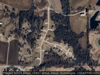
Map
Nearby Homes
- 11669 131st St
- 14338 115th Ave
- 5418 Chapel Hill Rd
- 2 Blue Grass Ct
- 720 Deer Woods Dr
- 717 Deer Woods Dr
- 9932 123rd St
- 818 N Utah Ave
- 4519 S Concord St
- 15503 108th Avenue Place
- 3836 Pearl Ave
- Lot 5 Hidden Valley Dr
- 3412 Michigan
- 3412 Sunnyside Ave
- 6225 W Locust St
- 3510 Rockingham Rd
- 4628 W 11th St
- 1117 S Ohio Ave
- 1417 Rhinelander Dr
- 5823 Shawnee Dr
- 13069 116th Ave
- Lot 28 116th Ave
- Lot 3 116th Ave
- Lot 5 116th Ave
- Lot 6 116th Ave
- Lot 1 116th Ave
- Lot 9 131st Street Ct
- 13066 116th Ave
- Lot 009 131st St
- Lot 15 131st St
- Lot 9 131st St
- 13078 116th Ave
- 11657 131st Street Ct
- 13081 116th Ave
- 13092 116th Ave
- 11664 131st Street Ct
- 11664 131st Street Ct
- 11663 131st Street Ct
- 11670 131st Street Ct
- 11670 131st Street Ct