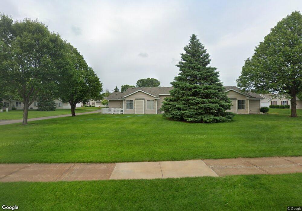
13078 Brookside Ln N Rogers, MN 55374
Estimated Value: $284,000 - $306,000
2
Beds
2
Baths
1,374
Sq Ft
$214/Sq Ft
Est. Value
About This Home
This home is located at 13078 Brookside Ln N, Rogers, MN 55374 and is currently estimated at $294,166, approximately $214 per square foot. 13078 Brookside Ln N is a home located in Hennepin County with nearby schools including Rogers Elementary School, Rogers Middle School, and Rogers Senior High School.
Ownership History
Date
Name
Owned For
Owner Type
Purchase Details
Closed on
Oct 30, 2019
Sold by
Pyffer Mary Catherine
Bought by
Pyffer Mary Catherine and Mcgroarty Timothy William
Current Estimated Value
Purchase Details
Closed on
Jul 30, 2013
Sold by
Schoenthaler Lyle Lyle
Bought by
Pyffer Mary Mary
Home Financials for this Owner
Home Financials are based on the most recent Mortgage that was taken out on this home.
Original Mortgage
$110,000
Interest Rate
4.31%
Purchase Details
Closed on
May 31, 2005
Sold by
Graff Donna M
Bought by
Schoenthaler Lyle J and Nordin Laura M
Purchase Details
Closed on
Sep 11, 1998
Sold by
Eagle Crest Nw Inc
Bought by
Graff Arthur and Graff Donna M
Purchase Details
Closed on
Mar 27, 1998
Sold by
Brook Park Realty Inc
Bought by
Eagle Crest Northwest Inc
Create a Home Valuation Report for This Property
The Home Valuation Report is an in-depth analysis detailing your home's value as well as a comparison with similar homes in the area
Home Values in the Area
Average Home Value in this Area
Purchase History
| Date | Buyer | Sale Price | Title Company |
|---|---|---|---|
| Pyffer Mary Catherine | -- | None Listed On Document | |
| Pyffer Mary Mary | $142,500 | -- | |
| Schoenthaler Lyle J | $181,500 | -- | |
| Graff Arthur | $113,000 | -- | |
| Eagle Crest Northwest Inc | $84,000 | -- |
Source: Public Records
Mortgage History
| Date | Status | Borrower | Loan Amount |
|---|---|---|---|
| Previous Owner | Pyffer Mary Mary | $110,000 |
Source: Public Records
Tax History Compared to Growth
Tax History
| Year | Tax Paid | Tax Assessment Tax Assessment Total Assessment is a certain percentage of the fair market value that is determined by local assessors to be the total taxable value of land and additions on the property. | Land | Improvement |
|---|---|---|---|---|
| 2024 | $3,261 | $264,100 | $32,000 | $232,100 |
| 2023 | $3,410 | $280,000 | $43,000 | $237,000 |
| 2022 | $2,715 | $241,000 | $15,000 | $226,000 |
| 2021 | $2,615 | $209,000 | $15,000 | $194,000 |
| 2020 | $2,642 | $201,000 | $12,000 | $189,000 |
| 2019 | $2,478 | $194,000 | $10,000 | $184,000 |
| 2018 | $2,392 | $197,000 | $18,000 | $179,000 |
| 2017 | $1,961 | $154,000 | $10,000 | $144,000 |
| 2016 | $1,861 | $145,000 | $18,000 | $127,000 |
| 2015 | $1,842 | $139,000 | $20,000 | $119,000 |
| 2014 | -- | $131,000 | $30,000 | $101,000 |
Source: Public Records
Map
Nearby Homes
- 13070 Brookside Ln N
- 13053 Brookside Ln N
- 13046 Brookside Ln N
- 13019 Brookside Ln N
- 22119 Brenly Way
- 12668 Garden Meadow Ln
- Waverly Plan at Aster Mill - Expressions
- Oakdale Plan at Aster Mill - Inspiration
- Continental Plan at Aster Mill - Expressions
- Mercer Plan at Aster Mill - Expressions
- Mitchell Plan at Aster Mill - Inspiration
- Crisfield Plan at Aster Mill - Inspiration
- Ashton Plan at Aster Mill - Freedom
- Linwood Plan at Aster Mill - Expressions
- Hampton Plan at Aster Mill - Inspiration
- Bowman Plan at Aster Mill - Freedom
- Aspire Plan at Aster Mill - Inspiration
- Duncan Plan at Aster Mill - Freedom
- 12845 Sawyer Ln
- 12841 Sawyer Ln
- 13076 Brookside Ln N
- 13068 Brookside Ln N
- 13088 Brookside Ln N
- 13080 Brookside Ln N
- 13084 Brookside Ln N
- 13060 Brookside Ln N
- 13062 Brookside Ln N
- 13072 Brookside Ln N
- 13096 Brookside Ln N
- 13052 Brookside Ln N
- 13094 Brookside Ln N
- 13054 Brookside Ln N
- 13090 Brookside Ln N
- 13082 Brookside Ln N
- 13086 Brookside Ln N
- 13098 Brookside Ln N
- 13074 Brookside Ln N
- 13064 Brookside Ln N
- 13056 Brookside Ln N
- 13066 Brookside Ln N