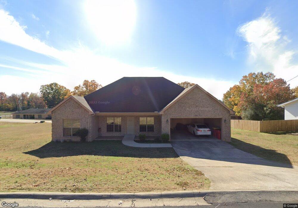
1308 Branch St Morrilton, AR 72110
Estimated Value: $200,000 - $243,463
Studio
2
Baths
2,028
Sq Ft
$110/Sq Ft
Est. Value
About This Home
This home is located at 1308 Branch St, Morrilton, AR 72110 and is currently estimated at $222,116, approximately $109 per square foot. 1308 Branch St is a home located in Conway County with nearby schools including Morrilton Primary School, Morrilton Elementary School, and Morrilton Intermediate School.
Ownership History
Date
Name
Owned For
Owner Type
Purchase Details
Closed on
Sep 22, 2017
Sold by
The Secretary Of Veterans Affairs
Bought by
White Stafford
Current Estimated Value
Home Financials for this Owner
Home Financials are based on the most recent Mortgage that was taken out on this home.
Original Mortgage
$109,500
Outstanding Balance
$91,416
Interest Rate
3.89%
Mortgage Type
New Conventional
Estimated Equity
$130,700
Purchase Details
Closed on
Jan 17, 2017
Sold by
Nationstar Mortgage Llc
Bought by
Secretary Of Veterans Affairs
Purchase Details
Closed on
Feb 23, 2011
Sold by
Green Design And Construction Company
Bought by
Everette David and Everette Sandra
Home Financials for this Owner
Home Financials are based on the most recent Mortgage that was taken out on this home.
Original Mortgage
$185,000
Interest Rate
4.78%
Create a Home Valuation Report for This Property
The Home Valuation Report is an in-depth analysis detailing your home's value as well as a comparison with similar homes in the area
Home Values in the Area
Average Home Value in this Area
Purchase History
| Date | Buyer | Sale Price | Title Company |
|---|---|---|---|
| White Stafford | $110,000 | None Available | |
| Secretary Of Veterans Affairs | -- | -- | |
| Everette David | -- | -- |
Source: Public Records
Mortgage History
| Date | Status | Borrower | Loan Amount |
|---|---|---|---|
| Open | White Stafford | $109,500 | |
| Previous Owner | Everette David | $185,000 |
Source: Public Records
Tax History
| Year | Tax Paid | Tax Assessment Tax Assessment Total Assessment is a certain percentage of the fair market value that is determined by local assessors to be the total taxable value of land and additions on the property. | Land | Improvement |
|---|---|---|---|---|
| 2025 | $1,264 | $36,800 | $2,520 | $34,280 |
| 2024 | $1,286 | $36,800 | $2,520 | $34,280 |
| 2023 | $1,284 | $36,800 | $2,520 | $34,280 |
| 2022 | $1,256 | $36,800 | $2,520 | $34,280 |
| 2021 | $1,178 | $28,710 | $1,500 | $27,210 |
| 2020 | $1,178 | $28,710 | $1,500 | $27,210 |
| 2019 | $1,178 | $28,710 | $1,500 | $27,210 |
| 2018 | $1,203 | $28,710 | $1,500 | $27,210 |
| 2017 | $1,203 | $28,710 | $1,500 | $27,210 |
| 2016 | $1,617 | $30,290 | $1,500 | $28,790 |
| 2015 | $1,499 | $30,290 | $1,500 | $28,790 |
| 2014 | $1,439 | $30,290 | $1,500 | $28,790 |
Source: Public Records
Map
Nearby Homes
- 1310 Branch St
- 600 Oaklawn Dr
- 1207 E Rock St
- 7 Sunset Blvd
- 1100 Carruthers Dr
- 705 E Commerce St
- 1413 View St
- 104 Arthur St
- 00 Winthrop Dr
- 4 Winthrop Dr
- 1550 E Harding Hwy 9
- 303 S Saint Joseph St
- 701 N Moose St
- 23 Walker Ln
- 13 Eugenia St
- 305 Parkway Ave
- 603 N Division St
- 9 W Winthrop Rd
- 106 Parkway Ave
- 00 E Holloway B2 Lots 7 10 and 14 St
Your Personal Tour Guide
Ask me questions while you tour the home.