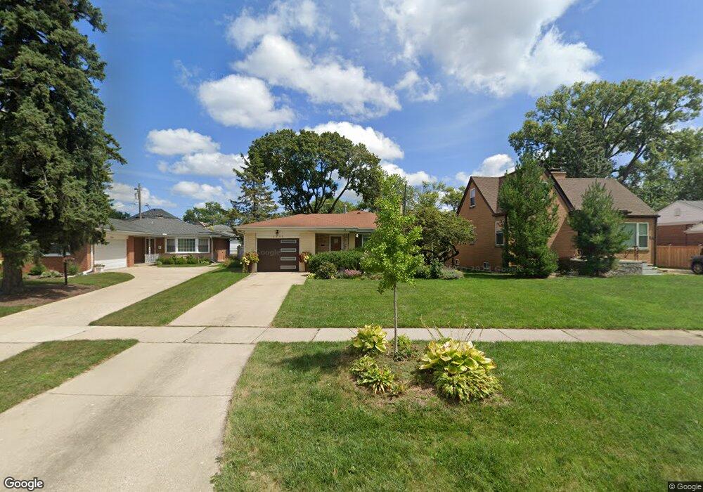
1309 Grove Ave Park Ridge, IL 60068
O'Hare NeighborhoodEstimated Value: $432,000 - $536,000
3
Beds
2
Baths
1,344
Sq Ft
$361/Sq Ft
Est. Value
About This Home
This home is located at 1309 Grove Ave, Park Ridge, IL 60068 and is currently estimated at $485,611, approximately $361 per square foot. 1309 Grove Ave is a home located in Cook County with nearby schools including Theodore Roosevelt Elementary School, Lincoln Middle School, and Maine South High School.
Ownership History
Date
Name
Owned For
Owner Type
Purchase Details
Closed on
Jul 14, 2016
Sold by
Jackson Charles H and Jackson Patricia A
Bought by
Takanarita Fujiko
Current Estimated Value
Home Financials for this Owner
Home Financials are based on the most recent Mortgage that was taken out on this home.
Original Mortgage
$150,000
Outstanding Balance
$118,928
Interest Rate
3.37%
Mortgage Type
New Conventional
Estimated Equity
$366,683
Purchase Details
Closed on
Oct 12, 2010
Sold by
Jackson Charles H and Jackson Patricia A
Bought by
Jackson Charles H and Jackson Patricia A
Create a Home Valuation Report for This Property
The Home Valuation Report is an in-depth analysis detailing your home's value as well as a comparison with similar homes in the area
Home Values in the Area
Average Home Value in this Area
Purchase History
| Date | Buyer | Sale Price | Title Company |
|---|---|---|---|
| Takanarita Fujiko | $317,000 | Attorneys Title Guaranty Fun | |
| Jackson Charles H | -- | None Available |
Source: Public Records
Mortgage History
| Date | Status | Borrower | Loan Amount |
|---|---|---|---|
| Open | Takanarita Fujiko | $150,000 |
Source: Public Records
Tax History Compared to Growth
Tax History
| Year | Tax Paid | Tax Assessment Tax Assessment Total Assessment is a certain percentage of the fair market value that is determined by local assessors to be the total taxable value of land and additions on the property. | Land | Improvement |
|---|---|---|---|---|
| 2024 | $4,575 | $18,657 | $4,515 | $14,142 |
| 2023 | $4,372 | $18,657 | $4,515 | $14,142 |
| 2022 | $4,372 | $18,657 | $4,515 | $14,142 |
| 2021 | $3,712 | $13,973 | $3,386 | $10,587 |
| 2020 | $3,621 | $13,973 | $3,386 | $10,587 |
| 2019 | $3,592 | $15,543 | $3,386 | $12,157 |
| 2018 | $4,101 | $16,169 | $2,821 | $13,348 |
| 2017 | $4,078 | $16,169 | $2,821 | $13,348 |
| 2016 | $3,802 | $16,169 | $2,821 | $13,348 |
| 2015 | $3,517 | $13,790 | $2,418 | $11,372 |
| 2014 | $3,462 | $13,790 | $2,418 | $11,372 |
| 2013 | $3,264 | $13,790 | $2,418 | $11,372 |
Source: Public Records
Map
Nearby Homes
- 1220 Canfield Rd
- 7725 W Myrtle Ave
- 1021 Cleveland Ave
- 7740 W Norwood St
- 1729 Linden Ave
- 1220 Courtland Ave
- 1632 S Vine Ave
- 7425 W Devon Ave
- 1705 S Crescent Ave
- 718 S Washington Ave
- 7744 W Thorndale Ave
- 7811 W Thorndale Ave
- 1705 S Prospect Ave
- 6681 N Northwest Hwy
- 1425 Brophy Ave
- 2009 Linden Ave
- 6815 N Olmsted Ave Unit 203
- 6625 N Northwest Hwy Unit 202
- 1929 S Ashland Ave
- 6524 N Northwest Hwy Unit A
- 1309 Grove Ave
- 1305 Grove Ave
- 1305 Grove Ave
- 1315 Grove Ave
- 1301 Grove Ave
- 1317 Grove Ave
- 1237 Grove Ave
- 1312 Canfield Rd
- 1312 Canfield Rd
- 1308 Canfield Rd
- 1316 Canfield Rd
- 1304 Canfield Rd
- 1321 Grove Ave
- 1233 Grove Ave
- 1300 Canfield Rd
- 1320 Canfield Rd
- 1320 Canfield Rd
- 1324 Canfield Rd
- 1324 Canfield Rd
- 1234 Canfield Rd