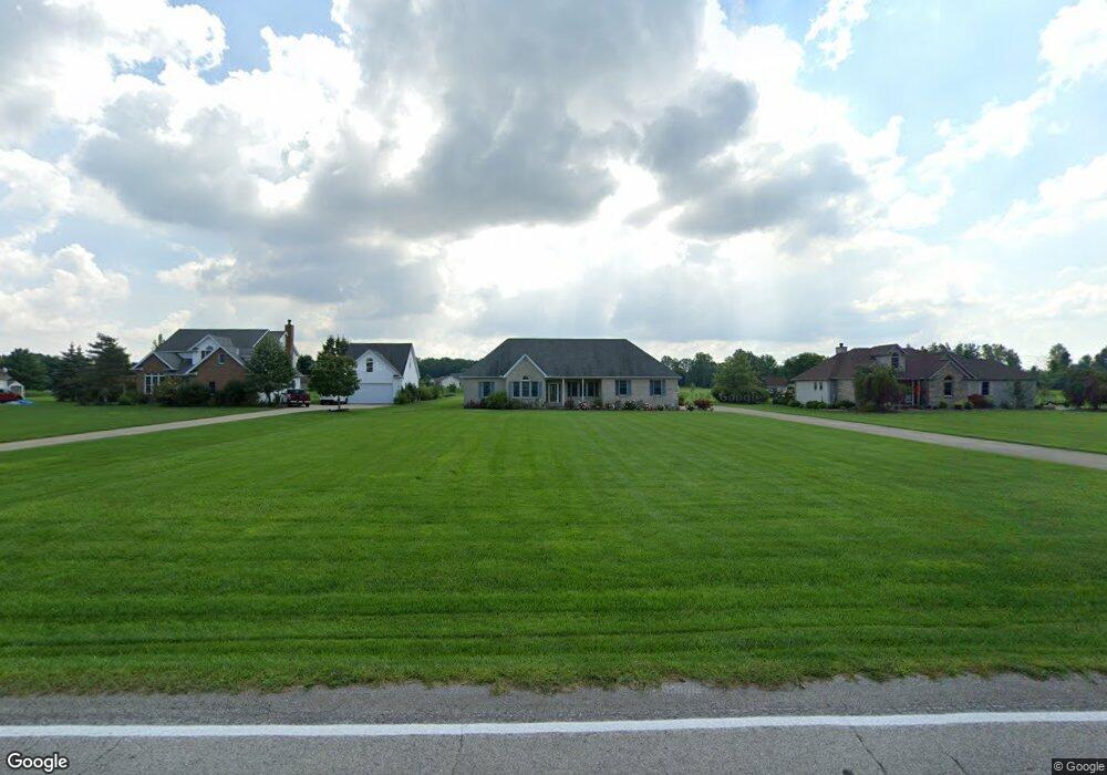
13091 Diagonal Rd Lagrange, OH 44050
Estimated Value: $434,189 - $539,000
3
Beds
2
Baths
2,357
Sq Ft
$203/Sq Ft
Est. Value
About This Home
This home is located at 13091 Diagonal Rd, Lagrange, OH 44050 and is currently estimated at $477,797, approximately $202 per square foot. 13091 Diagonal Rd is a home located in Lorain County with nearby schools including Keystone Elementary School, Keystone Middle School, and Keystone High School.
Ownership History
Date
Name
Owned For
Owner Type
Purchase Details
Closed on
Nov 16, 2017
Sold by
Kern Ralph T
Bought by
Kubiak Ramona F and Kern Charles D
Current Estimated Value
Purchase Details
Closed on
Feb 15, 1998
Sold by
Norris Builders Inc
Bought by
Kern Ralph T and Faye Kern V
Home Financials for this Owner
Home Financials are based on the most recent Mortgage that was taken out on this home.
Original Mortgage
$201,000
Interest Rate
7.12%
Create a Home Valuation Report for This Property
The Home Valuation Report is an in-depth analysis detailing your home's value as well as a comparison with similar homes in the area
Purchase History
| Date | Buyer | Sale Price | Title Company |
|---|---|---|---|
| Kubiak Ramona F | -- | -- | |
| Kern Ralph T | $38,000 | Midland Title |
Source: Public Records
Mortgage History
| Date | Status | Borrower | Loan Amount |
|---|---|---|---|
| Previous Owner | Kern Ralph T | $201,000 |
Source: Public Records
Tax History
| Year | Tax Paid | Tax Assessment Tax Assessment Total Assessment is a certain percentage of the fair market value that is determined by local assessors to be the total taxable value of land and additions on the property. | Land | Improvement |
|---|---|---|---|---|
| 2024 | $4,453 | $120,316 | $26,807 | $93,510 |
| 2023 | $4,362 | $98,511 | $24,934 | $73,577 |
| 2022 | $4,349 | $98,511 | $24,934 | $73,577 |
| 2021 | $4,348 | $98,511 | $24,934 | $73,577 |
| 2020 | $4,338 | $89,880 | $22,750 | $67,130 |
| 2019 | $4,310 | $89,880 | $22,750 | $67,130 |
| 2018 | $4,329 | $89,880 | $22,750 | $67,130 |
| 2017 | $4,137 | $81,190 | $23,310 | $57,880 |
| 2016 | $4,108 | $81,190 | $23,310 | $57,880 |
| 2015 | $4,039 | $81,190 | $23,310 | $57,880 |
| 2014 | $3,520 | $81,190 | $23,310 | $57,880 |
| 2013 | $3,359 | $81,190 | $23,310 | $57,880 |
Source: Public Records
Map
Nearby Homes
- 41341 Ravines Edge Way
- 40175 Banks Rd
- 40163 Banks Rd
- 43915 State Route 511
- 13301 Indian Hollow Rd
- 11861 Indian Hollow Rd
- 39535 Butternut Ridge Rd
- 40000 Myrtle Ct
- 114 River Run Dr
- 158 River Run Dr
- 502 Cedarwood Trail
- 10249 W Ridge Rd
- 437 Pheasant Run
- 221 River Run Dr
- 829 Robinson Dr
- 229 River Run Dr
- 246 River Run Dr
- 425 Pheasant Run
- 421 Pheasant Run
- 417 Pheasant Run
- 12987 Diagonal Rd
- 13195 Diagonal Rd
- 12881 Diagonal Rd
- 13197 Diagonal Rd
- 12875 Diagonal Rd
- 122 Mallard Creek Run
- 12869 Diagonal Rd
- 124 Mallard Creek Run
- 120 Mallard Creek Run
- 128 Mallard Creek Run
- 118 Mallard Creek Run
- 13250 Whitehead Rd
- 130 Mallard Creek Run
- SL 1 Whitehead Rd
- S/L Mallard Creek Run Unit 34
- 183 Mallard Creek Run
- SL 2 Whitehead Rd
- 132 Mallard Creek Run
- 13325 Whitehead Rd
- 116 Mallard Creek Run
Your Personal Tour Guide
Ask me questions while you tour the home.