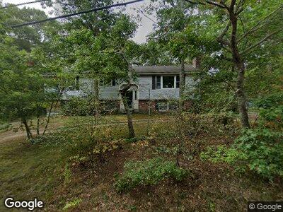
131 Back Rd Mashpee, MA 02649
Estimated Value: $462,000 - $506,000
2
Beds
2
Baths
1,449
Sq Ft
$333/Sq Ft
Est. Value
About This Home
This home is located at 131 Back Rd, Mashpee, MA 02649 and is currently estimated at $482,073, approximately $332 per square foot. 131 Back Rd is a home located in Barnstable County with nearby schools including Kenneth C. Coombs School, Quashnet School, and Mashpee Middle School.
Ownership History
Date
Name
Owned For
Owner Type
Purchase Details
Closed on
Mar 22, 2024
Sold by
Patch Frank H
Bought by
Patch Ft and Patch
Current Estimated Value
Purchase Details
Closed on
Nov 27, 1992
Sold by
Great Waterview Rlty
Bought by
Roundree Geraldine
Home Financials for this Owner
Home Financials are based on the most recent Mortgage that was taken out on this home.
Original Mortgage
$25,000
Interest Rate
8.06%
Mortgage Type
Purchase Money Mortgage
Create a Home Valuation Report for This Property
The Home Valuation Report is an in-depth analysis detailing your home's value as well as a comparison with similar homes in the area
Home Values in the Area
Average Home Value in this Area
Purchase History
| Date | Buyer | Sale Price | Title Company |
|---|---|---|---|
| Patch Ft | -- | None Available | |
| Roundree Geraldine | $85,000 | -- |
Source: Public Records
Mortgage History
| Date | Status | Borrower | Loan Amount |
|---|---|---|---|
| Previous Owner | Patch Frank H | $421,800 | |
| Previous Owner | Rountree Geraldine T | $13,000 | |
| Previous Owner | Roundree Geraldine | $13,000 | |
| Previous Owner | Roundree Geraldine | $25,000 |
Source: Public Records
Tax History Compared to Growth
Tax History
| Year | Tax Paid | Tax Assessment Tax Assessment Total Assessment is a certain percentage of the fair market value that is determined by local assessors to be the total taxable value of land and additions on the property. | Land | Improvement |
|---|---|---|---|---|
| 2024 | $2,677 | $416,300 | $0 | $416,300 |
| 2023 | $2,670 | $380,900 | $0 | $380,900 |
| 2022 | $2,568 | $314,300 | $0 | $314,300 |
| 2021 | $2,597 | $286,300 | $0 | $286,300 |
| 2020 | $2,570 | $282,700 | $0 | $282,700 |
| 2019 | $2,462 | $272,000 | $0 | $272,000 |
| 2018 | $2,271 | $254,600 | $0 | $254,600 |
| 2017 | $2,307 | $251,000 | $0 | $251,000 |
| 2016 | $2,110 | $228,400 | $0 | $228,400 |
| 2015 | $1,983 | $217,700 | $0 | $217,700 |
| 2014 | $1,926 | $205,100 | $0 | $205,100 |
Source: Public Records
Map
Nearby Homes
- 311 Hooppole Rd
- 7 Nicklaus Way
- 18 Driver Ln
- 115 Pine Hill Blvd Unit 347
- 115 Pine Hill Blvd
- 183 Leisure Green Dr N Unit 368
- 183 Leisure Green Dr N
- 181 Leisure Green Dr
- 14 N Ridge Rd Unit 441
- 14 N Ridge Rd
- 22 Country Club Ln
- 106 Pine Hill Blvd
- 4 N Ridge Rd Unit 431
- 4 N Ridge Rd
- 6 Masters Ct Unit 465
- 6 Masters Ct
- 19 Longwood Rd
- 15 Beacon Ct Unit 229
- 15 Beacon Ct
- 9 Longwood Rd