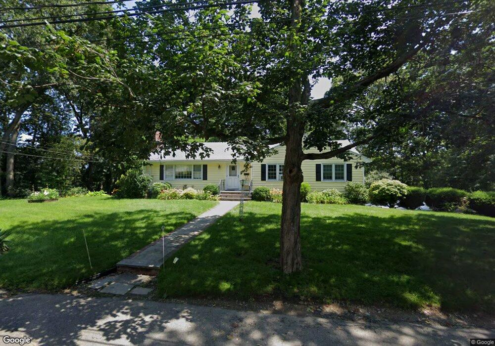
131 Cabot St Milton, MA 02186
Milton Hill NeighborhoodEstimated Value: $944,305 - $1,163,000
3
Beds
4
Baths
1,508
Sq Ft
$692/Sq Ft
Est. Value
About This Home
This home is located at 131 Cabot St, Milton, MA 02186 and is currently estimated at $1,043,326, approximately $691 per square foot. 131 Cabot St is a home located in Norfolk County with nearby schools including Milton High School, St. Agatha School, and Saint John Paul II Catholic Academy.
Ownership History
Date
Name
Owned For
Owner Type
Purchase Details
Closed on
May 8, 2019
Sold by
Carr Maureen M
Bought by
Maureen M Carr Ret
Current Estimated Value
Purchase Details
Closed on
Mar 15, 1995
Sold by
Maclellan Susan J
Bought by
Carr Walter S and Carr Maureen M
Home Financials for this Owner
Home Financials are based on the most recent Mortgage that was taken out on this home.
Original Mortgage
$90,000
Interest Rate
8.89%
Mortgage Type
Purchase Money Mortgage
Create a Home Valuation Report for This Property
The Home Valuation Report is an in-depth analysis detailing your home's value as well as a comparison with similar homes in the area
Home Values in the Area
Average Home Value in this Area
Purchase History
| Date | Buyer | Sale Price | Title Company |
|---|---|---|---|
| Maureen M Carr Ret | -- | -- | |
| Carr Walter S | $227,000 | -- |
Source: Public Records
Mortgage History
| Date | Status | Borrower | Loan Amount |
|---|---|---|---|
| Previous Owner | Carr Walter S | $88,000 | |
| Previous Owner | Carr Walter S | $90,000 |
Source: Public Records
Tax History Compared to Growth
Tax History
| Year | Tax Paid | Tax Assessment Tax Assessment Total Assessment is a certain percentage of the fair market value that is determined by local assessors to be the total taxable value of land and additions on the property. | Land | Improvement |
|---|---|---|---|---|
| 2025 | $8,764 | $790,300 | $528,800 | $261,500 |
| 2024 | $8,186 | $749,600 | $504,300 | $245,300 |
| 2023 | $8,077 | $708,500 | $480,600 | $227,900 |
| 2022 | $8,286 | $664,500 | $480,600 | $183,900 |
| 2021 | $8,426 | $641,700 | $466,600 | $175,100 |
| 2020 | $8,491 | $647,200 | $466,800 | $180,400 |
| 2019 | $8,282 | $628,400 | $453,300 | $175,100 |
| 2018 | $7,973 | $577,300 | $402,500 | $174,800 |
| 2017 | $7,459 | $550,100 | $383,400 | $166,700 |
| 2016 | $7,385 | $547,000 | $383,400 | $163,600 |
| 2015 | $6,882 | $493,700 | $336,800 | $156,900 |
Source: Public Records
Map
Nearby Homes
- 71 Cabot St
- 55 Christopher Dr
- 400 Adams St Unit A
- 400 Adams St Unit B
- 397 Adams St
- 639 Pleasant St Unit 639
- 639 Pleasant St
- 26 Berlin Ave
- 51 Denmark Ave
- 461 Centre St
- 312 Edge Hill Rd
- 46 Century Ln
- 22 Branchfield St Unit D4
- 795 Brook Rd
- 1076 Adams St
- 418 Pleasant St
- 21A High St Unit 2
- 60 Pond St
- 61 Hill Top St
- 118-120 Granite Ave Unit 2