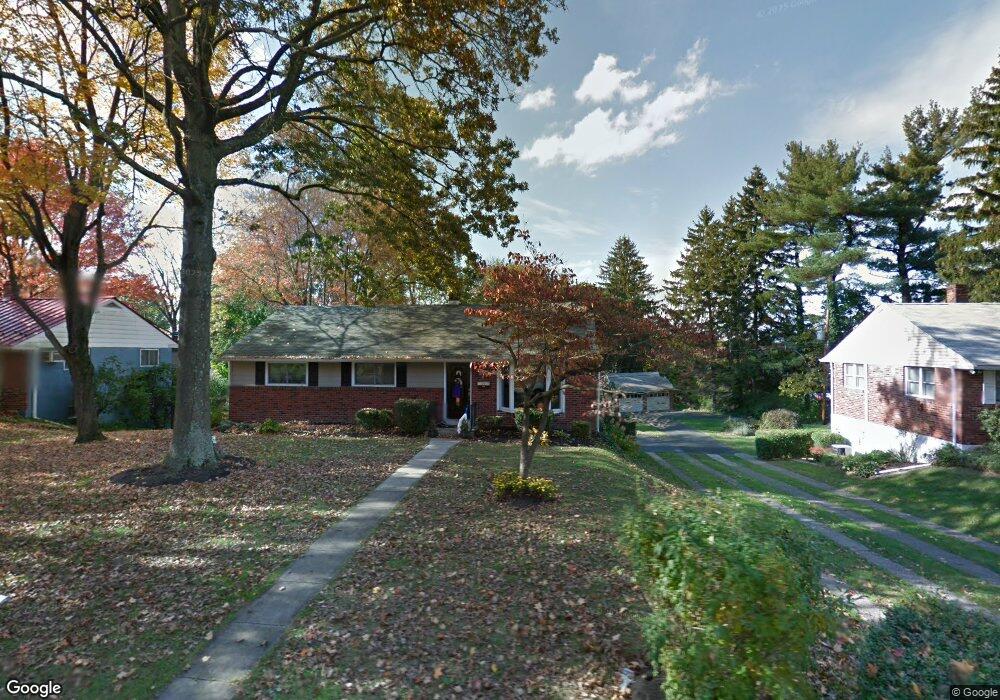
131 Davis Rd Doylestown, PA 18901
Estimated Value: $507,496 - $577,000
3
Beds
2
Baths
1,316
Sq Ft
$420/Sq Ft
Est. Value
About This Home
This home is located at 131 Davis Rd, Doylestown, PA 18901 and is currently estimated at $552,624, approximately $419 per square foot. 131 Davis Rd is a home located in Bucks County with nearby schools including Linden El School, Lenape Middle School, and Central Bucks High School-West.
Ownership History
Date
Name
Owned For
Owner Type
Purchase Details
Closed on
Aug 20, 1999
Sold by
Parker Elizabeth C
Bought by
Macadams Jason B and Macadams Stephanie L
Current Estimated Value
Home Financials for this Owner
Home Financials are based on the most recent Mortgage that was taken out on this home.
Original Mortgage
$154,908
Outstanding Balance
$43,994
Interest Rate
7.5%
Mortgage Type
FHA
Estimated Equity
$508,630
Purchase Details
Closed on
Dec 3, 1991
Bought by
Parker Elizabeth C Tr
Create a Home Valuation Report for This Property
The Home Valuation Report is an in-depth analysis detailing your home's value as well as a comparison with similar homes in the area
Home Values in the Area
Average Home Value in this Area
Purchase History
| Date | Buyer | Sale Price | Title Company |
|---|---|---|---|
| Macadams Jason B | $155,000 | -- | |
| Parker Elizabeth C Tr | -- | -- |
Source: Public Records
Mortgage History
| Date | Status | Borrower | Loan Amount |
|---|---|---|---|
| Open | Macadams Jason B | $154,908 |
Source: Public Records
Tax History Compared to Growth
Tax History
| Year | Tax Paid | Tax Assessment Tax Assessment Total Assessment is a certain percentage of the fair market value that is determined by local assessors to be the total taxable value of land and additions on the property. | Land | Improvement |
|---|---|---|---|---|
| 2025 | $4,329 | $24,030 | $7,120 | $16,910 |
| 2024 | $4,329 | $24,030 | $7,120 | $16,910 |
| 2023 | $4,124 | $24,030 | $7,120 | $16,910 |
| 2022 | $4,067 | $24,030 | $7,120 | $16,910 |
| 2021 | $4,022 | $24,030 | $7,120 | $16,910 |
| 2020 | $3,978 | $24,030 | $7,120 | $16,910 |
| 2019 | $3,934 | $24,030 | $7,120 | $16,910 |
| 2018 | $3,886 | $24,030 | $7,120 | $16,910 |
| 2017 | $3,845 | $24,030 | $7,120 | $16,910 |
| 2016 | $3,845 | $24,030 | $7,120 | $16,910 |
| 2015 | -- | $24,030 | $7,120 | $16,910 |
| 2014 | -- | $24,030 | $7,120 | $16,910 |
Source: Public Records
Map
Nearby Homes
- 418 North St
- 121 Cottage St
- 146 N Church St
- 90 Chapman Ave
- 169 N Main St
- 146 E Court St
- 4 Barnes Ct
- 155 E Oakland Ave
- 20 E Court St
- 5 Belmont Square
- 69 E Oakland Ave
- 339 E Ashland St
- 110 E Ashland St
- 37 N Clinton St
- 104 Kreutz Ave
- 333 Dorset Ct Unit 333
- 215 N Franklin St
- 0 Myers Dr
- 143 Myers Dr
- 236 Green St
- 149 Davis Rd
- 95 Davis Rd
- 167 Davis Rd
- 130 Davis Rd
- 112 Davis Rd
- 148 Davis Rd
- 129 Davids Way
- 185 Davis Rd
- 94 Davis Rd
- 184 Davis Rd
- 421 North St
- 76 Davis Rd
- 333 Lacey Ave Unit C4
- 333 Lacey Ave Unit D10
- 333 Lacey Ave Unit D9
- 333 Lacey Ave
- 333 Lacey Ave Unit C5
- 333 Lacey Ave
- 333 Lacey Ave
- 333 Lacey Ave Unit A6