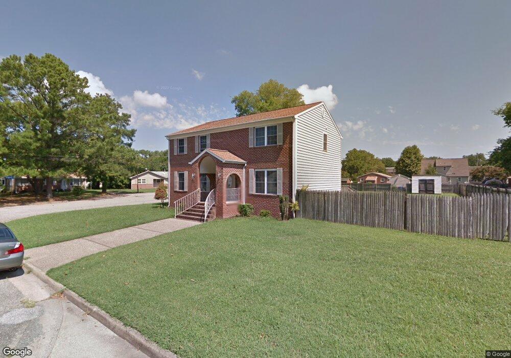
1310 Patrick St Hampton, VA 23669
Old North Hampton NeighborhoodEstimated Value: $354,350 - $393,000
4
Beds
3
Baths
2,298
Sq Ft
$165/Sq Ft
Est. Value
About This Home
This home is located at 1310 Patrick St, Hampton, VA 23669 and is currently estimated at $378,338, approximately $164 per square foot. 1310 Patrick St is a home located in Hampton City with nearby schools including Mary S. Peake Elementary School, C. Alton Lindsay Middle School, and Kecoughtan High School.
Ownership History
Date
Name
Owned For
Owner Type
Purchase Details
Closed on
Sep 26, 2006
Sold by
Barnes Montie H
Bought by
Cloud Mary L
Current Estimated Value
Home Financials for this Owner
Home Financials are based on the most recent Mortgage that was taken out on this home.
Original Mortgage
$236,520
Outstanding Balance
$141,214
Interest Rate
6.47%
Mortgage Type
New Conventional
Estimated Equity
$237,124
Create a Home Valuation Report for This Property
The Home Valuation Report is an in-depth analysis detailing your home's value as well as a comparison with similar homes in the area
Home Values in the Area
Average Home Value in this Area
Purchase History
| Date | Buyer | Sale Price | Title Company |
|---|---|---|---|
| Cloud Mary L | $249,000 | -- |
Source: Public Records
Mortgage History
| Date | Status | Borrower | Loan Amount |
|---|---|---|---|
| Open | Cloud Mary L | $236,520 |
Source: Public Records
Tax History
| Year | Tax Paid | Tax Assessment Tax Assessment Total Assessment is a certain percentage of the fair market value that is determined by local assessors to be the total taxable value of land and additions on the property. | Land | Improvement |
|---|---|---|---|---|
| 2025 | $4,100 | $365,100 | $50,000 | $315,100 |
| 2024 | $3,742 | $325,400 | $45,000 | $280,400 |
| 2023 | $3,540 | $292,900 | $45,000 | $247,900 |
| 2022 | $3,260 | $276,300 | $45,000 | $231,300 |
| 2021 | $2,883 | $222,000 | $30,000 | $192,000 |
| 2020 | $2,625 | $211,700 | $30,000 | $181,700 |
| 2019 | $2,610 | $210,500 | $30,000 | $180,500 |
| 2018 | $2,645 | $211,900 | $30,000 | $181,900 |
| 2017 | $2,722 | $0 | $0 | $0 |
| 2016 | $2,673 | $208,000 | $0 | $0 |
| 2015 | $2,568 | $0 | $0 | $0 |
| 2014 | $2,558 | $199,500 | $31,300 | $168,200 |
Source: Public Records
Map
Nearby Homes
- 915 Langley Ave
- 710 N Back River Rd
- 718 Langley Ave
- 1307 West Ave
- 382 Union St
- 925 Quash St
- 28 Maplewood St
- 358 Lincoln St
- 19 Maplewood St
- 142 Freeman Dr
- 144 Freeman Dr
- 146 Freeman Dr
- 845 N King St
- 148 Freeman Dr
- 150 Freeman Dr
- 152 Freeman Dr
- 154 Freeman Dr
- 156 Freeman Dr
- 158 Freeman Dr
- 160 Freeman Dr
- 1308 Patrick St
- 1306 Patrick St
- 500 Patrick Ct
- 1313 Thomas St
- 1309 Thomas St
- 1304 Patrick St
- 1301 Willnew Dr
- 504 Patrick Ct
- 1308 Willnew Dr
- 1305 Thomas St
- 502 Patrick Ct
- 1315 Thomas St
- 1302 Patrick St
- 1325 Patrick St
- 1303 Thomas St
- 1303 Willnew Dr
- 1317 Thomas St
- 1300 Patrick St
- 1301 Thomas St
- 1303 Patrick St
Your Personal Tour Guide
Ask me questions while you tour the home.