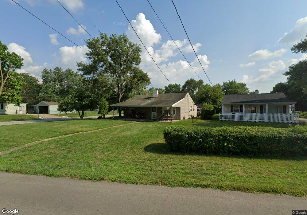
1310 Pershing Ave Middletown, OH 45044
Amanda-Oneida NeighborhoodEstimated Value: $103,000 - $142,000
2
Beds
1
Bath
816
Sq Ft
$154/Sq Ft
Est. Value
About This Home
This home is located at 1310 Pershing Ave, Middletown, OH 45044 and is currently estimated at $125,762, approximately $154 per square foot. 1310 Pershing Ave is a home located in Butler County with nearby schools including Amanda Elementary School, Highview 6th Grade Center, and Middletown Middle School.
Ownership History
Date
Name
Owned For
Owner Type
Purchase Details
Closed on
Jan 20, 2009
Sold by
Hsbc Mortgage Services Inc
Bought by
Browns Real Estate Investments Llc
Current Estimated Value
Purchase Details
Closed on
Oct 24, 2008
Sold by
Crase Mark Anthony and Crase Mark A
Bought by
Hsbc Mortgage Services Inc
Purchase Details
Closed on
Sep 5, 2003
Sold by
Crase Mary Louise and Crase Edgar E
Bought by
Crase Mark Anthony
Create a Home Valuation Report for This Property
The Home Valuation Report is an in-depth analysis detailing your home's value as well as a comparison with similar homes in the area
Home Values in the Area
Average Home Value in this Area
Purchase History
| Date | Buyer | Sale Price | Title Company |
|---|---|---|---|
| Browns Real Estate Investments Llc | $16,000 | Attorney | |
| Hsbc Mortgage Services Inc | $40,800 | None Available | |
| Crase Mark Anthony | $40,000 | -- |
Source: Public Records
Tax History
| Year | Tax Paid | Tax Assessment Tax Assessment Total Assessment is a certain percentage of the fair market value that is determined by local assessors to be the total taxable value of land and additions on the property. | Land | Improvement |
|---|---|---|---|---|
| 2025 | $1,707 | $32,200 | $6,590 | $25,610 |
| 2024 | $1,707 | $32,200 | $6,590 | $25,610 |
| 2023 | $1,696 | $32,020 | $6,590 | $25,430 |
| 2022 | $1,372 | $23,020 | $6,590 | $16,430 |
| 2021 | $1,320 | $23,020 | $6,590 | $16,430 |
| 2020 | $1,376 | $23,020 | $6,590 | $16,430 |
| 2019 | $1,095 | $15,110 | $6,520 | $8,590 |
| 2018 | $978 | $15,110 | $6,520 | $8,590 |
| 2017 | $980 | $15,110 | $6,520 | $8,590 |
| 2016 | $917 | $13,540 | $6,520 | $7,020 |
| 2015 | $904 | $13,540 | $6,520 | $7,020 |
| 2014 | $775 | $13,540 | $6,520 | $7,020 |
| 2013 | $775 | $12,610 | $6,520 | $6,090 |
Source: Public Records
Map
Nearby Homes
- 3003 Judy Dr
- 1401 Hood Ave
- 1309 Oxford State Rd
- 1321 Oxford State Rd
- 1408 Hood Ave
- 1505 Pershing Ave
- 1507 Pershing Ave
- 3113 Rufus St
- 3209 Rufus St
- 3210 Finley St
- 2804 Yankee Rd
- 1507 Meadow Ave
- 1511 Meadow Ave
- 2012 Oneka Ave
- 1808 Meadow Ave
- 3222 Mohawk St
- 2220 Yankee Rd
- 1619 Lafayette Ave
- 1621 Lafayette Ave
- 3102 Omaha St
- 1308 Pershing Ave
- 1306 Pershing Ave
- 1316 Pershing Ave
- 3004 Brent Dr
- 3003 Brent Dr
- 3006 Brent Dr
- 1318 Pershing Ave
- 3005 Brent Dr
- 1302 Pershing Ave
- 1311 Pershing Ave
- 1313 Pershing Ave
- 1309 Pershing Ave
- 3007 Brent Dr
- 1315 Pershing Ave
- 3001 Judy Dr
- 1320 Pershing Ave
- 1307 Pershing Ave
- 1317 Pershing Ave
- 1309 Bernice St
- 1307 Bernice St
Your Personal Tour Guide
Ask me questions while you tour the home.