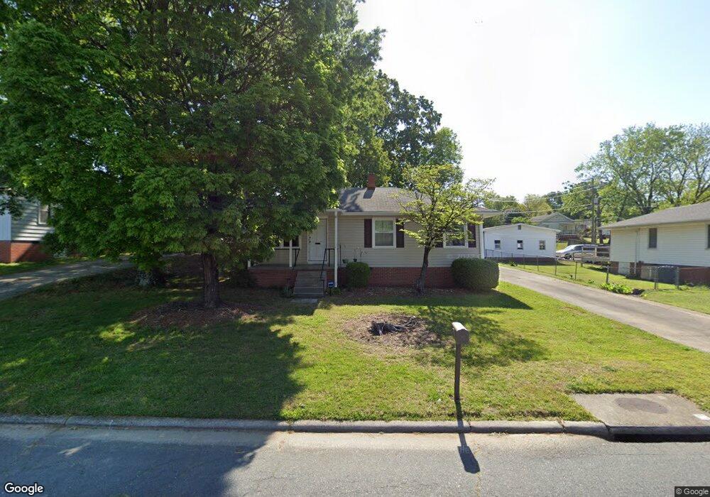
1310 Vine St Greensboro, NC 27405
Estimated Value: $158,000 - $170,000
3
Beds
1
Bath
1,012
Sq Ft
$164/Sq Ft
Est. Value
About This Home
This home is located at 1310 Vine St, Greensboro, NC 27405 and is currently estimated at $165,561, approximately $163 per square foot. 1310 Vine St is a home located in Guilford County with nearby schools including Irving Park Elementary School, Melvin C. Swann Jr. Middle School, and Page High School.
Ownership History
Date
Name
Owned For
Owner Type
Purchase Details
Closed on
Nov 7, 2006
Sold by
Johnson Ronnie and Johnson Dianna
Bought by
The Bank Of New York Trust Co Na
Current Estimated Value
Purchase Details
Closed on
Aug 31, 2006
Sold by
Weatherly Julie Sams and Marlowe Jean Sams
Bought by
Ferris Kris Brennan
Home Financials for this Owner
Home Financials are based on the most recent Mortgage that was taken out on this home.
Original Mortgage
$64,000
Interest Rate
9.57%
Mortgage Type
Purchase Money Mortgage
Purchase Details
Closed on
Jul 12, 2006
Sold by
Johnson Ronnie D
Bought by
Weatherly Julie Sams and Marlowe Jean Sams
Home Financials for this Owner
Home Financials are based on the most recent Mortgage that was taken out on this home.
Original Mortgage
$64,000
Interest Rate
9.57%
Mortgage Type
Purchase Money Mortgage
Purchase Details
Closed on
May 20, 1998
Sold by
Weatherly Julie Sams and Weatherly William H
Bought by
Johnson Ronnie D
Create a Home Valuation Report for This Property
The Home Valuation Report is an in-depth analysis detailing your home's value as well as a comparison with similar homes in the area
Home Values in the Area
Average Home Value in this Area
Purchase History
| Date | Buyer | Sale Price | Title Company |
|---|---|---|---|
| The Bank Of New York Trust Co Na | $136,000 | None Available | |
| Ferris Kris Brennan | $80,000 | None Available | |
| Weatherly Julie Sams | -- | None Available | |
| Johnson Ronnie D | -- | -- |
Source: Public Records
Mortgage History
| Date | Status | Borrower | Loan Amount |
|---|---|---|---|
| Previous Owner | Ferris Kris Brennan | $64,000 |
Source: Public Records
Tax History Compared to Growth
Tax History
| Year | Tax Paid | Tax Assessment Tax Assessment Total Assessment is a certain percentage of the fair market value that is determined by local assessors to be the total taxable value of land and additions on the property. | Land | Improvement |
|---|---|---|---|---|
| 2025 | $1,223 | $87,200 | $32,000 | $55,200 |
| 2024 | $1,223 | $87,200 | $32,000 | $55,200 |
| 2023 | $1,223 | $87,200 | $32,000 | $55,200 |
| 2022 | $1,189 | $87,200 | $32,000 | $55,200 |
| 2021 | $981 | $70,400 | $20,000 | $50,400 |
| 2020 | $981 | $70,400 | $20,000 | $50,400 |
| 2019 | $981 | $70,400 | $0 | $0 |
| 2018 | $953 | $70,400 | $0 | $0 |
| 2017 | $917 | $67,300 | $0 | $0 |
| 2016 | $1,013 | $73,200 | $0 | $0 |
| 2015 | $1,017 | $73,000 | $0 | $0 |
| 2014 | $1,024 | $73,000 | $0 | $0 |
Source: Public Records
Map
Nearby Homes
- 1406 Fairview St
- 1502 Fairview St
- 1210 Summit Ave
- 110 Sunset Cir Unit 102
- 1605 Ball St
- 1600 Ridgewood Ave
- 102 Sunset Cir Unit 203
- 1728 Kay St
- 1507 Tucker St
- 309 E Bessemer Ave
- 1525 Tucker St
- 1317 Joyce St
- 805 N Church St
- 103 Wentworth Dr
- 915 Olive St
- 1101 N Elm St Unit 202
- 1101 N Elm St Unit 104
- 1101 N Elm St Unit 907
- 1101 N Elm St Unit 303
- 1101 N Elm St Unit 304