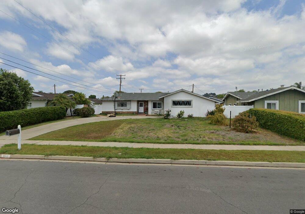
1311 Deborah Dr Tustin, CA 92780
Estimated Value: $1,201,000 - $1,529,000
3
Beds
3
Baths
1,922
Sq Ft
$729/Sq Ft
Est. Value
About This Home
This home is located at 1311 Deborah Dr, Tustin, CA 92780 and is currently estimated at $1,400,735, approximately $728 per square foot. 1311 Deborah Dr is a home located in Orange County with nearby schools including Red Hill Elementary School, Hewes Middle School, and Foothill High School.
Ownership History
Date
Name
Owned For
Owner Type
Purchase Details
Closed on
Jun 15, 2012
Sold by
Dezotell Steven G and Dezotell Catherine M
Bought by
Joyce Matthew and Joyce Jamie
Current Estimated Value
Home Financials for this Owner
Home Financials are based on the most recent Mortgage that was taken out on this home.
Original Mortgage
$375,200
Outstanding Balance
$257,821
Interest Rate
3.65%
Mortgage Type
New Conventional
Estimated Equity
$1,142,914
Purchase Details
Closed on
Jul 21, 2010
Sold by
Dezotell Marie E
Bought by
Dezotell Marie E and Marie E Dezotell Trust
Create a Home Valuation Report for This Property
The Home Valuation Report is an in-depth analysis detailing your home's value as well as a comparison with similar homes in the area
Home Values in the Area
Average Home Value in this Area
Purchase History
| Date | Buyer | Sale Price | Title Company |
|---|---|---|---|
| Joyce Matthew | $469,000 | First American Title | |
| Dezotell Marie E | -- | None Available |
Source: Public Records
Mortgage History
| Date | Status | Borrower | Loan Amount |
|---|---|---|---|
| Open | Joyce Matthew | $375,200 |
Source: Public Records
Tax History
| Year | Tax Paid | Tax Assessment Tax Assessment Total Assessment is a certain percentage of the fair market value that is determined by local assessors to be the total taxable value of land and additions on the property. | Land | Improvement |
|---|---|---|---|---|
| 2025 | $6,481 | $577,535 | $456,799 | $120,736 |
| 2024 | $6,481 | $566,211 | $447,842 | $118,369 |
| 2023 | $6,321 | $555,109 | $439,060 | $116,049 |
| 2022 | $6,223 | $544,225 | $430,451 | $113,774 |
| 2021 | $6,098 | $533,554 | $422,010 | $111,544 |
| 2020 | $6,066 | $528,084 | $417,683 | $110,401 |
| 2019 | $5,918 | $517,730 | $409,493 | $108,237 |
| 2018 | $5,821 | $507,579 | $401,464 | $106,115 |
| 2017 | $5,718 | $497,627 | $393,592 | $104,035 |
| 2016 | $5,616 | $487,870 | $385,874 | $101,996 |
| 2015 | $5,675 | $480,542 | $380,078 | $100,464 |
| 2014 | $5,529 | $471,129 | $372,632 | $98,497 |
Source: Public Records
Map
Nearby Homes
- 1281 La Colina Dr
- 1431 La Colina Dr
- 12192 Afton Ln
- 1062 El Camino Ln
- 1111 Tustin Pines Way
- 1271 Brittany Cross Rd
- 1016 Castlegate Ln
- 1532 Rainbow Dr
- 12811 Chaplet Place
- 1822 Loma Roja
- 1752 Sierra Alta Dr
- 13851 Gimbert Ln
- 13882 Berrington Ct
- 12911 Dean St
- 1542 La Loma Dr
- 12261 Browning Ave
- 13692 Jenet Cir
- 1681 Blueberry Way
- 2011 Redberry Rd
- 1121 Packers Cir Unit 53
- 1321 Deborah Dr
- 1291 Deborah Dr
- 12381 Woodlawn Ave
- 12402 Charloma Dr
- 12382 Charloma Dr
- 1312 Deborah Dr
- 12361 Woodlawn Ave
- 1322 Deborah Dr
- 1292 Deborah Dr
- 12362 Charloma Dr
- 12412 Woodlawn Ave
- 12402 Woodlawn Ave
- 12442 Woodlawn Ave
- 12372 Woodlawn Ave
- 12352 Charloma Dr
- 12401 Charloma Dr
- 1262 Deborah Dr
- 12471 Woodlawn Ave
- 12381 Charloma Dr
- 12362 Woodlawn Ave
Your Personal Tour Guide
Ask me questions while you tour the home.