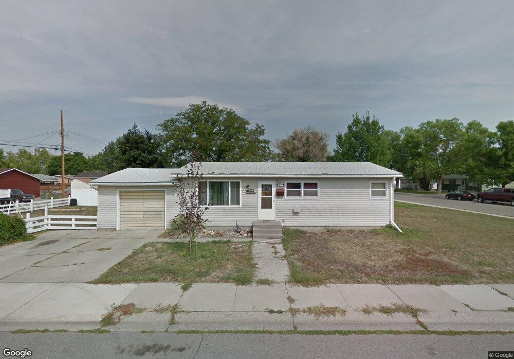
1311 Miles Ave Billings, MT 59102
East Central Billings NeighborhoodEstimated Value: $303,000 - $319,000
3
Beds
2
Baths
1,040
Sq Ft
$299/Sq Ft
Est. Value
About This Home
This home is located at 1311 Miles Ave, Billings, MT 59102 and is currently estimated at $310,675, approximately $298 per square foot. 1311 Miles Ave is a home located in Yellowstone County with nearby schools including Miles Avenue School, Lewis & Clark Junior High School, and Billings West High School.
Ownership History
Date
Name
Owned For
Owner Type
Purchase Details
Closed on
Sep 10, 2012
Sold by
Bladow Dean R and Bladow Madelein C
Bought by
Kurokawa Steven Y
Current Estimated Value
Home Financials for this Owner
Home Financials are based on the most recent Mortgage that was taken out on this home.
Original Mortgage
$128,205
Outstanding Balance
$89,957
Interest Rate
3.87%
Mortgage Type
FHA
Estimated Equity
$220,718
Create a Home Valuation Report for This Property
The Home Valuation Report is an in-depth analysis detailing your home's value as well as a comparison with similar homes in the area
Home Values in the Area
Average Home Value in this Area
Purchase History
| Date | Buyer | Sale Price | Title Company |
|---|---|---|---|
| Kurokawa Steven Y | -- | Chicago Title |
Source: Public Records
Mortgage History
| Date | Status | Borrower | Loan Amount |
|---|---|---|---|
| Open | Kurokawa Steven Y | $128,205 |
Source: Public Records
Tax History
| Year | Tax Paid | Tax Assessment Tax Assessment Total Assessment is a certain percentage of the fair market value that is determined by local assessors to be the total taxable value of land and additions on the property. | Land | Improvement |
|---|---|---|---|---|
| 2025 | $2,570 | $293,100 | $47,930 | $245,170 |
| 2024 | $2,570 | $265,100 | $44,351 | $220,749 |
| 2023 | $2,575 | $265,100 | $44,351 | $220,749 |
| 2022 | $2,057 | $183,500 | $0 | $0 |
| 2021 | $1,959 | $183,500 | $0 | $0 |
| 2020 | $2,109 | $189,800 | $0 | $0 |
| 2019 | $2,015 | $189,800 | $0 | $0 |
| 2018 | $1,887 | $173,600 | $0 | $0 |
| 2017 | $1,832 | $173,600 | $0 | $0 |
| 2016 | $1,801 | $173,300 | $0 | $0 |
| 2015 | $1,761 | $173,300 | $0 | $0 |
| 2014 | $1,572 | $81,779 | $0 | $0 |
Source: Public Records
Map
Nearby Homes
- 1245 Cook Ave
- 1326 Custer Ave
- 1342 Custer Ave
- 1205 Lynn Ave
- 1310 Yellowstone Ave Unit 6
- 1310 Yellowstone Ave Unit 16
- 1288 Yellowstone Ave Unit 2
- 1537 Wyoming Ave Unit D
- 1216 Eldorado Dr
- 1204 Eldorado Dr
- 1225 Clark Ave
- 947 Howard Ave
- 1009 Wyoming Ave
- 925 Miles Ave
- 1029 Yellowstone Ave Unit 2
- 1003 Wyoming Ave
- 1627 Yellowstone Ave
- 11 Alma Ln
- 1736 Broadwater Ave
- 43 Prickett Ln
- 408 Normandy Dr
- 412 Normandy Dr
- 1312 Miles Ave
- 1315 Miles Ave
- 405 14th St W
- 416 Normandy Dr
- 1307 Miles Ave
- 409 14th St W
- 1316 Miles Ave
- 405 Normandy Dr
- 320 Normandy Dr
- 409 Normandy Dr
- 1308 Miles Ave
- 413 14th St W
- 420 Normandy Dr
- 417 14th St W
- 413 Normandy Dr
- 321 14th St W
- 321 Normandy Dr
- 1311 Howard Ave
Your Personal Tour Guide
Ask me questions while you tour the home.