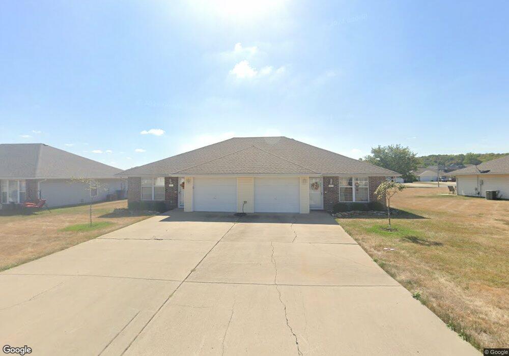
1311 SW Blue Branch Dr Grain Valley, MO 64029
Estimated Value: $291,000 - $316,000
4
Beds
2
Baths
1,969
Sq Ft
$153/Sq Ft
Est. Value
About This Home
This home is located at 1311 SW Blue Branch Dr, Grain Valley, MO 64029 and is currently estimated at $301,681, approximately $153 per square foot. 1311 SW Blue Branch Dr is a home located in Jackson County with nearby schools including Grain Valley High School.
Ownership History
Date
Name
Owned For
Owner Type
Purchase Details
Closed on
Sep 3, 2021
Sold by
Bd Land Llc
Bought by
Lexis Investments Llc
Current Estimated Value
Purchase Details
Closed on
Jul 31, 2019
Sold by
Diamond Key Management Llc
Bought by
Barker Wanda
Purchase Details
Closed on
Nov 1, 2018
Sold by
Cogan Mary Jane
Bought by
Diamond Key Management Llc
Purchase Details
Closed on
May 19, 2004
Sold by
Gildehaus Steven K and Gildehaus Debra K
Bought by
Jeff Handy Construction
Home Financials for this Owner
Home Financials are based on the most recent Mortgage that was taken out on this home.
Original Mortgage
$124,000
Interest Rate
6.12%
Mortgage Type
Construction
Create a Home Valuation Report for This Property
The Home Valuation Report is an in-depth analysis detailing your home's value as well as a comparison with similar homes in the area
Home Values in the Area
Average Home Value in this Area
Purchase History
| Date | Buyer | Sale Price | Title Company |
|---|---|---|---|
| Lexis Investments Llc | -- | Chicago Title | |
| Barker Wanda | -- | None Available | |
| Diamond Key Management Llc | -- | Kansas City Title Inc | |
| Jeff Handy Construction | -- | Stewart |
Source: Public Records
Mortgage History
| Date | Status | Borrower | Loan Amount |
|---|---|---|---|
| Previous Owner | Jeff Handy Construction | $124,000 |
Source: Public Records
Tax History Compared to Growth
Tax History
| Year | Tax Paid | Tax Assessment Tax Assessment Total Assessment is a certain percentage of the fair market value that is determined by local assessors to be the total taxable value of land and additions on the property. | Land | Improvement |
|---|---|---|---|---|
| 2025 | $3,305 | $44,726 | $7,009 | $37,717 |
| 2024 | $3,182 | $40,130 | $6,555 | $33,575 |
| 2023 | $3,182 | $40,130 | $6,053 | $34,077 |
| 2022 | $3,066 | $33,820 | $3,749 | $30,071 |
| 2021 | $2,994 | $33,820 | $3,749 | $30,071 |
| 2020 | $2,655 | $29,580 | $3,749 | $25,831 |
| 2019 | $2,601 | $29,580 | $3,749 | $25,831 |
| 2018 | $2,423 | $25,744 | $3,263 | $22,481 |
| 2017 | $2,361 | $25,744 | $3,263 | $22,481 |
| 2016 | $2,361 | $25,099 | $3,933 | $21,166 |
| 2014 | $2,116 | $22,325 | $4,072 | $18,253 |
Source: Public Records
Map
Nearby Homes
- 1418 SW Blue Branch Dr
- 401 S Minter Rd
- 509 SW Joseph Ct
- 1024 Christie Ln
- 1402 NW Broadway Throughway
- 1215 SW Lone Star Ct
- 200 Cross Creek Ln
- 719 S Minter Rd
- 636 SW Lakeview Dr
- 1235 NW Ashley Ln
- 209 SW Cross Creek Dr
- 1214 SW Windcrest Ct
- 1219 SW Windcrest Ct
- 1229 NW Ashley Dr
- 207 Pebblebrook St
- 1309 SW Graystone Cir
- 29605 SW Eagles Pkwy
- 6205 Chiles Rd
- 714 SW Brome Dr
- 29800 E 65th St
- 1307 SW Blue Branch Dr
- 1313 SW Blue Branch Dr
- 1305 SW Blue Branch Dr
- 1322 SW Stoneybrooke Dr
- 1320 SW Stoneybrooke Dr
- 1303 SW Blue Branch Dr
- 1312 SW Stoneybrooke Dr
- 1308 SW Blue Branch Dr
- 1312 SW Blue Branch Dr
- 1304 SW Blue Branch Dr
- 1318 SW Blue Branch Dr
- 1316 SW Blue Branch Dr
- 1308 SW Stoneybrooke Dr
- 1341 SW Stoneybrooke Dr
- 1302 SW Blue Branch Dr
- 1304 SW Stoneybrooke Dr
- 1400 SW Blue Branch Dr
- 1400 SW Blue Branch Dr
- 1337 SW Stoneybrooke Dr
- 1300 SW Blue Branch Dr