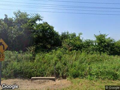
13122 Highway 201 N Clarkridge, AR 72623
Estimated Value: $236,807 - $387,000
--
Bed
2
Baths
2,506
Sq Ft
$120/Sq Ft
Est. Value
About This Home
This home is located at 13122 Highway 201 N, Clarkridge, AR 72623 and is currently estimated at $300,602, approximately $119 per square foot. 13122 Highway 201 N is a home located in Baxter County with nearby schools including Mountain Home Kindergarten, Nelson Wilks Herron Elementary School, and Hackler Intermediate School.
Ownership History
Date
Name
Owned For
Owner Type
Purchase Details
Closed on
Jan 6, 2022
Sold by
Gerald Farris
Bought by
Farris Nathan
Current Estimated Value
Home Financials for this Owner
Home Financials are based on the most recent Mortgage that was taken out on this home.
Original Mortgage
$155,387
Outstanding Balance
$146,682
Interest Rate
3.12%
Mortgage Type
New Conventional
Create a Home Valuation Report for This Property
The Home Valuation Report is an in-depth analysis detailing your home's value as well as a comparison with similar homes in the area
Home Values in the Area
Average Home Value in this Area
Purchase History
| Date | Buyer | Sale Price | Title Company |
|---|---|---|---|
| Farris Nathan | $153,452 | Robert S Clarke Of Sanders Mor |
Source: Public Records
Mortgage History
| Date | Status | Borrower | Loan Amount |
|---|---|---|---|
| Open | Farris Nathan | $155,387 | |
| Previous Owner | Farris Gerald W | $260,000 | |
| Previous Owner | Farris Gerald W | $200,000 |
Source: Public Records
Tax History Compared to Growth
Tax History
| Year | Tax Paid | Tax Assessment Tax Assessment Total Assessment is a certain percentage of the fair market value that is determined by local assessors to be the total taxable value of land and additions on the property. | Land | Improvement |
|---|---|---|---|---|
| 2024 | $374 | $8,270 | $1,300 | $6,970 |
| 2023 | $383 | $8,270 | $1,300 | $6,970 |
| 2022 | $383 | $8,270 | $1,300 | $6,970 |
| 2021 | $385 | $8,310 | $1,340 | $6,970 |
| 2020 | $385 | $8,310 | $1,340 | $6,970 |
| 2019 | $403 | $8,310 | $1,340 | $6,970 |
| 2018 | $1,912 | $54,810 | $1,890 | $52,920 |
| 2017 | $1,540 | $50,250 | $1,890 | $48,360 |
| 2016 | $1,434 | $40,740 | $2,050 | $38,690 |
| 2015 | $1,455 | $40,740 | $2,050 | $38,690 |
| 2014 | $1,434 | $40,740 | $2,050 | $38,690 |
Source: Public Records
Map
Nearby Homes
- 118 Cr 97
- 001-03457-002 County Road 38
- Tract 15 Arkansas 201
- Tract 14 Arkansas 201
- Tract 13 Arkansas 201
- Tract 9 Arkansas 201
- Tract 8 Arkansas 201
- Lots 19-22 Arkansas 201
- Tract 7 Arkansas 201
- 002-11022-041 County Road 36
- 4193 County Road 36
- 687 County Road 479
- 686 County Road 479
- 001-07445-013 County Road 1423
- 506 B-Q Rd
- 106 Ellison Ln
- 83 Sir Williams
- Tbd County Road 553 A
- 000 State Highway J
- 0 County Road 553
- 13122 Highway 201 N
- 52 County Road 37
- 12999 Highway 201 N
- 13290 Arkansas 201
- 12979 Highway 201 N
- 13277 Highway 201 N
- 12891 Highway 201 N
- 180 County Road 37
- 13436 Highway 201 N
- 20 Cr 521
- 20 County Road 521
- 181 County Road 37
- 226 County Road 37
- 12726 Highway 201 N
- 12727 Highway 201 N
- 418 Cr 521
- 418 Cr 521
- 418 County Road 521
- 00 County Road 36
- 11 County Road 36
