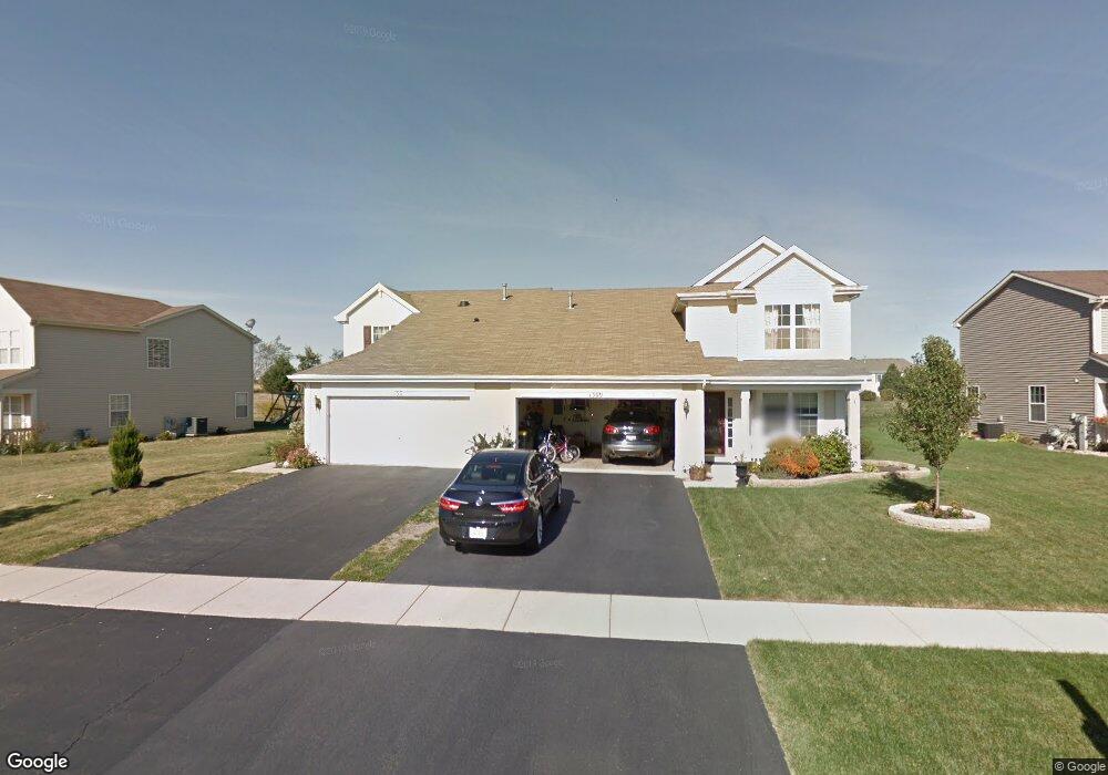
1313 Cape Cod Ln Pingree Grove, IL 60140
Estimated Value: $288,775 - $317,000
About This Home
This home is located at 1313 Cape Cod Ln, Pingree Grove, IL 60140 and is currently estimated at $299,694, approximately $210 per square foot. 1313 Cape Cod Ln is a home located in Kane County with nearby schools including Hampshire Middle School, Hampshire High School, and Cambridge Lakes Charter School.
Ownership History
We collect this data history from publicly available records. To have your information removed, we recommend requesting removal directly through your county’s website.
Purchase Details
Home Financials for this Owner
Home Financials are based on the most recent Mortgage that was taken out on this home.Home Values in the Area
Average Home Value in this Area
Purchase History
We collect this data history from publicly available records. To have your information removed, we recommend requesting removal directly through your county’s website.
| Date | Buyer | Sale Price | Title Company |
|---|---|---|---|
| $194,500 | First American Title |
Mortgage History
We collect this data history from publicly available records. To have your information removed, we recommend requesting removal directly through your county’s website.
| Date | Status | Borrower | Loan Amount |
|---|---|---|---|
| Previous Owner | $184,400 |
Tax History
We collect this data history from publicly available records. To have your information removed, we recommend requesting removal directly through your county’s website.
| Year | Tax Paid | Tax Assessment Tax Assessment Total Assessment is a certain percentage of the fair market value that is determined by local assessors to be the total taxable value of land and additions on the property. | Land | Improvement |
|---|---|---|---|---|
| 2024 | $1,217 | $79,005 | $20,937 | $58,068 |
| 2023 | $1,263 | $71,446 | $18,934 | $52,512 |
| 2022 | $1,283 | $61,631 | $17,457 | $44,174 |
| 2021 | $1,261 | $57,967 | $16,419 | $41,548 |
| 2020 | $1,240 | $56,487 | $16,000 | $40,487 |
| 2019 | $1,225 | $54,216 | $15,357 | $38,859 |
| 2018 | $4,827 | $51,429 | $14,413 | $37,016 |
| 2017 | $1,211 | $48,975 | $13,725 | $35,250 |
| 2016 | $1,206 | $46,625 | $13,066 | $33,559 |
| 2015 | -- | $44,035 | $12,340 | $31,695 |
| 2014 | -- | $43,888 | $12,193 | $31,695 |
| 2013 | -- | $44,693 | $12,417 | $32,276 |
Map
- 1889 Lake Bluff Ln
- 1863 Lake Bluff Ln
- 1334 Promontory Dr
- 1250 Promontory Dr
- 1709 Windward Dr
- 2220 Aurora Dr Unit 23
- 1670 Ruby Dr
- 1668 Ruby Dr
- 1634 Windward Dr
- 1566 Dublin Dr
- 2305 Aurora Dr Unit 8
- 1587 Windward Dr
- 2517 Alison Ave
- 1365 Broadland Dr
- 1074 Chestnut Dr
- 1417 Newport Cir
- 1196 Port Royal Rd
- 2442 Alison Ave
- 43W428 U S 20
- 1355 Lighthouse Ln
- 1309 Cape Cod Ln
- 1317 Cape Cod Ln
- 1305 Cape Cod Ln
- 1325 Cape Cod Ln
- 1301 Cape Cod Ln
- 1959 Peninsula Ct
- 1962 Peninsula Ct
- 1329 Cape Cod Ln
- 1963 Peninsula Ct Unit 15
- 1324 Cape Cod Ln
- 1918 Diamond Head Trail
- 1966 Peninsula Ct
- 1333 Cape Cod Ln
- 1895 Lake Bluff Ln
- 1967 Peninsula Ct
- 1901 Lake Bluff Ln
- 1926 Diamond Head Trail
- 1970 Peninsula Ct
- 1337 Cape Cod Ln
- 1328 Cape Cod Ln
Ask me questions while you tour the home.