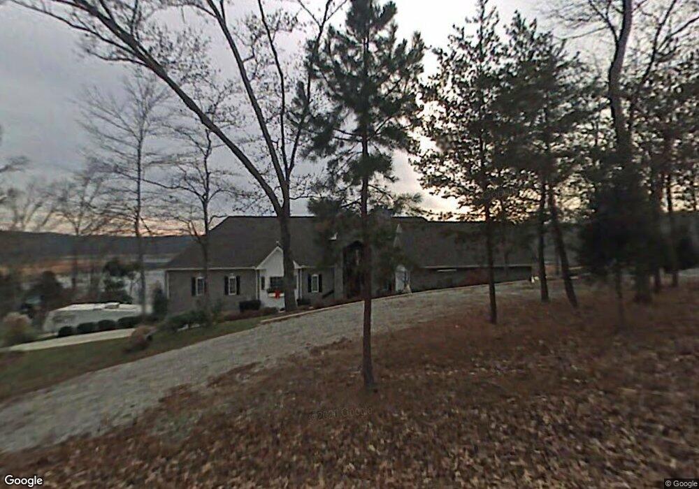
1314 E Norris Point Rd La Follette, TN 37766
Estimated Value: $1,242,000 - $1,433,226
--
Bed
4
Baths
4,202
Sq Ft
$315/Sq Ft
Est. Value
About This Home
This home is located at 1314 E Norris Point Rd, La Follette, TN 37766 and is currently estimated at $1,323,409, approximately $314 per square foot. 1314 E Norris Point Rd is a home located in Campbell County.
Ownership History
Date
Name
Owned For
Owner Type
Purchase Details
Closed on
Jun 21, 2021
Sold by
Mills Michael
Bought by
Rent Norris Llc
Current Estimated Value
Purchase Details
Closed on
Mar 1, 2021
Sold by
Rent Norris Llc
Bought by
Mills Michael
Purchase Details
Closed on
Mar 30, 2020
Sold by
Holtslag James E and Holtslag Gail E
Bought by
Rent Norris Llc
Purchase Details
Closed on
Feb 24, 2010
Sold by
Holtslag James E
Bought by
Holtslag Family Revocable Trus
Purchase Details
Closed on
Feb 11, 1994
Bought by
Holtslag James E and Holtslag Gail E
Create a Home Valuation Report for This Property
The Home Valuation Report is an in-depth analysis detailing your home's value as well as a comparison with similar homes in the area
Home Values in the Area
Average Home Value in this Area
Purchase History
| Date | Buyer | Sale Price | Title Company |
|---|---|---|---|
| Rent Norris Llc | -- | None Available | |
| Mills Michael | -- | None Available | |
| Rent Norris Llc | $825,000 | None Available | |
| Holtslag Family Revocable Trus | -- | -- | |
| Holtslag James E | $39,500 | -- |
Source: Public Records
Tax History Compared to Growth
Tax History
| Year | Tax Paid | Tax Assessment Tax Assessment Total Assessment is a certain percentage of the fair market value that is determined by local assessors to be the total taxable value of land and additions on the property. | Land | Improvement |
|---|---|---|---|---|
| 2024 | $3,292 | $270,825 | $89,225 | $181,600 |
| 2023 | $3,862 | $186,925 | $56,250 | $130,675 |
| 2022 | $3,862 | $186,925 | $56,250 | $130,675 |
| 2021 | $3,862 | $186,925 | $56,250 | $130,675 |
| 2020 | $3,785 | $186,925 | $56,250 | $130,675 |
| 2019 | $3,862 | $186,925 | $56,250 | $130,675 |
| 2018 | $4,206 | $186,950 | $56,250 | $130,700 |
| 2017 | $4,206 | $186,950 | $56,250 | $130,700 |
| 2016 | $4,206 | $186,950 | $56,250 | $130,700 |
| 2015 | $3,720 | $186,950 | $56,250 | $130,700 |
| 2014 | -- | $186,950 | $56,250 | $130,700 |
| 2013 | -- | $186,950 | $56,250 | $130,700 |
Source: Public Records
Map
Nearby Homes
- 939 E Norris Point Rd
- 444 Chapman Village Dr
- 536 E Norris Point Rd
- 643 Crown Pointe Rd
- TBD Brandt Pike
- 0 White Ln
- 201 Crown Jewel Ln
- 195 Kennedys Loop
- 0 Hueston Wood Ln Unit 1278197
- 138 Bethlehem Ln
- 339 Flat Hollow Marina Rd
- 455 Alder Springs Rd
- 176 Flat Hollow Marina Rd
- 735 Alder Springs Rd
- 309 Alder Shore Ln
- 0 Lakesprings Dr Unit 1315301
- 0 Victory Rd Unit 1316112
- Lot 172 Saddleridge Dr
- Lot172&173 Saddleridge Dr
- 264 Victory Rd
- 1296 E Norris Point Rd
- 1332 E Norris Point Rd
- 1282 E Norris Point Rd
- 1282 E Norris Point Rd Unit 1
- 1338 E Norris Point Rd
- 1266 E Norris Point Rd
- 1445 E Norris Point Rd
- 1455 E Norris Point Rd
- 1360 E Norris Point Rd
- 1279 E Norris Point Rd
- 1435 E Norris Point Rd
- 1344 E Norris Point Rd
- 1385 E Norris Point Rd E
- 1380 E Norris Point Rd
- Lot 6 Norris Point Rd E
- 1244 E Norris Point Rd
- 1388 E Norris Point Rd
- 1230 E Norris Point Rd
- 1205 E Norris Point Rd
- 1205 E Norris Point Rd