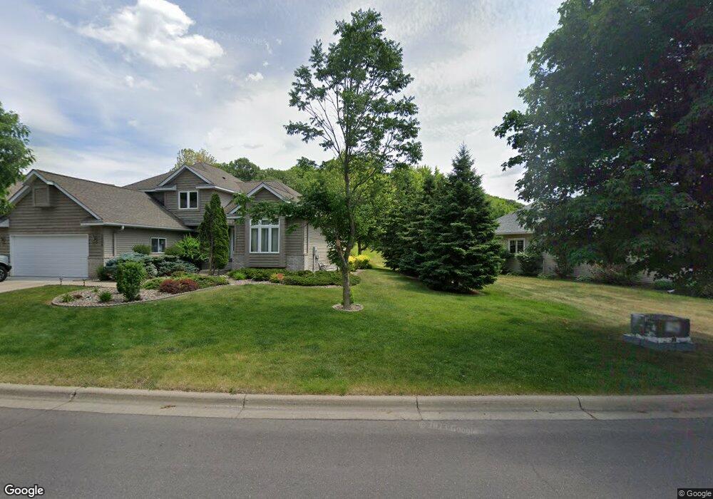
1315 Newhall Dr Faribault, MN 55021
Estimated Value: $529,000 - $668,093
4
Beds
6
Baths
2,490
Sq Ft
$245/Sq Ft
Est. Value
About This Home
This home is located at 1315 Newhall Dr, Faribault, MN 55021 and is currently estimated at $611,273, approximately $245 per square foot. 1315 Newhall Dr is a home located in Rice County with nearby schools including Roosevelt Elementary School, Faribault Middle School, and Faribault Senior High School.
Ownership History
Date
Name
Owned For
Owner Type
Purchase Details
Closed on
Nov 21, 2017
Sold by
Belling Diaone and Belling Lyle
Bought by
Belling Lyle and Belling Dione
Current Estimated Value
Purchase Details
Closed on
Sep 26, 2007
Sold by
Olson Kristin M
Bought by
Peterson Dione
Purchase Details
Closed on
Aug 3, 2004
Sold by
Nomeland Thomas J and Nomeland Rebecca Z
Bought by
Olson Kristin M
Purchase Details
Closed on
Nov 1, 2002
Sold by
Legary Lane Development
Bought by
Nomeland Thomas J and Nomeland Rebecca Z
Create a Home Valuation Report for This Property
The Home Valuation Report is an in-depth analysis detailing your home's value as well as a comparison with similar homes in the area
Home Values in the Area
Average Home Value in this Area
Purchase History
| Date | Buyer | Sale Price | Title Company |
|---|---|---|---|
| Belling Lyle | -- | None Available | |
| Peterson Dione | $84,000 | -- | |
| Olson Kristin M | $79,000 | -- | |
| Nomeland Thomas J | $72,000 | -- |
Source: Public Records
Tax History Compared to Growth
Tax History
| Year | Tax Paid | Tax Assessment Tax Assessment Total Assessment is a certain percentage of the fair market value that is determined by local assessors to be the total taxable value of land and additions on the property. | Land | Improvement |
|---|---|---|---|---|
| 2025 | $7,796 | $628,800 | $89,900 | $538,900 |
| 2024 | $7,796 | $592,200 | $83,900 | $508,300 |
| 2023 | $6,048 | $592,200 | $83,900 | $508,300 |
| 2022 | $5,476 | $497,900 | $85,200 | $412,700 |
| 2021 | $5,242 | $420,400 | $69,400 | $351,000 |
| 2020 | $4,624 | $400,900 | $66,200 | $334,700 |
| 2019 | $4,372 | $363,100 | $63,100 | $300,000 |
| 2018 | $4,118 | $340,300 | $64,000 | $276,300 |
| 2017 | $4,080 | $314,300 | $51,200 | $263,100 |
| 2016 | $3,920 | $293,500 | $48,500 | $245,000 |
| 2015 | $3,642 | $276,200 | $48,500 | $227,700 |
| 2014 | -- | $269,300 | $48,500 | $220,800 |
Source: Public Records
Map
Nearby Homes
- 1107 Shumway Ct
- 854 Rogers Row
- 815 Rogers Row
- 2038 Legacy Dr
- Parkdale Plan at The Meadows
- St. Croix Plan at The Meadows
- McKenna Plan at The Meadows
- Monroe Plan at The Meadows
- Mayberry Plan at The Meadows
- Marquette Plan at The Meadows
- Majestic Plan at The Meadows
- Macalaster Plan at The Meadows
- Linden Plan at The Meadows
- Hammond Plan at The Meadows
- Everleigh Plan at The Meadows
- Garrison Plan at The Meadows
- Enclave II Plan at The Meadows
- Eastbrook Plan at The Meadows
- Cottonwood II Plan at The Meadows
- Canton II Plan at The Meadows
- 1309 Newhall Dr
- 1305 Newhall Dr
- 1213 Newhall Dr
- 1205 Newhall Dr
- 1029 Matteson St
- 1209 Newhall Dr
- 1113 Newhall Dr
- 1208 11th Ave NE
- 1314 Newhall Dr
- 1310 Newhall Dr
- 1306 Newhall Dr
- 1320 11th Ave NE
- 1109 Newhall Dr
- 1302 Newhall Dr
- 1216 Newhall Dr
- 1212 Newhall Dr
- 1208 Newhall Dr
- 1204 Newhall Dr
- 1114 Newhall Dr
- 1105 Newhall Dr