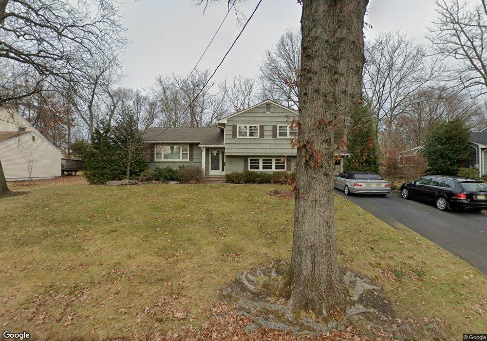
1317 Graymill Dr Scotch Plains, NJ 07076
Estimated Value: $690,217 - $967,000
--
Bed
--
Bath
2,056
Sq Ft
$398/Sq Ft
Est. Value
About This Home
This home is located at 1317 Graymill Dr, Scotch Plains, NJ 07076 and is currently estimated at $817,554, approximately $397 per square foot. 1317 Graymill Dr is a home located in Union County with nearby schools including William J. McGinn Elementary School, Terrill Middle School, and Scotch Plains-Fanwood High School.
Ownership History
Date
Name
Owned For
Owner Type
Purchase Details
Closed on
Mar 24, 2025
Sold by
Sank Anne C and Davis Bruce Alan
Bought by
Rodak Homes Inc
Current Estimated Value
Home Financials for this Owner
Home Financials are based on the most recent Mortgage that was taken out on this home.
Original Mortgage
$1,396,492
Outstanding Balance
$946,593
Interest Rate
6.76%
Mortgage Type
New Conventional
Estimated Equity
-$129,039
Purchase Details
Closed on
Oct 8, 2014
Sold by
Davis Bruce Alan and Davis Ann Sank
Bought by
Davis Bruce Alan and Davis Ann Sank
Create a Home Valuation Report for This Property
The Home Valuation Report is an in-depth analysis detailing your home's value as well as a comparison with similar homes in the area
Home Values in the Area
Average Home Value in this Area
Purchase History
| Date | Buyer | Sale Price | Title Company |
|---|---|---|---|
| Rodak Homes Inc | $750,000 | Fidelity National Title | |
| Rodak Homes Inc | $750,000 | Fidelity National Title | |
| Davis Bruce Alan | -- | None Available |
Source: Public Records
Mortgage History
| Date | Status | Borrower | Loan Amount |
|---|---|---|---|
| Open | Rodak Homes Inc | $1,396,492 | |
| Closed | Rodak Homes Inc | $1,396,492 |
Source: Public Records
Tax History Compared to Growth
Tax History
| Year | Tax Paid | Tax Assessment Tax Assessment Total Assessment is a certain percentage of the fair market value that is determined by local assessors to be the total taxable value of land and additions on the property. | Land | Improvement |
|---|---|---|---|---|
| 2025 | $15,192 | $129,100 | $43,100 | $86,000 |
| 2024 | $14,745 | $129,100 | $43,100 | $86,000 |
| 2023 | $14,745 | $129,100 | $43,100 | $86,000 |
| 2022 | $14,569 | $129,100 | $43,100 | $86,000 |
| 2021 | $14,544 | $129,100 | $43,100 | $86,000 |
| 2020 | $14,475 | $129,100 | $43,100 | $86,000 |
| 2019 | $14,368 | $129,100 | $43,100 | $86,000 |
| 2018 | $14,126 | $129,100 | $43,100 | $86,000 |
| 2017 | $13,812 | $129,100 | $43,100 | $86,000 |
| 2016 | $13,546 | $129,100 | $43,100 | $86,000 |
| 2015 | $13,324 | $129,100 | $43,100 | $86,000 |
| 2014 | $12,885 | $129,100 | $43,100 | $86,000 |
Source: Public Records
Map
Nearby Homes
- 1933 W Broad St
- 1933 Mary Ellen Ln
- 2 Brookside Ct
- 2154 W Broad St
- 2116 Newark Ave
- 119 Lamberts Mill Rd
- 57 Rambling Dr
- 187 King St
- 1466 Lamberts Mill Rd
- 2 Dutch Ln
- 314 Highgate Ave
- 5 Robin Rd
- 120 S Martine Ave
- 2212 Shady Ln
- 1380 Terrill Rd
- 345 La Grande Ave
- 32 Gere Place
- 40 1st St
- 2 Unami Ln
- 2219 North Ave Unit 6
- 1309 Graymill Dr
- 1325 Graymill Dr
- 1972 W Broad St
- 1333 Graymill Dr
- 1301 Graymill Dr
- 1978 W Broad St
- 1316 Graymill Dr
- 1324 Graymill Dr
- 1982 W Broad St
- 1308 Graymill Dr
- 1341 Graymill Dr
- 1332 Graymill Dr
- 1988 W Broad St
- 1942 W Broad St
- 1340 Graymill Dr
- 1351 Graymill Dr
- 1965 W Broad St
- 1957 W Broad St
- 1996 W Broad St
- 1975 W Broad St