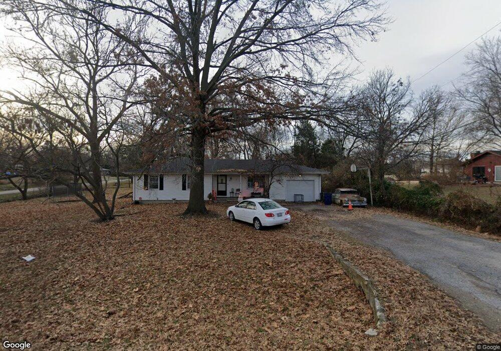
1317 N 1770 Rd Lawrence, KS 66044
Estimated Value: $241,000 - $292,000
3
Beds
2
Baths
1,038
Sq Ft
$251/Sq Ft
Est. Value
About This Home
This home is located at 1317 N 1770 Rd, Lawrence, KS 66044 and is currently estimated at $260,499, approximately $250 per square foot. 1317 N 1770 Rd is a home located in Douglas County with nearby schools including Deerfield Elementary School, West Middle School, and Lawrence Free State High School.
Ownership History
Date
Name
Owned For
Owner Type
Purchase Details
Closed on
May 10, 2007
Sold by
Lynds Jarrod
Bought by
Loeppke Derek W and Loeppke Khara
Current Estimated Value
Home Financials for this Owner
Home Financials are based on the most recent Mortgage that was taken out on this home.
Original Mortgage
$141,282
Outstanding Balance
$85,891
Interest Rate
6.16%
Mortgage Type
FHA
Estimated Equity
$174,608
Purchase Details
Closed on
Aug 25, 2003
Sold by
Kufahl Mary K
Bought by
Lynds Jarrod
Home Financials for this Owner
Home Financials are based on the most recent Mortgage that was taken out on this home.
Original Mortgage
$127,500
Interest Rate
5.71%
Mortgage Type
Purchase Money Mortgage
Create a Home Valuation Report for This Property
The Home Valuation Report is an in-depth analysis detailing your home's value as well as a comparison with similar homes in the area
Home Values in the Area
Average Home Value in this Area
Purchase History
| Date | Buyer | Sale Price | Title Company |
|---|---|---|---|
| Loeppke Derek W | -- | First American Title | |
| Lynds Jarrod | -- | First American Title |
Source: Public Records
Mortgage History
| Date | Status | Borrower | Loan Amount |
|---|---|---|---|
| Open | Loeppke Derek W | $141,282 | |
| Previous Owner | Lynds Jarrod | $127,500 |
Source: Public Records
Tax History Compared to Growth
Tax History
| Year | Tax Paid | Tax Assessment Tax Assessment Total Assessment is a certain percentage of the fair market value that is determined by local assessors to be the total taxable value of land and additions on the property. | Land | Improvement |
|---|---|---|---|---|
| 2025 | $2,657 | $25,818 | $5,750 | $20,068 |
| 2024 | $2,657 | $25,427 | $5,405 | $20,022 |
| 2023 | $2,636 | $23,943 | $5,175 | $18,768 |
| 2022 | $2,492 | $22,056 | $4,600 | $17,456 |
| 2021 | $2,219 | $18,851 | $4,368 | $14,483 |
| 2020 | $2,054 | $17,618 | $4,368 | $13,250 |
| 2019 | $1,944 | $16,721 | $3,798 | $12,923 |
| 2018 | $1,876 | $15,997 | $3,571 | $12,426 |
| 2017 | $1,873 | $15,698 | $3,571 | $12,127 |
| 2016 | $1,786 | $15,560 | $4,598 | $10,962 |
| 2015 | $1,775 | $15,399 | $4,598 | $10,801 |
| 2014 | $1,737 | $15,157 | $4,598 | $10,559 |
Source: Public Records
Map
Nearby Homes
- 1757 E 1318 Rd
- 1316 N 1750 Rd
- 709 N Michigan Cir
- 501 River Bend Ct
- 2305 Brett Dr
- 255 N Michigan St Unit 22
- 2412 Stowe Dr
- 212 N Minnesota St
- 1515 Pinewood Dr
- 209 Yorkshire Dr
- 120 Minnesota St
- 121 Florida St
- 515 McDonald Dr
- 1211 N 1800 Rd
- 808 Morning Dove Ct
- 307 Wisconsin St
- 322 Birch Ln
- 229 Deerfield Ln
- Lot 3 Peterson Rd
- Lot 2 Peterson Rd