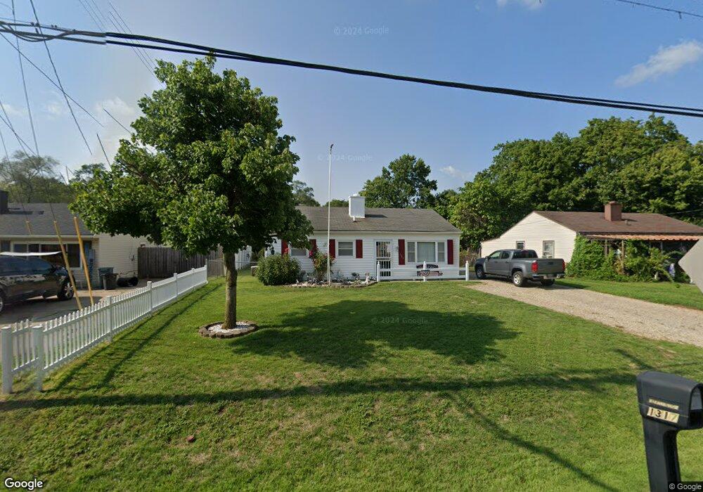
1317 Pershing Ave Middletown, OH 45044
Amanda-Oneida NeighborhoodEstimated Value: $97,619 - $166,000
3
Beds
1
Bath
816
Sq Ft
$152/Sq Ft
Est. Value
About This Home
This home is located at 1317 Pershing Ave, Middletown, OH 45044 and is currently estimated at $124,405, approximately $152 per square foot. 1317 Pershing Ave is a home located in Butler County with nearby schools including Amanda Elementary School, Highview 6th Grade Center, and Middletown Middle School.
Ownership History
Date
Name
Owned For
Owner Type
Purchase Details
Closed on
Sep 26, 2022
Sold by
Pennington Arthur Lee
Bought by
Pennington Arthur L and Pennington Judith E
Current Estimated Value
Home Financials for this Owner
Home Financials are based on the most recent Mortgage that was taken out on this home.
Original Mortgage
$133,500
Outstanding Balance
$133,223
Interest Rate
6.53%
Mortgage Type
Credit Line Revolving
Estimated Equity
-$8,818
Create a Home Valuation Report for This Property
The Home Valuation Report is an in-depth analysis detailing your home's value as well as a comparison with similar homes in the area
Home Values in the Area
Average Home Value in this Area
Purchase History
| Date | Buyer | Sale Price | Title Company |
|---|---|---|---|
| Pennington Arthur L | -- | -- |
Source: Public Records
Mortgage History
| Date | Status | Borrower | Loan Amount |
|---|---|---|---|
| Open | Pennington Arthur L | $133,500 | |
| Closed | Pennington Arthur L | $133,500 |
Source: Public Records
Tax History Compared to Growth
Tax History
| Year | Tax Paid | Tax Assessment Tax Assessment Total Assessment is a certain percentage of the fair market value that is determined by local assessors to be the total taxable value of land and additions on the property. | Land | Improvement |
|---|---|---|---|---|
| 2024 | $1,083 | $30,460 | $6,200 | $24,260 |
| 2023 | $1,093 | $30,710 | $6,200 | $24,510 |
| 2022 | $822 | $22,900 | $6,200 | $16,700 |
| 2021 | $791 | $22,900 | $6,200 | $16,700 |
| 2020 | $824 | $22,900 | $6,200 | $16,700 |
| 2019 | $1,197 | $16,520 | $6,170 | $10,350 |
| 2018 | $490 | $16,520 | $6,170 | $10,350 |
| 2017 | $491 | $16,520 | $6,170 | $10,350 |
| 2016 | $403 | $14,850 | $6,170 | $8,680 |
| 2015 | $397 | $14,850 | $6,170 | $8,680 |
| 2014 | $867 | $14,850 | $6,170 | $8,680 |
| 2013 | $867 | $23,270 | $6,170 | $17,100 |
Source: Public Records
Map
Nearby Homes
- 3003 Judy Dr
- 1505 Pershing Ave
- 1507 Pershing Ave
- 1309 Oxford State Rd
- 3113 Rufus St
- 1613 Sheridan Ave
- 3106 Finley St
- 0 Jackson St Unit 895859
- 0 Jackson St Unit 1780028
- 1507 Meadow Ave
- 1509 Meadow Ave
- 1511 Meadow Ave
- 712 Buena Ave
- 720 Diamond Loop
- 3220 Finley St
- 1602 Oxford State Rd
- 1709 Oxford State Rd
- 514 Granada Ave
- 1808 Meadow Ave
- 2012 Oneka Ave
- 1319 Pershing Ave
- 1315 Pershing Ave
- 1313 Pershing Ave
- 1321 Pershing Ave
- 1311 Pershing Ave
- 1323 Pershing Ave
- 1316 Pershing Ave
- 1318 Pershing Ave
- 1309 Pershing Ave
- 1325 Pershing Ave
- 1320 Pershing Ave
- 1310 Pershing Ave
- 1322 Pershing Ave
- 1327 Pershing Ave
- 1307 Pershing Ave
- 1308 Pershing Ave
- 1324 Pershing Ave
- 3003 Brent Dr
- 1306 Pershing Ave
- 1401 Pershing Ave