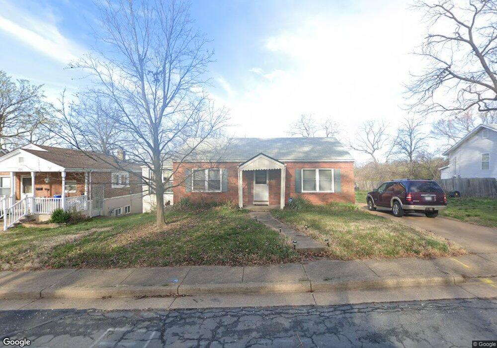
1317 Westover Ave Saint Louis, MO 63130
Estimated Value: $144,000 - $170,000
2
Beds
1
Bath
1,080
Sq Ft
$146/Sq Ft
Est. Value
About This Home
This home is located at 1317 Westover Ave, Saint Louis, MO 63130 and is currently estimated at $158,041, approximately $146 per square foot. 1317 Westover Ave is a home located in St. Louis County with nearby schools including Barbara C. Jordan Elementary School, Brittany Woods Middle School, and University City High School.
Ownership History
Date
Name
Owned For
Owner Type
Purchase Details
Closed on
Dec 17, 2001
Sold by
Noghreh Maureen and Noghreh Kamran
Bought by
Ray Katherine C
Current Estimated Value
Home Financials for this Owner
Home Financials are based on the most recent Mortgage that was taken out on this home.
Original Mortgage
$65,840
Outstanding Balance
$25,422
Interest Rate
6.41%
Estimated Equity
$132,619
Purchase Details
Closed on
Oct 4, 2000
Sold by
Hovland Lynn F and Hovland Betty J
Bought by
Noghreh Maureen and Noghreh Kamren
Create a Home Valuation Report for This Property
The Home Valuation Report is an in-depth analysis detailing your home's value as well as a comparison with similar homes in the area
Home Values in the Area
Average Home Value in this Area
Purchase History
| Date | Buyer | Sale Price | Title Company |
|---|---|---|---|
| Ray Katherine C | $82,300 | -- | |
| Noghreh Maureen | -- | -- |
Source: Public Records
Mortgage History
| Date | Status | Borrower | Loan Amount |
|---|---|---|---|
| Open | Ray Katherine C | $65,840 |
Source: Public Records
Tax History Compared to Growth
Tax History
| Year | Tax Paid | Tax Assessment Tax Assessment Total Assessment is a certain percentage of the fair market value that is determined by local assessors to be the total taxable value of land and additions on the property. | Land | Improvement |
|---|---|---|---|---|
| 2025 | $1,858 | $24,870 | $5,070 | $19,800 |
| 2024 | $1,858 | $25,670 | $2,660 | $23,010 |
| 2023 | $1,856 | $25,670 | $2,660 | $23,010 |
| 2022 | $1,305 | $16,630 | $3,100 | $13,530 |
| 2021 | $1,292 | $16,630 | $3,100 | $13,530 |
| 2020 | $1,310 | $16,440 | $6,160 | $10,280 |
| 2019 | $1,298 | $16,440 | $6,160 | $10,280 |
| 2018 | $1,309 | $15,340 | $3,880 | $11,460 |
| 2017 | $1,312 | $15,340 | $3,880 | $11,460 |
| 2016 | $1,372 | $15,380 | $3,500 | $11,880 |
| 2015 | $1,378 | $15,380 | $3,500 | $11,880 |
| 2014 | $1,268 | $13,870 | $3,780 | $10,090 |
Source: Public Records
Map
Nearby Homes
- 1323 Fairview Ave
- 1237 Fairview Ave
- 8003 Briar Ct
- 1319 Rushmore Dr
- 1349 Rushmore Dr
- 1276 N and Rd S
- 8034 Appleton Dr
- 1459 Lyndale Ave
- 7576 Melrose Ave
- 7742 Elene Ave
- 7831 Trenton Ave
- 7529 Melrose Ave
- 7525 Dajoby Ln
- 955 Mulberry Ln
- 946 Abbeville Dr
- 7723 Wild Plum Ln
- 1432 Tamerton Ave
- 8370 Orchard Ave
- 8362 Braddock Dr
- 7624 Fairham Ave
- 1315 Westover Ave
- 1323 Westover Ave
- 1311 Westover Ave
- 1308 Mendell Dr
- 1320 Mendell Dr
- 1327 Westover Ave
- 1301 Westover Ave
- 1324 Mendell Dr
- 1316 Westover Ave
- 1310 Westover Ave
- 1306 Westover Ave
- 1239 Westover Ave
- 1324 Westover Ave
- 1328 Mendell Dr
- 1300 Mendell Dr
- 1335 Westover Ave
- 1300 Westover Ave
- 1330 Westover Ave
- 1235 Westover Ave
- 1332 Mendell Dr