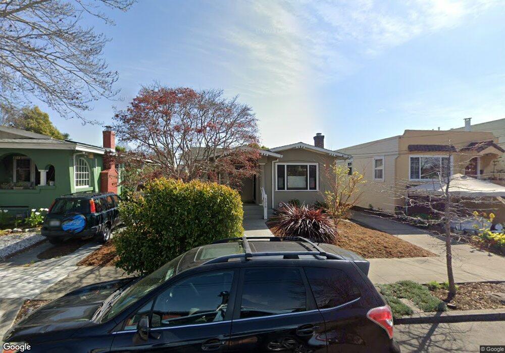
1318 Blake St Berkeley, CA 94702
West Berkeley NeighborhoodEstimated Value: $1,144,867 - $1,297,000
4
Beds
1
Bath
1,462
Sq Ft
$844/Sq Ft
Est. Value
About This Home
This home is located at 1318 Blake St, Berkeley, CA 94702 and is currently estimated at $1,233,467, approximately $843 per square foot. 1318 Blake St is a home located in Alameda County with nearby schools including Oxford Elementary School, Washington Elementary School, and Malcolm X Elementary School.
Ownership History
Date
Name
Owned For
Owner Type
Purchase Details
Closed on
Mar 7, 2013
Sold by
Mitchell Arthur C
Bought by
Mitchell Arthur and The Arthur Mitchell Living Tru
Current Estimated Value
Purchase Details
Closed on
Apr 5, 2011
Sold by
Mitchell Marylese A and Marylese A Mitchell Living Tru
Bought by
Mitchell Arthur C
Home Financials for this Owner
Home Financials are based on the most recent Mortgage that was taken out on this home.
Original Mortgage
$450,000
Interest Rate
4.83%
Mortgage Type
New Conventional
Purchase Details
Closed on
Mar 26, 2010
Sold by
Mitchell Marylese A
Bought by
Mitchell Marylese A and Marylese A Mitchell Living Tru
Create a Home Valuation Report for This Property
The Home Valuation Report is an in-depth analysis detailing your home's value as well as a comparison with similar homes in the area
Home Values in the Area
Average Home Value in this Area
Purchase History
| Date | Buyer | Sale Price | Title Company |
|---|---|---|---|
| Mitchell Arthur | -- | None Available | |
| Mitchell Arthur C | -- | None Available | |
| Mitchell Marylese A | -- | None Available |
Source: Public Records
Mortgage History
| Date | Status | Borrower | Loan Amount |
|---|---|---|---|
| Closed | Mitchell Arthur C | $450,000 |
Source: Public Records
Tax History
| Year | Tax Paid | Tax Assessment Tax Assessment Total Assessment is a certain percentage of the fair market value that is determined by local assessors to be the total taxable value of land and additions on the property. | Land | Improvement |
|---|---|---|---|---|
| 2025 | $4,183 | $51,352 | $33,589 | $24,763 |
| 2024 | $4,183 | $50,207 | $32,930 | $24,277 |
| 2023 | $4,004 | $56,086 | $32,285 | $23,801 |
| 2022 | $3,803 | $47,986 | $31,652 | $23,334 |
| 2021 | $3,764 | $46,908 | $31,031 | $22,877 |
| 2020 | $3,445 | $53,355 | $30,713 | $22,642 |
| 2019 | $3,169 | $52,309 | $30,111 | $22,198 |
| 2018 | $3,063 | $51,284 | $29,521 | $21,763 |
| 2017 | $2,920 | $50,279 | $28,942 | $21,337 |
| 2016 | $2,709 | $49,292 | $28,374 | $20,918 |
| 2015 | $2,646 | $48,552 | $27,948 | $20,604 |
| 2014 | $2,524 | $47,601 | $27,401 | $20,200 |
Source: Public Records
Map
Nearby Homes
- 1142 Dwight Way
- 1118 Dwight Way
- 1515 Derby St
- 2324 Browning St
- 1450 Ward St
- 2750 Sacramento St
- 2758 Sacramento St
- 1092 Dwight Way
- 2774 Sacramento St
- 1612 Parker St
- 2782 Sacramento St
- 2790 Sacramento St
- 1612 Carleton St
- 1039 Channing Way
- 2751 Wallace St
- 1645 Dwight Way
- 2747 San Pablo Ave Unit 507
- 2231 Byron St
- 2327 10th St Unit 4
- 1530 Stuart St
Your Personal Tour Guide
Ask me questions while you tour the home.