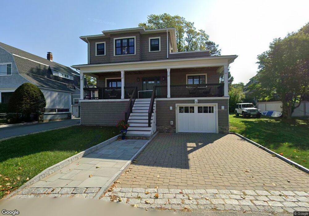
131A Wheeler St Gloucester, MA 01930
Riverview NeighborhoodEstimated Value: $951,000 - $1,077,000
2
Beds
3
Baths
2,410
Sq Ft
$424/Sq Ft
Est. Value
About This Home
This home is located at 131A Wheeler St, Gloucester, MA 01930 and is currently estimated at $1,022,633, approximately $424 per square foot. 131A Wheeler St is a home located in Essex County with nearby schools including Beeman Memorial, Ralph B O'maley Middle School, and Gloucester High School.
Ownership History
Date
Name
Owned For
Owner Type
Purchase Details
Closed on
May 21, 2009
Sold by
Noonan Richard E
Bought by
Noonan Richard E
Current Estimated Value
Purchase Details
Closed on
Oct 21, 2004
Sold by
Es Skaradzinski John W
Bought by
Noonan Richard E
Home Financials for this Owner
Home Financials are based on the most recent Mortgage that was taken out on this home.
Original Mortgage
$244,000
Interest Rate
5.85%
Mortgage Type
Purchase Money Mortgage
Create a Home Valuation Report for This Property
The Home Valuation Report is an in-depth analysis detailing your home's value as well as a comparison with similar homes in the area
Home Values in the Area
Average Home Value in this Area
Purchase History
| Date | Buyer | Sale Price | Title Company |
|---|---|---|---|
| Noonan Richard E | -- | -- | |
| Noonan Richard E | $321,000 | -- |
Source: Public Records
Mortgage History
| Date | Status | Borrower | Loan Amount |
|---|---|---|---|
| Open | Noonan Richard E | $215,000 | |
| Previous Owner | Noonan Richard E | $244,000 |
Source: Public Records
Tax History Compared to Growth
Tax History
| Year | Tax Paid | Tax Assessment Tax Assessment Total Assessment is a certain percentage of the fair market value that is determined by local assessors to be the total taxable value of land and additions on the property. | Land | Improvement |
|---|---|---|---|---|
| 2025 | $9,075 | $933,600 | $216,200 | $717,400 |
| 2024 | $8,984 | $923,300 | $205,900 | $717,400 |
| 2023 | $8,654 | $817,200 | $183,900 | $633,300 |
| 2022 | $8,407 | $716,700 | $156,200 | $560,500 |
| 2021 | $6,063 | $487,400 | $142,000 | $345,400 |
| 2020 | $1,751 | $142,000 | $142,000 | $0 |
| 2019 | $4,444 | $350,200 | $142,000 | $208,200 |
| 2018 | $4,378 | $338,600 | $142,000 | $196,600 |
| 2017 | $4,264 | $323,300 | $135,300 | $188,000 |
| 2016 | $4,039 | $296,800 | $135,700 | $161,100 |
| 2015 | $3,984 | $291,900 | $135,700 | $156,200 |
Source: Public Records
Map
Nearby Homes
- 672 Washington St
- 109 Riverview Rd
- 188 Atlantic St
- 226 Atlantic St
- 65 Poplar St
- 19 Mystic Ave
- 78 Grove St
- 196 Washington St
- 16 Cleveland Place Unit 11
- 40 Sargent St
- 15 Harvard St
- 5 Samoset Rd Unit A
- 119 Pleasant St
- 33 Maplewood Ave Unit 21
- 8 Summer St Unit 103
- 4 Mount Vernon St
- 5 Washington Square
- 22 Taylor St Unit 1
- 29 Harrison Ave
- 90 Middle St Unit L
- 131 Wheeler St
- 137 Wheeler St
- 6 Wheelers Point Rd
- 4 Orchard Way
- 132 Wheeler St
- 2 Orchard Way
- 5 Wheelers Point Rd
- 132 1/2 Wheeler St
- 6 Orchard Way
- 134 Wheeler St
- 127 Wheeler St
- 7 Wheelers Point Rd
- 128A Wheeler St
- 3 Orchard Way
- 1 Breezy Point Rd
- 8 Wheelers Point Rd
- 141 Wheeler St
- 8 Orchard Way
- 125 Wheeler St
- 138 Wheeler St