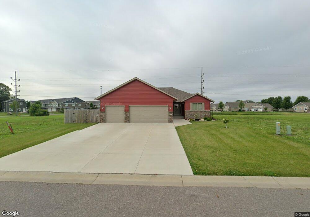
132 Bear Path Dr Mankato, MN 56001
Country Club Estates NeighborhoodEstimated Value: $429,166 - $449,000
5
Beds
2
Baths
1,769
Sq Ft
$246/Sq Ft
Est. Value
About This Home
This home is located at 132 Bear Path Dr, Mankato, MN 56001 and is currently estimated at $434,542, approximately $245 per square foot. 132 Bear Path Dr is a home with nearby schools including Franklin Elementary School, Prairie Winds Middle School, and Mankato East Senior High School.
Ownership History
Date
Name
Owned For
Owner Type
Purchase Details
Closed on
Feb 14, 2025
Sold by
Kerr Wendy and Richards David Roy
Bought by
Christensen Michael D and Christensen Sidney L
Current Estimated Value
Purchase Details
Closed on
Oct 9, 2020
Sold by
Hiniker Homes Inc
Bought by
Richards David Roya and Richards Janice Lynn
Home Financials for this Owner
Home Financials are based on the most recent Mortgage that was taken out on this home.
Original Mortgage
$270,513
Interest Rate
2.8%
Mortgage Type
New Conventional
Create a Home Valuation Report for This Property
The Home Valuation Report is an in-depth analysis detailing your home's value as well as a comparison with similar homes in the area
Home Values in the Area
Average Home Value in this Area
Purchase History
| Date | Buyer | Sale Price | Title Company |
|---|---|---|---|
| Christensen Michael D | $417,000 | None Listed On Document | |
| Richards David Roya | $370,512 | Title Resources Llc |
Source: Public Records
Mortgage History
| Date | Status | Borrower | Loan Amount |
|---|---|---|---|
| Previous Owner | Richards David Roya | $270,513 |
Source: Public Records
Tax History Compared to Growth
Tax History
| Year | Tax Paid | Tax Assessment Tax Assessment Total Assessment is a certain percentage of the fair market value that is determined by local assessors to be the total taxable value of land and additions on the property. | Land | Improvement |
|---|---|---|---|---|
| 2025 | $4,832 | $440,800 | $41,600 | $399,200 |
| 2024 | $4,832 | $432,300 | $41,600 | $390,700 |
| 2023 | $4,816 | $422,000 | $41,600 | $380,400 |
| 2022 | $4,280 | $411,200 | $41,600 | $369,600 |
| 2021 | $80 | $342,400 | $41,600 | $300,800 |
Source: Public Records
Map
Nearby Homes
- 105 Dr
- 814 Pinnacle Path
- 814 814 Pinnacle Path
- 104 104 Castle Pines Ct
- 320 Grovebrook Ct
- 320 320 Grovebrook Ct
- 147 147 Waynesborough Way
- 147 Waynesborough Way
- 101 La Costa Ln
- 117 Ct
- 116 116 Torrey Pines Dr Unit 116 Torrey Pines Dri
- 409 409 Grayhawk Dr
- 0 Tbd N Victory Dr Unit 7036367
- 0 Tbd St Andrews Dr Unit 7037517
- 113 Bunker Ct
- 640 Grayhawk Dr
- 640 640 Grayhawk Dr
- 21 Wood Dr Unit 7
- 29 Wood Dr Unit 11
- 0 Tbd St Unit 2 Adams Street
- 129 Bear Path Dr
- 125 Bear Path Dr
- 133 Bear Path Dr
- 200 Bear Path Dr
- 137 Bear Path Dr
- 220 Grovebrook Cir
- 141 Sugar Loaf Dr
- 220 220 Grovebrook Cir
- 216 Grovebrook Cir
- 153 153 Sugar Loaf Dr
- 1024 Castle Pines Dr
- 1024 Castle Pines Dr Unit 636
- 1024 Castle Pines Dr
- 212 Grovebrook Cir
- 137 137 Sugar Loaf Dr
- 145 145 Sugar Loaf Dr
- 129 Sugar Loaf Dr
- 145 Sugar Loaf Dr
- 224 Grovebrook Cir
- 133 133 Sugar Loaf Dr