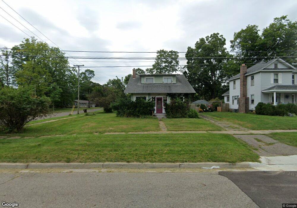
132 Lincoln St Marshall, MI 49068
Estimated Value: $187,000 - $214,000
3
Beds
2
Baths
1,431
Sq Ft
$140/Sq Ft
Est. Value
About This Home
This home is located at 132 Lincoln St, Marshall, MI 49068 and is currently estimated at $200,837, approximately $140 per square foot. 132 Lincoln St is a home located in Calhoun County with nearby schools including Harrington Elementary School, Marshall High School, and Marshall Academy.
Ownership History
Date
Name
Owned For
Owner Type
Purchase Details
Closed on
Jan 19, 2022
Sold by
Norton Angela R
Bought by
Norton Angela R
Current Estimated Value
Purchase Details
Closed on
Sep 11, 2001
Sold by
Wagenschutz Karen
Bought by
Norton Angela R
Purchase Details
Closed on
May 30, 1997
Sold by
Miller Ellen
Bought by
Wagenschutz Karen
Purchase Details
Closed on
Sep 1, 1992
Purchase Details
Closed on
Aug 1, 1988
Create a Home Valuation Report for This Property
The Home Valuation Report is an in-depth analysis detailing your home's value as well as a comparison with similar homes in the area
Home Values in the Area
Average Home Value in this Area
Purchase History
| Date | Buyer | Sale Price | Title Company |
|---|---|---|---|
| Norton Angela R | -- | None Listed On Document | |
| Norton Angela R | $109,000 | -- | |
| Wagenschutz Karen | $84,000 | -- | |
| -- | $65,500 | -- | |
| -- | $42,000 | -- |
Source: Public Records
Tax History
| Year | Tax Paid | Tax Assessment Tax Assessment Total Assessment is a certain percentage of the fair market value that is determined by local assessors to be the total taxable value of land and additions on the property. | Land | Improvement |
|---|---|---|---|---|
| 2025 | $2,753 | $83,000 | $0 | $0 |
| 2024 | $541 | $80,300 | $0 | $0 |
| 2023 | $2,470 | $68,400 | $0 | $0 |
| 2022 | $1,975 | $61,400 | $0 | $0 |
| 2021 | $2,394 | $58,100 | $0 | $0 |
| 2020 | $2,273 | $55,100 | $0 | $0 |
| 2019 | $0 | $52,800 | $0 | $0 |
| 2018 | $0 | $54,400 | $10,300 | $44,100 |
| 2017 | $0 | $52,300 | $0 | $0 |
| 2016 | $0 | $50,300 | $0 | $0 |
| 2015 | -- | $51,100 | $0 | $0 |
| 2014 | -- | $53,300 | $0 | $0 |
Source: Public Records
Map
Nearby Homes
- 832 E Michigan Ave
- 620 E Green St
- 215 S Liberty St
- 619 E Michigan Ave
- 741 Montgomery St
- 217 S Marshall Ave
- 319 Ferguson Rd
- 106 S Marshall Ave
- 610 Montgomery St
- 825 Mann Rd
- 905 Valley View Ct
- 339 N Marshall Ave
- 816 Forest St
- 107 Hart St
- 103 Hart St
- 529 Hill Road Ct
- 617 N Gordon St
- 126 W Hanover St
- 222 N Eagle St
- 208 W Prospect St
- 130 Lincoln St
- 749 B__1x Green St
- 749 E Green St
- 128 Lincoln St
- 745 E Green St
- 802 E Green St
- 129 Lincoln St
- 126 Lincoln St
- 744 E Green St
- 125 Lincoln St
- 124 Lincoln St
- 811 E Green St
- 735 E Green St
- 121 Lincoln St
- 734 E Green St
- 807 E Green St
- 116 Lincoln St
- 742 E Michigan Ave
- 811 W Green St
- 727 W Green St
Your Personal Tour Guide
Ask me questions while you tour the home.