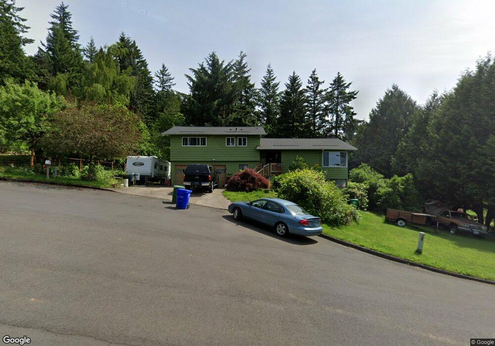
1320 SW 26th Ct Gresham, OR 97080
Gresham Butte NeighborhoodEstimated Value: $483,000 - $584,000
3
Beds
3
Baths
1,422
Sq Ft
$384/Sq Ft
Est. Value
About This Home
This home is located at 1320 SW 26th Ct, Gresham, OR 97080 and is currently estimated at $545,565, approximately $383 per square foot. 1320 SW 26th Ct is a home located in Multnomah County with nearby schools including Dexter McCarty Middle School, Gresham High School, and Portland Adventist Elementary School.
Ownership History
Date
Name
Owned For
Owner Type
Purchase Details
Closed on
Aug 29, 1997
Sold by
Sletten Steven H
Bought by
Hendrickson Larry and Hendrickson Linda R
Current Estimated Value
Home Financials for this Owner
Home Financials are based on the most recent Mortgage that was taken out on this home.
Original Mortgage
$161,900
Outstanding Balance
$21,069
Interest Rate
7.42%
Mortgage Type
Purchase Money Mortgage
Estimated Equity
$524,496
Create a Home Valuation Report for This Property
The Home Valuation Report is an in-depth analysis detailing your home's value as well as a comparison with similar homes in the area
Home Values in the Area
Average Home Value in this Area
Purchase History
| Date | Buyer | Sale Price | Title Company |
|---|---|---|---|
| Hendrickson Larry | $179,900 | First American Title Ins Co |
Source: Public Records
Mortgage History
| Date | Status | Borrower | Loan Amount |
|---|---|---|---|
| Open | Hendrickson Larry | $161,900 |
Source: Public Records
Tax History
| Year | Tax Paid | Tax Assessment Tax Assessment Total Assessment is a certain percentage of the fair market value that is determined by local assessors to be the total taxable value of land and additions on the property. | Land | Improvement |
|---|---|---|---|---|
| 2025 | $6,549 | $321,830 | -- | -- |
| 2024 | $6,269 | $312,460 | -- | -- |
| 2023 | $5,712 | $303,360 | $0 | $0 |
| 2022 | $5,552 | $294,530 | $0 | $0 |
| 2021 | $5,412 | $285,960 | $0 | $0 |
| 2020 | $5,092 | $277,640 | $0 | $0 |
| 2019 | $4,959 | $269,560 | $0 | $0 |
| 2018 | $4,729 | $261,710 | $0 | $0 |
| 2017 | $4,537 | $254,090 | $0 | $0 |
| 2016 | $4,000 | $246,690 | $0 | $0 |
| 2015 | $3,914 | $239,510 | $0 | $0 |
| 2014 | $3,818 | $232,540 | $0 | $0 |
Source: Public Records
Map
Nearby Homes
- 2520 SW Towle Ave
- 1278 SW 27th Ct
- 1261 SW Binford Lake Pkwy
- 1441 SW 23rd Ct
- 1421 SW Binford Lake Pkwy
- 3120 SW Orchard Place
- 1320 SW 31st St
- 1333 SW 19th Dr
- 1859 SW Angeline Ave
- 1488 SW 17th Ct
- 1829 SW 17th St
- 2791 SW Myers Dr
- 1960 SW 13th Ct
- 1744 SW Battaglia Ave
- 1175 SW Chastain Dr
- 1963 SW Myers Place
- 3506 SW Battaglia Ave
- 3512 SW Battaglia Ave
- 3536 SW Battaglia Ave
- 3558 SW Battaglia Ave
- 1380 SW 26th Ct
- 1280 SW 26th Ct
- 1285 SW 27th Ct
- 1377 SW 27th Ct
- 1420 SW 26th Ct
- 1325 SW 26th Ct
- 1385 SW 26th Ct
- 1285 SW 26th Ct
- 0 SW 27th Ct
- 1415 SW 27th Ct
- 1275 SW 27th Ct
- 1425 SW 26th Ct
- 2620 SW Towle Ave
- 1450 SW 26th Ct
- 1435 SW 26th Ct
- 2630 SW Towle Ave
- 1250 SW 25th Ct
- 1290 SW 27th Ct
- 1310 SW 25th Ct
- 2650 SW Towle Ave
Your Personal Tour Guide
Ask me questions while you tour the home.