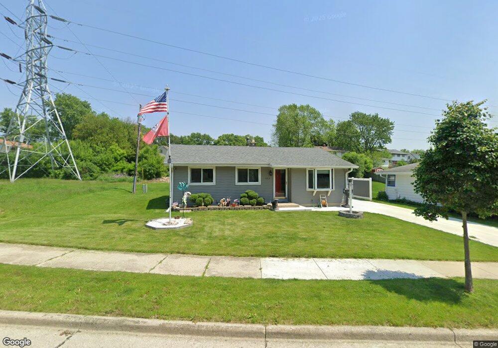
1323 Atlantic Dr Waukesha, WI 53186
Estimated Value: $296,000 - $331,000
3
Beds
1
Bath
1,014
Sq Ft
$310/Sq Ft
Est. Value
About This Home
This home is located at 1323 Atlantic Dr, Waukesha, WI 53186 and is currently estimated at $314,158, approximately $309 per square foot. 1323 Atlantic Dr is a home located in Waukesha County with nearby schools including John F. Miller School, Banting Elementary School, and Horning Middle School.
Ownership History
Date
Name
Owned For
Owner Type
Purchase Details
Closed on
Apr 17, 2024
Sold by
Monreal Michael T
Bought by
Monreal Michael T and Monreal Karen M
Current Estimated Value
Purchase Details
Closed on
Aug 1, 2006
Sold by
Monreal Rosemary
Bought by
Monreal Michael T
Home Financials for this Owner
Home Financials are based on the most recent Mortgage that was taken out on this home.
Original Mortgage
$53,000
Interest Rate
6.49%
Mortgage Type
Stand Alone Second
Purchase Details
Closed on
Jun 28, 2000
Sold by
Herche Randall S and Herche Deborah L
Bought by
Monreal Michael T and Monreal Rosemary
Home Financials for this Owner
Home Financials are based on the most recent Mortgage that was taken out on this home.
Original Mortgage
$124,500
Interest Rate
8.55%
Create a Home Valuation Report for This Property
The Home Valuation Report is an in-depth analysis detailing your home's value as well as a comparison with similar homes in the area
Home Values in the Area
Average Home Value in this Area
Purchase History
| Date | Buyer | Sale Price | Title Company |
|---|---|---|---|
| Monreal Michael T | -- | None Listed On Document | |
| Monreal Michael T | -- | None Available | |
| Monreal Michael T | $131,500 | -- |
Source: Public Records
Mortgage History
| Date | Status | Borrower | Loan Amount |
|---|---|---|---|
| Previous Owner | Monreal Michael T | $53,000 | |
| Previous Owner | Monreal Michael T | $124,500 |
Source: Public Records
Tax History Compared to Growth
Tax History
| Year | Tax Paid | Tax Assessment Tax Assessment Total Assessment is a certain percentage of the fair market value that is determined by local assessors to be the total taxable value of land and additions on the property. | Land | Improvement |
|---|---|---|---|---|
| 2024 | $3,477 | $226,900 | $56,000 | $170,900 |
| 2023 | $3,197 | $226,900 | $56,000 | $170,900 |
| 2022 | $3,959 | $208,100 | $58,000 | $150,100 |
| 2021 | $4,048 | $208,100 | $58,000 | $150,100 |
| 2020 | $3,918 | $208,100 | $58,000 | $150,100 |
| 2019 | $3,792 | $208,100 | $58,000 | $150,100 |
| 2018 | $3,549 | $190,900 | $51,500 | $139,400 |
| 2017 | $3,544 | $190,900 | $51,500 | $139,400 |
| 2016 | $3,395 | $172,000 | $51,500 | $120,500 |
| 2015 | $3,377 | $172,000 | $51,500 | $120,500 |
| 2014 | $3,450 | $168,600 | $51,500 | $117,100 |
| 2013 | $3,450 | $168,600 | $51,500 | $117,100 |
Source: Public Records
Map
Nearby Homes
- 1112 Gertrude St
- 1116 Josephine St
- 1308 Danny St
- 1471 Cleveland Ave
- 1333 Niagara St
- 1542 Whiterock Ave
- 1415 Niagara St Unit 109
- 937 E Moreland Blvd
- 918 Niagara St
- 1729 Stardust Dr Unit B
- 2109 Melody Ln
- 1522 Pewaukee Rd
- 440 Gascoigne Dr
- 925 Harding Ave
- 526 Peters Dr
- 1021 Aurora St
- 1139 White Rock Ave
- 1021 Arcadian Ave
- 1103 Arcadian Ave
- 512 E Main St
- 1322 Atlantic Dr
- 1317 Atlantic Dr
- 1316 Atlantic Dr
- 1310 Atlantic Dr
- 1311 Atlantic Dr
- 1351 Atlantic Dr
- 1304 Atlantic Dr
- 1352 Atlantic Dr
- 2020 Cardinal Dr
- 1358 Atlantic Dr
- 1300 Atlantic Dr
- 2026 Cardinal Dr
- 2006 Cardinal Dr Unit 8
- 2015 Cardinal Dr
- 2000 Cardinal Dr
- 2014 Cardinal Dr
- 2014 Cardinal Dr Unit 2014
- 2014 Cardinal Dr Unit 2016
- 1930 Cardinal Dr
- 1930 Cardinal Dr Unit 1932