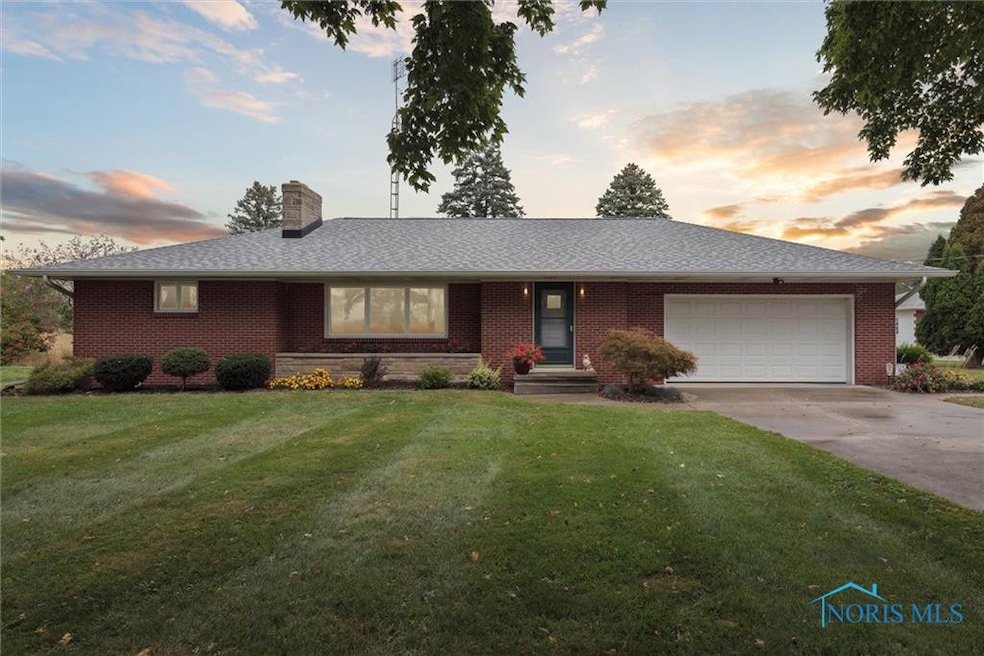
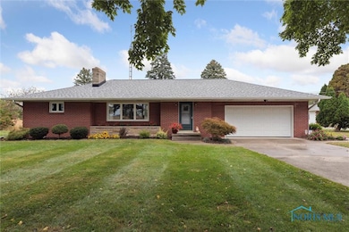
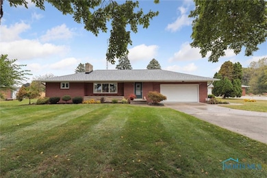
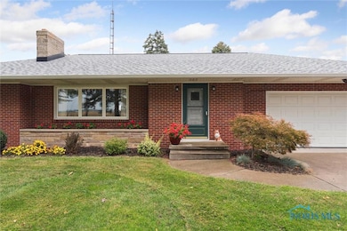
13242 Us Highway 20a Wauseon, OH 43567
Estimated payment $1,940/month
Highlights
- Traditional Architecture
- Patio
- Garage
- Pole Barn
- Forced Air Heating and Cooling System
About This Home
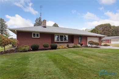
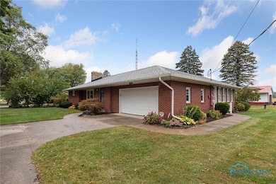
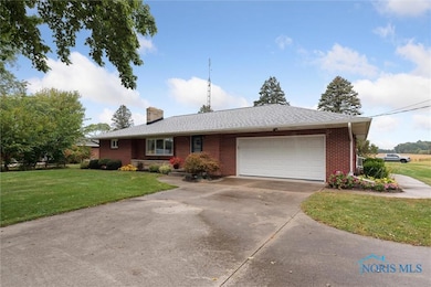
The cleanest people in Fulton County are moving. Solid 3-bedroom, brick ranch. High Quality of construction. Open Family room is a newer addition. Dry/Clean full basement has additional living space. 2 Car attached garage, 30' x 40' pole barn, tons of storage space. Updates to mechanical systems, roof 3 years old. Move in ready!
Home Details
Home Type
- Single Family
Est. Annual Taxes
- $3,327
Year Built
- Built in 1960
Lot Details
- 0.85 Acre Lot
- Lot Dimensions are 120 x 306
Parking
- Garage
- Driveway
Home Design
- Traditional Architecture
- Brick Exterior Construction
- Shingle Roof
Interior Spaces
- 1,724 Sq Ft Home
- 1-Story Property
- Basement Fills Entire Space Under The House
Kitchen
- Microwave
- Dishwasher
Bedrooms and Bathrooms
- 3 Bedrooms
Laundry
- Dryer
- Washer
Outdoor Features
- Patio
- Pole Barn
Schools
- Wauseon Elementary School
- Wauseon High School
Utilities
- Forced Air Heating and Cooling System
- Heating System Uses Natural Gas
- Private Water Source
- Well
- Water Heater
- Septic Tank
Listing and Financial Details
- Assessor Parcel Number 05-007600-00.000
Map
Home Values in the Area
Average Home Value in this Area
Tax History
| Year | Tax Paid | Tax Assessment Tax Assessment Total Assessment is a certain percentage of the fair market value that is determined by local assessors to be the total taxable value of land and additions on the property. | Land | Improvement |
|---|---|---|---|---|
| 2024 | $3,327 | $78,650 | $8,680 | $69,970 |
| 2023 | $3,329 | $78,650 | $8,680 | $69,970 |
| 2022 | $2,998 | $61,080 | $7,250 | $53,830 |
| 2021 | $3,140 | $61,080 | $7,250 | $53,830 |
| 2020 | $2,934 | $61,080 | $7,250 | $53,830 |
| 2019 | $2,740 | $56,810 | $7,110 | $49,700 |
| 2018 | $2,311 | $56,810 | $7,110 | $49,700 |
| 2017 | $2,287 | $56,810 | $7,110 | $49,700 |
| 2016 | $2,185 | $49,150 | $7,110 | $42,040 |
| 2015 | $2,037 | $49,150 | $7,110 | $42,040 |
| 2014 | $2,037 | $49,150 | $7,110 | $42,040 |
| 2013 | $2,529 | $54,820 | $7,810 | $47,010 |
Property History
| Date | Event | Price | List to Sale | Price per Sq Ft |
|---|---|---|---|---|
| 09/23/2025 09/23/25 | For Sale | $315,000 | -- | $183 / Sq Ft |
Purchase History
| Date | Type | Sale Price | Title Company |
|---|---|---|---|
| Fiduciary Deed | -- | None Available | |
| Interfamily Deed Transfer | -- | Attorney | |
| Deed | -- | -- |
Source: Northwest Ohio Real Estate Information Service (NORIS)
MLS Number: 6135750
APN: 05-007600-00.000
Disclaimer: Certain information contained herein is derived from information provided by parties other than Homes.com. All information provided is deemed reliable, but is not guaranteed to be accurate and should be independently verified.
![]() IDX information is provided exclusively for personal, non-commercial use, and may not be used for any purpose other than to identify prospective properties consumers may be interested in purchasing. Information is deemed reliable but not guaranteed. ©2025 NORIS. All rights reserved.
IDX information is provided exclusively for personal, non-commercial use, and may not be used for any purpose other than to identify prospective properties consumers may be interested in purchasing. Information is deemed reliable but not guaranteed. ©2025 NORIS. All rights reserved.
- 13354 U S 20a
- 1209 Apache Dr
- Integrity 1830 Plan at Arrowhead Trails
- integrity 2280 Plan at Arrowhead Trails
- Integrity 2080 Plan at Arrowhead Trails
- 460 Airport Hwy
- 1062 Seneca Dr
- 1090 Seneca Dr
- 1058 Seneca Dr
- 1066 Seneca Dr
- 0 County Road H
- 1285 N Shoop Ave
- 7373 County Road 12
- 14578 Us Highway 20a
- 7620 County Road 12
- 801 N Shoop Ave
- 8453 County Road 13
- 1338 N Park Ln
- 1270 S Park Ln
- 351 E Walnut St
- 1112 Oakview Dr
- 1112 Oakview Dr Unit 1106
- 137 Garden Dr Unit Lutz Villas
- 2400 Glen Arbors Dr
- 238 Gorham St
- 1800 Oakwood Ave
- 1140 E Riverview Ave
- 112 Franklin Ave Unit 2
- 780 Sheffield Ave
- 9425 Newbury Ln
- 2200 E Gier Rd
- 1501 Pray Blvd
- 10 E Colony Dr
- 3017 Coffeetree Ln
- 133 Grand River Dr
- 130 Shiawassee River Dr
- 1956 W Cadmus Rd
- 291 Medina River Ct
- 1940 W Cadmus Rd Unit 104
- 1940 W Cadmus Rd Unit 102
