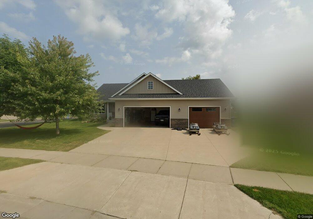
1325 Osauka Rd NE Sauk Rapids, MN 56379
Estimated Value: $392,052 - $414,000
4
Beds
3
Baths
3,148
Sq Ft
$128/Sq Ft
Est. Value
About This Home
This home is located at 1325 Osauka Rd NE, Sauk Rapids, MN 56379 and is currently estimated at $403,763, approximately $128 per square foot. 1325 Osauka Rd NE is a home located in Benton County with nearby schools including Mississippi Heights Elementary School, Sauk Rapids-Rice Middle School, and Sauk Rapids-Rice Senior High School.
Ownership History
Date
Name
Owned For
Owner Type
Purchase Details
Closed on
Jun 16, 2020
Sold by
Robbins Jerry L and Robbins Marlon M
Bought by
Preusser Dustin A and Preusser Megan L
Current Estimated Value
Home Financials for this Owner
Home Financials are based on the most recent Mortgage that was taken out on this home.
Original Mortgage
$249,600
Outstanding Balance
$221,251
Interest Rate
3.2%
Mortgage Type
New Conventional
Estimated Equity
$182,512
Purchase Details
Closed on
Aug 29, 2006
Sold by
Don Girtz Construction Inc
Bought by
Robbins Jerry L and Robbins Marion M
Home Financials for this Owner
Home Financials are based on the most recent Mortgage that was taken out on this home.
Original Mortgage
$125,100
Interest Rate
6.88%
Mortgage Type
New Conventional
Purchase Details
Closed on
Jun 6, 2006
Sold by
Lumber One Development Co Llc
Bought by
Don Girtz Construction Inc
Create a Home Valuation Report for This Property
The Home Valuation Report is an in-depth analysis detailing your home's value as well as a comparison with similar homes in the area
Home Values in the Area
Average Home Value in this Area
Purchase History
| Date | Buyer | Sale Price | Title Company |
|---|---|---|---|
| Preusser Dustin A | $312,000 | Burnet Title | |
| Robbins Jerry L | $259,045 | -- | |
| Don Girtz Construction Inc | $58,400 | -- |
Source: Public Records
Mortgage History
| Date | Status | Borrower | Loan Amount |
|---|---|---|---|
| Open | Preusser Dustin A | $249,600 | |
| Previous Owner | Robbins Jerry L | $125,100 |
Source: Public Records
Tax History Compared to Growth
Tax History
| Year | Tax Paid | Tax Assessment Tax Assessment Total Assessment is a certain percentage of the fair market value that is determined by local assessors to be the total taxable value of land and additions on the property. | Land | Improvement |
|---|---|---|---|---|
| 2025 | $4,604 | $372,200 | $44,800 | $327,400 |
| 2024 | $4,802 | $368,300 | $44,800 | $323,500 |
| 2023 | $4,606 | $395,200 | $44,800 | $350,400 |
| 2022 | $4,774 | $348,100 | $40,800 | $307,300 |
| 2021 | $4,658 | $327,900 | $40,800 | $287,100 |
| 2018 | $4,236 | $282,800 | $37,758 | $245,042 |
| 2017 | $4,236 | $262,100 | $37,416 | $224,684 |
| 2016 | $4,042 | $266,000 | $39,200 | $226,800 |
| 2015 | $4,078 | $227,300 | $36,713 | $190,587 |
| 2014 | -- | $217,600 | $36,484 | $181,116 |
| 2013 | -- | $222,700 | $36,603 | $186,097 |
Source: Public Records
Map
Nearby Homes
- 1355 Onyx Way NE
- 1128 29th St NE
- 1156 Orchid Dr NE
- 2873 11th Ave NE
- 2886 29th St NE
- 2892 29th St NE
- TBD Lot D Mayhew Lake Rd NE
- 1015 29th St NE
- 3154 Orchard Ave NE
- 55xx Mayhew Lake Rd NE
- 1664 Payton Ct NE
- XXXX Golden Spike Rd NE
- xxx Lot 2
- 3346 Old Stone Way NE
- TBD Lot H Mayhew Lake Rd
- TBD Lot G Mayhew Lake Rd
- TBD Lot A Mayhew Lake Rd
- TBD Lot F Mayhew Lake Rd
- TBD Lot E Mayhew Lake Rd
- TBD Lot B Mayhew Lake Rd
- 1335 Osauka Rd NE
- 1305 Osauka Rd NE
- 1338 Osauka Rd NE
- 1314 Osauka Rd NE
- 1323 Onyx Way NE
- 1346 Onyx Way NE
- 1327 Onyx Way NE
- 1331 Onyx Way NE
- 1337 Onyx Way NE
- 1339 Onyx Way NE
- 1347 Onyx Way NE
- 1343 Onyx Way NE
- 1304 Osauka Rd NE
- 1350 Onyx Way NE
- 1397 Osauka Rd NE
- 1326 Osauka Rd NE
- 1295 Osauka Rd NE
- 1351 Onyx Way NE
- 1352 Osauka Rd NE
- 1296 Osauka Rd NE