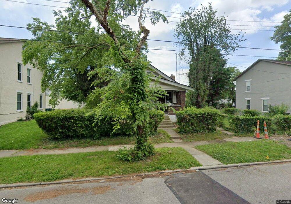
1325 Regent Ave Cincinnati, OH 45237
Bond Hill NeighborhoodEstimated Value: $180,526 - $273,000
3
Beds
2
Baths
1,575
Sq Ft
$141/Sq Ft
Est. Value
About This Home
This home is located at 1325 Regent Ave, Cincinnati, OH 45237 and is currently estimated at $222,632, approximately $141 per square foot. 1325 Regent Ave is a home located in Hamilton County with nearby schools including Bond Hill Academy Elementary School, Shroder High School, and Clark Montessori High School.
Ownership History
Date
Name
Owned For
Owner Type
Purchase Details
Closed on
Dec 27, 2013
Sold by
Holt Blockson Gayle and Holt Blockson Gayle Ranford
Bought by
Holt Blockson Gayle and Holt Renee
Current Estimated Value
Purchase Details
Closed on
Oct 13, 2006
Sold by
Estate Of Rossie B Ranford Lee
Bought by
Blockson Gayle Ranford Holt
Purchase Details
Closed on
Oct 10, 2003
Sold by
Ranford Carl Steige Isom and Ranford Ray Jeane
Bought by
Lee Rossie Ranford
Purchase Details
Closed on
Oct 2, 2003
Sold by
Estate Of Lena Ranford
Bought by
Ranford Carstege Isan and Ranford Rayjean
Create a Home Valuation Report for This Property
The Home Valuation Report is an in-depth analysis detailing your home's value as well as a comparison with similar homes in the area
Home Values in the Area
Average Home Value in this Area
Purchase History
| Date | Buyer | Sale Price | Title Company |
|---|---|---|---|
| Holt Blockson Gayle | -- | Attorney | |
| Blockson Gayle Ranford Holt | -- | None Available | |
| Lee Rossie Ranford | $27,600 | -- | |
| Ranford Carstege Isan | -- | -- |
Source: Public Records
Tax History
| Year | Tax Paid | Tax Assessment Tax Assessment Total Assessment is a certain percentage of the fair market value that is determined by local assessors to be the total taxable value of land and additions on the property. | Land | Improvement |
|---|---|---|---|---|
| 2025 | $2,249 | $35,890 | $6,808 | $29,082 |
| 2024 | $2,182 | $35,890 | $6,808 | $29,082 |
| 2023 | $2,230 | $35,890 | $6,808 | $29,082 |
| 2022 | $1,356 | $19,328 | $5,828 | $13,500 |
| 2021 | $1,293 | $19,328 | $5,828 | $13,500 |
| 2020 | $1,330 | $19,328 | $5,828 | $13,500 |
| 2019 | $1,359 | $18,064 | $5,446 | $12,618 |
| 2018 | $1,361 | $18,064 | $5,446 | $12,618 |
| 2017 | $1,292 | $18,064 | $5,446 | $12,618 |
| 2016 | $1,417 | $19,579 | $5,719 | $13,860 |
| 2015 | $1,280 | $19,579 | $5,719 | $13,860 |
| 2014 | $1,289 | $19,579 | $5,719 | $13,860 |
| 2013 | $1,400 | $19,979 | $5,835 | $14,144 |
Source: Public Records
Map
Nearby Homes
- 1309 Regent Ave
- 1307 Regent Ave
- 1305 Regent Ave
- 1303 Regent Ave
- 1435 Laidlaw Ave
- 1301 Carolina Ave
- 1318 Franklin Ave
- 1227 Carolina Ave
- 1226 Franklin Ave
- 1214 Franklin Ave
- 1409 Yarmouth Ave
- 1144 Carolina Ave
- 1435 Yarmouth Ave
- 1100 Carolina Ave
- 1525 Joseph St
- 1730 Dale Rd
- 1740 Garden Ln
- 1858 Garden Ln
- 5104 Lillian Dr
- 0 Township Road 111
- 1323 Regent Ave
- 1335 Regent Ave
- 1336 California Ave
- 1330 California Ave
- 1319 Regent Ave
- 1324 California Ave
- 1334 California Ave
- 1322 California Ave
- 1403 Regent Ave
- 1328 Regent Ave
- 1317 Regent Ave
- 1318 California Ave
- 1324 Regent Ave
- 1334 Regent Ave
- 4932 Oberlin Ave
- 1318 Regent Ave
- 1313 Regent Ave
- 1407 Regent Ave
- 1402 California Ave
- 1404 California Ave
Your Personal Tour Guide
Ask me questions while you tour the home.