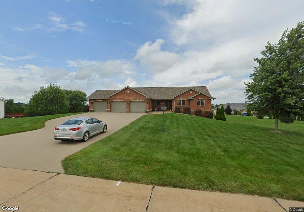
13255 W Clay Dr Dubuque, IA 52002
Estimated Value: $471,000 - $552,000
4
Beds
5
Baths
1,851
Sq Ft
$275/Sq Ft
Est. Value
About This Home
This home is located at 13255 W Clay Dr, Dubuque, IA 52002 and is currently estimated at $508,657, approximately $274 per square foot. 13255 W Clay Dr is a home located in Dubuque County with nearby schools including Carver Elementary School, Eleanor Roosevelt Middle School, and Hempstead High School.
Ownership History
Date
Name
Owned For
Owner Type
Purchase Details
Closed on
Sep 28, 2022
Sold by
Fens Randy J and Fens Mary E
Bought by
Fens Family Revocable Trust
Current Estimated Value
Purchase Details
Closed on
Feb 15, 2007
Sold by
Oberbroeckling Kevin L and Oberbroeckling Christine L
Bought by
Fens Randy J and Fens Mary E
Home Financials for this Owner
Home Financials are based on the most recent Mortgage that was taken out on this home.
Original Mortgage
$200,000
Interest Rate
6.27%
Mortgage Type
New Conventional
Purchase Details
Closed on
Aug 4, 2006
Sold by
E L W Corp
Bought by
Oberbroeckling Kevin L and Oberbroeckling Christine L
Home Financials for this Owner
Home Financials are based on the most recent Mortgage that was taken out on this home.
Original Mortgage
$221,162
Interest Rate
6.83%
Mortgage Type
Construction
Create a Home Valuation Report for This Property
The Home Valuation Report is an in-depth analysis detailing your home's value as well as a comparison with similar homes in the area
Home Values in the Area
Average Home Value in this Area
Purchase History
| Date | Buyer | Sale Price | Title Company |
|---|---|---|---|
| Fens Family Revocable Trust | -- | -- | |
| Fens Randy J | $250,000 | None Available | |
| Oberbroeckling Kevin L | $32,500 | None Available |
Source: Public Records
Mortgage History
| Date | Status | Borrower | Loan Amount |
|---|---|---|---|
| Previous Owner | Fens Randy J | $200,000 | |
| Previous Owner | Oberbroeckling Kevin L | $221,162 |
Source: Public Records
Tax History Compared to Growth
Tax History
| Year | Tax Paid | Tax Assessment Tax Assessment Total Assessment is a certain percentage of the fair market value that is determined by local assessors to be the total taxable value of land and additions on the property. | Land | Improvement |
|---|---|---|---|---|
| 2025 | $5,324 | $516,300 | $73,700 | $442,600 |
| 2024 | $5,324 | $465,400 | $70,200 | $395,200 |
| 2023 | $5,144 | $465,400 | $70,200 | $395,200 |
| 2022 | $4,976 | $374,060 | $65,000 | $309,060 |
| 2021 | $4,976 | $374,060 | $65,000 | $309,060 |
| 2020 | $5,004 | $351,900 | $51,000 | $300,900 |
| 2019 | $5,044 | $351,900 | $51,000 | $300,900 |
| 2018 | $4,910 | $340,330 | $42,500 | $297,830 |
| 2017 | $4,786 | $340,330 | $42,500 | $297,830 |
| 2016 | $4,786 | $315,680 | $40,000 | $275,680 |
| 2015 | $4,654 | $315,680 | $40,000 | $275,680 |
| 2014 | $4,152 | $292,260 | $37,500 | $254,760 |
Source: Public Records
Map
Nearby Homes
- 13149 W Clay Dr
- Lot 5 Cap Cana Dr
- Lot 1 of 3 Regency Dr
- Lot 35 Tuscany Ridge Dr
- Lot 34 Tuscany Ridge Dr
- Lot 33 Tuscany Ridge Dr
- Lot 2 Tuscany Ridge Dr
- Lot 2-2 Hidden Meadows Dr
- 7019 Budd Rd
- 2189 Tuscany Ridge Dr
- 16978 Asbury Rd
- 8166 Tegan Dr
- Lot 83 Tegan Dr
- Lot 84 Tegan Dr
- Lot 89 Tegan Dr
- Lot 54 Tegan Dr
- Lot 53 Tegan Dr
- Lot 52 Tegan Dr
- Lot 51 Tegan Dr
- Lot 50 Tegan Dr
- 0 W Clay Unit 121284
- 17494 Alan Jackson Dr
- 13235 W Clay Dr
- 17532 Alan Jackson Dr
- 13277 W Clay Dr
- 13254 W Clay Dr
- 13264 W Clay Dr
- 13206 W Clay Dr
- 17482 Alan Jackson Dr
- 17562 Alan Jackson Dr
- 13199 W Clay Dr
- 13286 W Clay Dr
- 17509 Alan Jackson Dr
- 13307 W Clay Dr
- 17499 Alan Jackson Dr
- 17549 Alan Jackson Dr
- 13194 W Clay Dr
- 17475 Alan Jackson Dr
- 17586 Alan Jackson Dr
- 13304 W Clay Dr