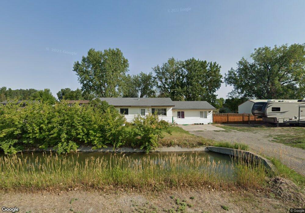
1327 Barrett Rd Billings, MT 59105
Billings Heights NeighborhoodEstimated Value: $365,000 - $412,000
5
Beds
2
Baths
1,492
Sq Ft
$256/Sq Ft
Est. Value
About This Home
This home is located at 1327 Barrett Rd, Billings, MT 59105 and is currently estimated at $382,223, approximately $256 per square foot. 1327 Barrett Rd is a home located in Yellowstone County with nearby schools including Beartooth School, Medicine Crow Middle School, and Skyview High School.
Ownership History
Date
Name
Owned For
Owner Type
Purchase Details
Closed on
Apr 25, 2019
Sold by
Collins Christopher R and Laughlin Amber R
Bought by
Collins Christopher R and Laughlin Amber R
Current Estimated Value
Purchase Details
Closed on
Oct 13, 2006
Sold by
Beach Monte R and Beach Pam L
Bought by
Collins Christopher R and Laughlin Amber R
Home Financials for this Owner
Home Financials are based on the most recent Mortgage that was taken out on this home.
Original Mortgage
$148,824
Interest Rate
6.46%
Mortgage Type
FHA
Create a Home Valuation Report for This Property
The Home Valuation Report is an in-depth analysis detailing your home's value as well as a comparison with similar homes in the area
Home Values in the Area
Average Home Value in this Area
Purchase History
| Date | Buyer | Sale Price | Title Company |
|---|---|---|---|
| Collins Christopher R | -- | First Montana Title Co | |
| Collins Christopher R | -- | None Available |
Source: Public Records
Mortgage History
| Date | Status | Borrower | Loan Amount |
|---|---|---|---|
| Previous Owner | Collins Christopher R | $148,824 |
Source: Public Records
Tax History Compared to Growth
Tax History
| Year | Tax Paid | Tax Assessment Tax Assessment Total Assessment is a certain percentage of the fair market value that is determined by local assessors to be the total taxable value of land and additions on the property. | Land | Improvement |
|---|---|---|---|---|
| 2025 | $2,640 | $341,600 | $81,674 | $259,926 |
| 2024 | $2,640 | $319,800 | $73,666 | $246,134 |
| 2023 | $2,792 | $319,800 | $73,666 | $246,134 |
| 2022 | $1,709 | $222,600 | $0 | $0 |
| 2021 | $2,201 | $222,600 | $0 | $0 |
| 2020 | $2,009 | $203,900 | $0 | $0 |
| 2019 | $1,971 | $203,900 | $0 | $0 |
| 2018 | $1,786 | $178,200 | $0 | $0 |
| 2017 | $1,737 | $178,200 | $0 | $0 |
| 2016 | $1,715 | $178,500 | $0 | $0 |
| 2015 | $1,689 | $178,500 | $0 | $0 |
| 2014 | $1,527 | $84,323 | $0 | $0 |
Source: Public Records
Map
Nearby Homes
- 1320 Mading Dr
- 1203 Peony Dr
- TBD Barrett Rd
- na Hawthorne Ln
- 1961 Bitterroot Dr
- 1512 Mary St
- 1819 Natalie St
- 901 Kale Dr
- 1007 Crist Dr
- 1982 Sandra Dr
- 1512 Mustang Valley Dr
- 1403 Eugene Ave
- 1518 S Ping Cir
- 1374 Kelsey Ln
- 1402 Emma Ave
- 2542 Kaley Ln
- 1327 Tania Cir
- 1727 Wicks Ln
- 2530 Kaley Ln
- 1526 Spring Gulch Way
- 1326 Bluebell Dr
- 1404 Barrett Rd
- 1318 Bluebell Dr
- 1310 Bluebell Dr
- 1936 Columbine Dr
- 1950 Carroll Heights Cir
- 1955 Carroll Heights Cir
- 1941 Columbine Dr
- 1924 Columbine Dr
- 1302 Bluebell Dr
- 1319 Bluebell Dr
- 1935 Columbine Dr
- 1920 Columbine Dr
- 1334 Mading Dr
- 1258 Bluebell Dr
- 1927 Columbine Dr
- 1942 Dogwood Dr
- 1406 Mading Dr
- 1305 Bluebell Dr
- 1916 Columbine Dr