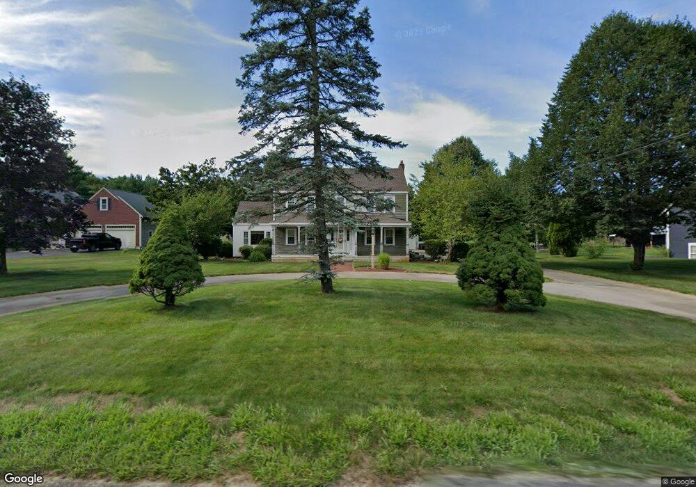
1327 Broadway Hanover, MA 02339
Estimated Value: $844,000 - $1,266,000
5
Beds
4
Baths
4,090
Sq Ft
$270/Sq Ft
Est. Value
About This Home
This home is located at 1327 Broadway, Hanover, MA 02339 and is currently estimated at $1,102,839, approximately $269 per square foot. 1327 Broadway is a home located in Plymouth County with nearby schools including Hanover High School, Cadence Academy Preschool - Hanover, and Cardinal Cushing Centers.
Ownership History
Date
Name
Owned For
Owner Type
Purchase Details
Closed on
Apr 28, 2022
Sold by
Carlson John A and Carlson Diane M
Bought by
Mmf Rt and Carlson
Current Estimated Value
Purchase Details
Closed on
Sep 5, 1984
Bought by
Carlson John A and Carlson Diane M
Create a Home Valuation Report for This Property
The Home Valuation Report is an in-depth analysis detailing your home's value as well as a comparison with similar homes in the area
Home Values in the Area
Average Home Value in this Area
Purchase History
| Date | Buyer | Sale Price | Title Company |
|---|---|---|---|
| Mmf Rt | -- | None Available | |
| Mmf Rt | -- | None Available | |
| Carlson John A | -- | None Available | |
| Carlson John A | -- | -- |
Source: Public Records
Mortgage History
| Date | Status | Borrower | Loan Amount |
|---|---|---|---|
| Previous Owner | Carlson John A | $200,000 | |
| Previous Owner | Carlson John A | $135,000 | |
| Previous Owner | Carlson John A | $135,000 |
Source: Public Records
Tax History Compared to Growth
Tax History
| Year | Tax Paid | Tax Assessment Tax Assessment Total Assessment is a certain percentage of the fair market value that is determined by local assessors to be the total taxable value of land and additions on the property. | Land | Improvement |
|---|---|---|---|---|
| 2025 | $12,622 | $1,022,000 | $281,200 | $740,800 |
| 2024 | $12,233 | $952,700 | $281,200 | $671,500 |
| 2023 | $12,265 | $909,200 | $258,600 | $650,600 |
| 2022 | $12,760 | $836,700 | $258,600 | $578,100 |
| 2021 | $12,811 | $784,500 | $235,500 | $549,000 |
| 2020 | $12,418 | $761,400 | $235,500 | $525,900 |
| 2019 | $11,961 | $728,900 | $235,500 | $493,400 |
| 2018 | $11,119 | $683,000 | $235,500 | $447,500 |
| 2017 | $10,847 | $656,600 | $219,100 | $437,500 |
| 2016 | $10,581 | $627,600 | $199,500 | $428,100 |
| 2015 | $10,136 | $627,600 | $199,500 | $428,100 |
Source: Public Records
Map
Nearby Homes
- 1251 Broadway
- 41 Gail Rd
- Lot 22 Adams Cir
- 553 Center St
- 842 E Washington St
- 436 Center St
- 154 Winter St
- 15 Elm Place
- 51 Cervelli Farm Dr
- 37 Dr
- 23 Cervelli Farm Dr
- 38 Cervelli Farm Dr
- 9 Cervelli Farm Dr
- 250 Center St
- 114 Graham Hill Dr
- 37 Brook St
- 418 E Washington St
- 67 School St
- 21 King St
- 248 E Washington St