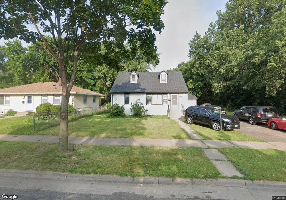
1327 Mcafee St Saint Paul, MN 55106
Estimated Value: $295,000 - $346,000
4
Beds
2
Baths
2,340
Sq Ft
$138/Sq Ft
Est. Value
About This Home
This home is located at 1327 Mcafee St, Saint Paul, MN 55106 and is currently estimated at $323,751, approximately $138 per square foot. 1327 Mcafee St is a home located in Ramsey County with nearby schools including Frost Lake Elementary School, Txuj Ci HMong Language and Culture Upper Campus, and Johnson Senior High School.
Ownership History
Date
Name
Owned For
Owner Type
Purchase Details
Closed on
Dec 23, 2014
Sold by
The Secretary Of Housing & Urban Develop
Bought by
Vang Xue and Vang Kurt
Current Estimated Value
Purchase Details
Closed on
Jun 19, 2013
Sold by
Bank Of America Na
Bought by
The Secretary Of Housing & Urban Develop
Purchase Details
Closed on
May 22, 2013
Sold by
Semple Patrick M
Bought by
Bank Of America Na
Purchase Details
Closed on
Sep 12, 2008
Sold by
Deutsche Bank National Trust Co
Bought by
Semple Patrick M
Purchase Details
Closed on
Jun 25, 2002
Sold by
Kochan Konrad G
Bought by
Cendant Mobility Financial Government
Purchase Details
Closed on
Dec 29, 2000
Sold by
Meyer William J and Meyer Beverly A
Bought by
Kochan Konrad G
Create a Home Valuation Report for This Property
The Home Valuation Report is an in-depth analysis detailing your home's value as well as a comparison with similar homes in the area
Home Values in the Area
Average Home Value in this Area
Purchase History
| Date | Buyer | Sale Price | Title Company |
|---|---|---|---|
| Vang Xue | -- | Tradition Title | |
| The Secretary Of Housing & Urban Develop | -- | None Available | |
| Bank Of America Na | $135,725 | None Available | |
| Semple Patrick M | $153,000 | -- | |
| Cendant Mobility Financial Government | $180,000 | -- | |
| Yang Tcheu Len | $180,000 | -- | |
| Kochan Konrad G | $155,000 | -- |
Source: Public Records
Tax History Compared to Growth
Tax History
| Year | Tax Paid | Tax Assessment Tax Assessment Total Assessment is a certain percentage of the fair market value that is determined by local assessors to be the total taxable value of land and additions on the property. | Land | Improvement |
|---|---|---|---|---|
| 2025 | $4,278 | $303,500 | $37,500 | $266,000 |
| 2023 | $4,278 | $276,400 | $31,300 | $245,100 |
| 2022 | $4,054 | $302,300 | $31,300 | $271,000 |
| 2021 | $3,370 | $250,400 | $31,300 | $219,100 |
| 2020 | $3,292 | $217,500 | $18,900 | $198,600 |
| 2019 | $3,278 | $209,500 | $18,900 | $190,600 |
| 2018 | $3,026 | $205,600 | $18,900 | $186,700 |
| 2017 | $3,122 | $191,700 | $18,900 | $172,800 |
| 2016 | $3,082 | $0 | $0 | $0 |
| 2015 | $2,658 | $161,900 | $18,900 | $143,000 |
| 2014 | $2,128 | $0 | $0 | $0 |
Source: Public Records
Map
Nearby Homes
- 1377 Clarence St
- 1357 Birmingham St
- 1229 Clarence St
- 1221 Clarence St
- 1343 Maryland Ave E
- 1635 Maryland Ave E
- 1450 Arlington Ave E
- 1186 Duluth St
- 866 Clear Ave E
- 1114 Lane Place
- 1562 Ivy Ave E
- 1567 Atlantic St
- 1583 Nevada Ave E
- 1639 Clarence St
- 992 Orange Ave E
- 1181 Herbert St
- 968 Hyacinth Ave E
- 1664 Orange Ave E
- 1672 Manton St
- 1607 Hoyt Ave E
- 1327 1327 McAfee-street-
- 1321 Mcafee St
- 1339 Mcafee St
- 1317 Mcafee St
- 1317 1317 McAfee-street-
- 1345 Mcafee St
- 1345 1345 McAfee-street-
- 1311 Mcafee St
- 1330 1330 McAfee-street-
- 1324 Mcafee St
- 1330 Mcafee St
- 1320 Mcafee St
- 1303 Mcafee St
- 1349 Mcafee St
- 1349 1349 McAfee-street-
- 1336 Mcafee St
- 1316 Topic Ln
- 1342 1342 McAfee-street-
- 1342 Mcafee St
- 1299 Mcafee St