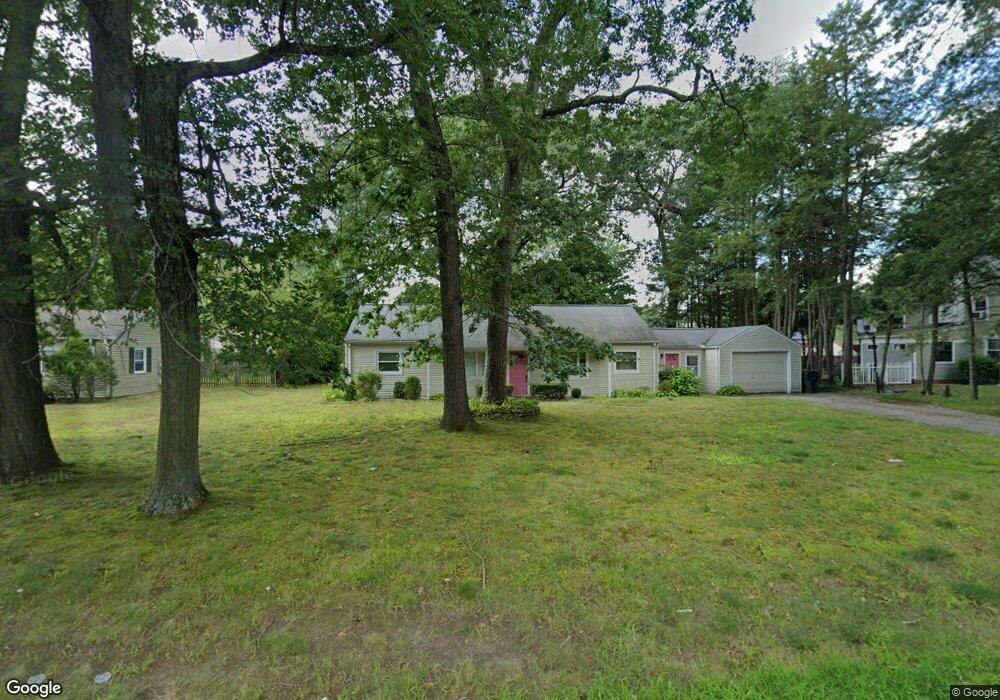
1328 Plumtree Rd Springfield, MA 01119
Sixteen Acres NeighborhoodEstimated Value: $305,174 - $356,000
4
Beds
1
Bath
1,404
Sq Ft
$231/Sq Ft
Est. Value
About This Home
This home is located at 1328 Plumtree Rd, Springfield, MA 01119 and is currently estimated at $324,044, approximately $230 per square foot. 1328 Plumtree Rd is a home located in Hampden County with nearby schools including Glickman Elementary, M Marcus Kiley Middle, and Springfield High School of Science and Technology.
Ownership History
Date
Name
Owned For
Owner Type
Purchase Details
Closed on
Oct 13, 1999
Sold by
Long James M and Long Carol H
Bought by
Tynes Julian T and Tynes Debra K
Current Estimated Value
Home Financials for this Owner
Home Financials are based on the most recent Mortgage that was taken out on this home.
Original Mortgage
$75,396
Outstanding Balance
$22,713
Interest Rate
7.8%
Mortgage Type
Purchase Money Mortgage
Estimated Equity
$301,331
Create a Home Valuation Report for This Property
The Home Valuation Report is an in-depth analysis detailing your home's value as well as a comparison with similar homes in the area
Home Values in the Area
Average Home Value in this Area
Purchase History
| Date | Buyer | Sale Price | Title Company |
|---|---|---|---|
| Tynes Julian T | $78,000 | -- |
Source: Public Records
Mortgage History
| Date | Status | Borrower | Loan Amount |
|---|---|---|---|
| Open | Tynes Julian T | $75,396 | |
| Previous Owner | Tynes Julian T | $81,000 | |
| Closed | Tynes Julian T | $2,060 |
Source: Public Records
Tax History
| Year | Tax Paid | Tax Assessment Tax Assessment Total Assessment is a certain percentage of the fair market value that is determined by local assessors to be the total taxable value of land and additions on the property. | Land | Improvement |
|---|---|---|---|---|
| 2025 | $4,078 | $260,100 | $53,000 | $207,100 |
| 2024 | $3,816 | $237,600 | $53,000 | $184,600 |
| 2023 | $3,463 | $203,100 | $50,400 | $152,700 |
| 2022 | $3,416 | $181,500 | $50,400 | $131,100 |
| 2021 | $3,067 | $162,300 | $45,900 | $116,400 |
| 2020 | $3,172 | $162,400 | $45,900 | $116,500 |
| 2019 | $3,003 | $152,600 | $45,900 | $106,700 |
| 2018 | $2,903 | $147,500 | $45,900 | $101,600 |
| 2017 | $2,868 | $145,900 | $42,600 | $103,300 |
| 2016 | $2,654 | $135,000 | $42,600 | $92,400 |
| 2015 | $2,598 | $132,100 | $42,600 | $89,500 |
Source: Public Records
Map
Nearby Homes
- 108 Birchland Ave
- 46 Puritan Cir
- 73 Timber Ln
- 55 Old Farm Rd
- 74 Valley Rd
- Lot 37 Kane St
- 119 Acrebrook Rd
- 86 Wildwood Ave
- 744 Bradley Rd
- 81 W Crystal Brook Dr
- 228 Acrebrook Rd
- 88 Senator St
- 381 N Brook Rd
- 120 Bridle Path Rd
- 60 Jeanne Marie St
- 17 Jeanne Marie St
- 647 Plumtree Rd
- 30 W Hill Rd
- 121 Mallowhill Rd
- 24 Wands St
- 1318 Plumtree Rd
- 1338 Plumtree Rd
- 65 Balboa Dr
- 75 Balboa Dr
- 55 Balboa Dr
- 1321 Plumtree Rd
- 1350 Plumtree Rd
- 85 Balboa Dr
- 1300 Plumtree Rd
- 70 Balboa Dr
- 1331 Plumtree Rd
- 41 Balboa Dr
- 58 Balboa Dr
- 1360 Plumtree Rd
- 1311 Plumtree Rd
- 80 Balboa Dr
- 1341 Plumtree Rd
- 1353 Plumtree Rd
- 1294 Plumtree Rd
- 93 Balboa Dr
Your Personal Tour Guide
Ask me questions while you tour the home.