Estimated Value: $489,504 - $649,000
3
Beds
3
Baths
2,587
Sq Ft
$216/Sq Ft
Est. Value
About This Home
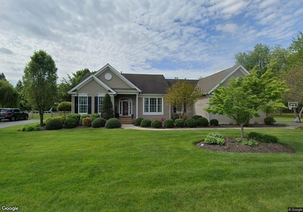
This home is located at 133 Clark Ct, Dover, DE 19901 and is currently estimated at $559,126, approximately $216 per square foot. 133 Clark Ct is a home located in Kent County with nearby schools including Star Hill Elementary School, F. Niel Postlethwait Middle School, and Caesar Rodney High School.
Ownership History
Date
Name
Owned For
Owner Type
Purchase Details
Closed on
Nov 15, 2011
Sold by
Tull Stephen E and Tull Lisa S
Bought by
Payne Jason R and Payne Pamela S
Current Estimated Value
Home Financials for this Owner
Home Financials are based on the most recent Mortgage that was taken out on this home.
Original Mortgage
$342,000
Outstanding Balance
$232,082
Interest Rate
3.92%
Mortgage Type
New Conventional
Estimated Equity
$327,044
Purchase Details
Closed on
Mar 24, 2005
Sold by
Barry Paul L and Barry Brenda L
Bought by
Tull Stephen E and Tull Lisa S
Home Financials for this Owner
Home Financials are based on the most recent Mortgage that was taken out on this home.
Original Mortgage
$252,000
Interest Rate
5.56%
Mortgage Type
New Conventional
Create a Home Valuation Report for This Property
The Home Valuation Report is an in-depth analysis detailing your home's value as well as a comparison with similar homes in the area
Home Values in the Area
Average Home Value in this Area
Purchase History
| Date | Buyer | Sale Price | Title Company |
|---|---|---|---|
| Payne Jason R | $360,000 | None Available | |
| Tull Stephen E | -- | None Available |
Source: Public Records
Mortgage History
| Date | Status | Borrower | Loan Amount |
|---|---|---|---|
| Open | Payne Jason R | $342,000 | |
| Previous Owner | Tull Stephen E | $252,000 |
Source: Public Records
Tax History
| Year | Tax Paid | Tax Assessment Tax Assessment Total Assessment is a certain percentage of the fair market value that is determined by local assessors to be the total taxable value of land and additions on the property. | Land | Improvement |
|---|---|---|---|---|
| 2025 | $2,385 | $466,400 | $116,900 | $349,500 |
| 2024 | $2,397 | $466,400 | $116,900 | $349,500 |
| 2023 | $2,218 | $67,900 | $8,800 | $59,100 |
| 2022 | $2,088 | $67,900 | $8,800 | $59,100 |
| 2021 | $2,077 | $67,900 | $8,800 | $59,100 |
| 2020 | $2,019 | $67,900 | $8,800 | $59,100 |
| 2019 | $1,950 | $67,900 | $8,800 | $59,100 |
| 2018 | $1,906 | $67,900 | $8,800 | $59,100 |
| 2017 | $1,868 | $67,900 | $0 | $0 |
| 2016 | $1,767 | $67,900 | $0 | $0 |
| 2015 | $1,527 | $67,900 | $0 | $0 |
| 2014 | $1,547 | $67,900 | $0 | $0 |
Source: Public Records
Map
Nearby Homes
- 850 Brookfield Dr
- 870 Brookfield Dr
- LOT 102 AST King Henry Ct
- LOT 105 SYC Brookfield Dr
- Lot 22 Bee Brookfield Dr
- Lot 42 Lin Brookfield Dr
- Lot 47 Red Brookfield Dr
- 1041 Fawn Haven Walk
- 13 Casterline Ct
- 256 Headstart Ln
- 100 Brookfield Dr
- 46 Brookfield Dr
- 24 Brookfield Dr
- Lot 104 Gar Brookfield Dr
- 43 Brookfield Dr
- 45 Brookfield Dr
- 235 Fawn Haven Walk
- 1275 Lochmeath Way
- 1317 Lochmeath Way
- 157 Roundabout Trail
- 111 Clark Ct
- 134 Clark Ct
- 91 Clark Ct
- 110 Clark Ct
- 660 Brookfield Dr
- 682 Brookfield Dr
- 90 Clark Ct
- 67 Clark Ct
- 612 Brookfield Dr
- 139 King Henry Ct
- 117 King Henry Ct
- 60 Clark Ct
- 103 King Henry Ct
- 694 Brookfield Dr
- 93 King Henry Ct
- 45 Clark Ct
- 688 Brookfield Dr
- 588 Brookfield Dr
- 724 Brookfield Dr
- 639 Brookfield Dr
Your Personal Tour Guide
Ask me questions while you tour the home.