Estimated payment $1,459/month
Highlights
- Deck
- Cooling Available
- Baseboard Heating
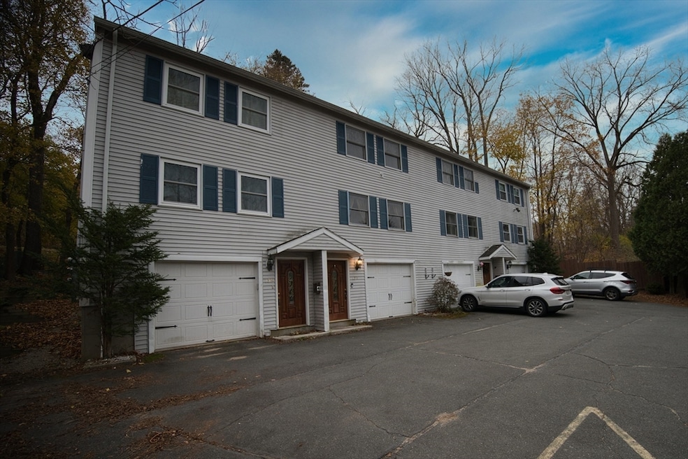
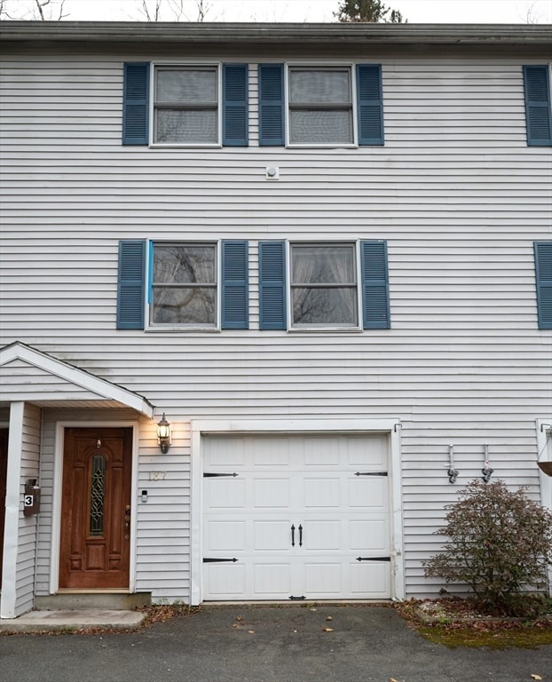
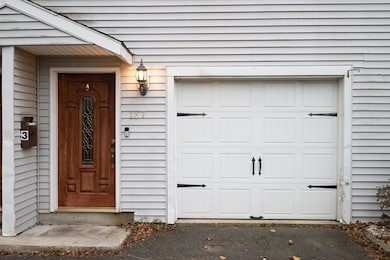
- 1 Car Attached Garage
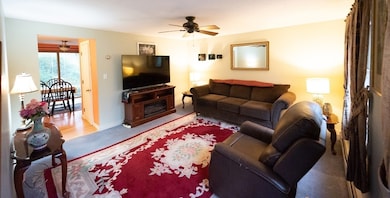
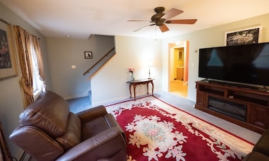
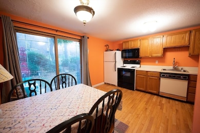
About This Home
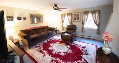
Come on out and be the first to see this meticulously maintained town house condo in great family neighborhood. If maintenance free living is what your striving towards look no further. Large and bright rooms give this unit a very comfortable and homey feel. Back yard deck is good for entertaining. Washer and dryer stack system included. Many improvements and upgrades with this home. Motivated sellers ! Bring all offers !!
Townhouse Details
Home Type
- Townhome
Est. Annual Taxes
- $2,462
Year Built
- Built in 1988
HOA Fees
- $200 Monthly HOA Fees
Parking
- 1 Car Attached Garage
- Tuck Under Parking
- Off-Street Parking
Home Design
- Entry on the 3rd floor
- Frame Construction
- Shingle Roof
Interior Spaces
- 1,008 Sq Ft Home
- 2-Story Property
- Basement
Bedrooms and Bathrooms
- 2 Bedrooms
Outdoor Features
- Deck
Utilities
- Cooling Available
- Heating System Uses Oil
- Baseboard Heating
Community Details
- Association fees include insurance, maintenance structure, ground maintenance, snow removal
- 4 Units
Listing and Financial Details
- Assessor Parcel Number M:00032 B:00312 L:00003,4439950
Map
Home Values in the Area
Average Home Value in this Area
Tax History
| Year | Tax Paid | Tax Assessment Tax Assessment Total Assessment is a certain percentage of the fair market value that is determined by local assessors to be the total taxable value of land and additions on the property. | Land | Improvement |
|---|---|---|---|---|
| 2025 | $2,462 | $193,700 | $0 | $193,700 |
| 2024 | $1,714 | $133,600 | $0 | $133,600 |
| 2023 | $1,842 | $131,200 | $0 | $131,200 |
| 2022 | $2,122 | $132,200 | $0 | $132,200 |
| 2021 | $1,289 | $73,000 | $0 | $73,000 |
| 2020 | $1,185 | $69,000 | $0 | $69,000 |
| 2019 | $1,181 | $67,700 | $0 | $67,700 |
| 2018 | $1,325 | $67,700 | $0 | $67,700 |
| 2017 | $1,212 | $59,400 | $0 | $59,400 |
| 2016 | $1,116 | $56,300 | $0 | $56,300 |
| 2015 | $1,071 | $56,300 | $0 | $56,300 |
| 2014 | $1,038 | $56,300 | $0 | $56,300 |
Property History
| Date | Event | Price | List to Sale | Price per Sq Ft |
|---|---|---|---|---|
| 11/06/2025 11/06/25 | For Sale | $199,900 | -- | $198 / Sq Ft |
Purchase History
| Date | Type | Sale Price | Title Company |
|---|---|---|---|
| Deed | $97,000 | -- | |
| Deed | $105,000 | -- |
Mortgage History
| Date | Status | Loan Amount | Loan Type |
|---|---|---|---|
| Open | $76,000 | Purchase Money Mortgage | |
| Previous Owner | $99,750 | Purchase Money Mortgage |
Source: MLS Property Information Network (MLS PIN)
MLS Number: 73452412
APN: ATHO-000032-000312-000003
Disclaimer: Certain information contained herein is derived from information provided by parties other than Homes.com. All information provided is deemed reliable, but is not guaranteed to be accurate and should be independently verified.
![]() The property listing data and information, or the Images, set forth herein were provided to MLS Property Information Network, Inc. from third party sources, including sellers, lessors and public records, and were compiled by MLS Property Information Network, Inc. The property listing data and information, and the Images, are for the personal, non-commercial use of consumers having a good faith interest in purchasing or leasing listed properties of the type displayed to them and may not be used for any purpose other than to identify prospective properties which such consumers may have a good faith interest in purchasing or leasing. MLS Property Information Network, Inc. and its subscribers disclaim any and all representations and warranties as to the accuracy of the property listing data and information, or as to the accuracy of any of the Images, set forth herein.
The property listing data and information, or the Images, set forth herein were provided to MLS Property Information Network, Inc. from third party sources, including sellers, lessors and public records, and were compiled by MLS Property Information Network, Inc. The property listing data and information, and the Images, are for the personal, non-commercial use of consumers having a good faith interest in purchasing or leasing listed properties of the type displayed to them and may not be used for any purpose other than to identify prospective properties which such consumers may have a good faith interest in purchasing or leasing. MLS Property Information Network, Inc. and its subscribers disclaim any and all representations and warranties as to the accuracy of the property listing data and information, or as to the accuracy of any of the Images, set forth herein.
- 50 Park St Unit 2
- 50 Park St
- 2154 Main St Unit 1
- 232 Pequoig Ave Unit 2
- 129 Union St
- 1151 Silver Lake St
- 419 E River St
- 25 High St Unit 1
- 39 W Main St Unit 2
- 166-168-168 W Main St Unit 168-5
- 30 Whitney St Unit 2B
- 15 N Main St Unit 3
- 11 Main St Unit 3
- 53 Spruce St Unit 2
- 24 Leamy St Unit 24
- 14 Coleman St Unit 2
- 13 Greenwood St Unit 1
- 13 Greenwood St Unit 3
- 33 Ash St Unit 1
- 40 Moran St
