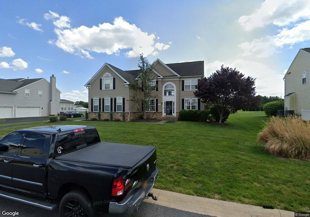
133 Loder Dr Smyrna, DE 19977
Estimated Value: $633,000 - $675,000
4
Beds
3
Baths
3,696
Sq Ft
$177/Sq Ft
Est. Value
About This Home
This home is located at 133 Loder Dr, Smyrna, DE 19977 and is currently estimated at $655,061, approximately $177 per square foot. 133 Loder Dr is a home located in Kent County with nearby schools including Sunnyside Elementary School, John Bassett Moore Intermediate School, and Smyrna Middle School.
Ownership History
Date
Name
Owned For
Owner Type
Purchase Details
Closed on
Apr 3, 2007
Sold by
Timber Mills Llc
Bought by
Craighton Damien and Craighton Lori
Current Estimated Value
Home Financials for this Owner
Home Financials are based on the most recent Mortgage that was taken out on this home.
Original Mortgage
$38,623
Outstanding Balance
$23,481
Interest Rate
6.25%
Mortgage Type
Seller Take Back
Estimated Equity
$631,580
Purchase Details
Closed on
Jan 3, 2006
Sold by
Sheats P Lloyd and Sheats David E
Bought by
Mff 3 Llc
Create a Home Valuation Report for This Property
The Home Valuation Report is an in-depth analysis detailing your home's value as well as a comparison with similar homes in the area
Home Values in the Area
Average Home Value in this Area
Purchase History
| Date | Buyer | Sale Price | Title Company |
|---|---|---|---|
| Craighton Damien | $386,239 | None Available | |
| Mff 3 Llc | $110,940 | None Available |
Source: Public Records
Mortgage History
| Date | Status | Borrower | Loan Amount |
|---|---|---|---|
| Open | Craighton Damien | $38,623 |
Source: Public Records
Tax History
| Year | Tax Paid | Tax Assessment Tax Assessment Total Assessment is a certain percentage of the fair market value that is determined by local assessors to be the total taxable value of land and additions on the property. | Land | Improvement |
|---|---|---|---|---|
| 2025 | $2,911 | $588,700 | $109,800 | $478,900 |
| 2024 | $2,879 | $588,700 | $109,800 | $478,900 |
| 2023 | $2,530 | $80,300 | $9,300 | $71,000 |
| 2022 | $2,438 | $80,300 | $9,300 | $71,000 |
| 2021 | $2,385 | $80,300 | $9,300 | $71,000 |
| 2020 | $2,121 | $80,300 | $9,300 | $71,000 |
| 2019 | $2,136 | $80,300 | $9,300 | $71,000 |
| 2018 | $2,136 | $80,300 | $9,300 | $71,000 |
| 2017 | $2,169 | $82,000 | $0 | $0 |
| 2016 | $2,134 | $82,000 | $0 | $0 |
| 2015 | $2,115 | $82,000 | $0 | $0 |
| 2014 | $1,994 | $82,000 | $0 | $0 |
Source: Public Records
Map
Nearby Homes
- 40 Loder Dr
- 342 Bryn Ln
- 31 Summit Dr
- 9 Summit Dr Unit LEGEND
- 4 Summit Dr Unit JACKSON
- 3 Summit Dr
- 7 Summit Dr Unit GATSBY
- 6 Summit Dr Unit JEFFERSON
- 10 Summit Dr Unit GLADWYN
- 8 Summit Dr Unit BRANDYWINE
- 174 Hardrock Dr
- 263 Smoky Ln
- 114 Hardrock Dr
- Sassafras II Plan at Greene Hill Farm Estates
- Bayard Plan at Village of Eastridge - 55+ Active Adult - Village of Eastridge
- 33 Seldon Dr Unit 3 OXFORD
- 33 Seldon Dr Unit 2 GREENSPRING
- Asbury Plan at Village of Eastridge - 55+ Active Adult - Village of Eastridge
- 33 Seldon Dr Unit 1 EDEN
- Eden Plan at Greene Hill Farm Estates
- 115 Loder Dr
- 153 Loder Dr
- 95 Loder Dr
- 171 Loder Dr
- 110 Loder Dr
- 130 Loder Dr Unit WILL
- 130 Loder Dr
- 90 Loder Dr Unit PATUX
- 90 Loder Dr
- 77 Loder Dr
- 150 Loder Dr
- 187 Loder Dr
- 170 Loder Dr Unit 1
- 170 Loder Dr
- 92 Loder Dr Unit PATUX
- 92 Loder Dr
- 190 Loder Dr Unit WHITE
- 190 Loder Dr
- 190 Loder Dr Unit POTOMA
- 72 Loder Dr