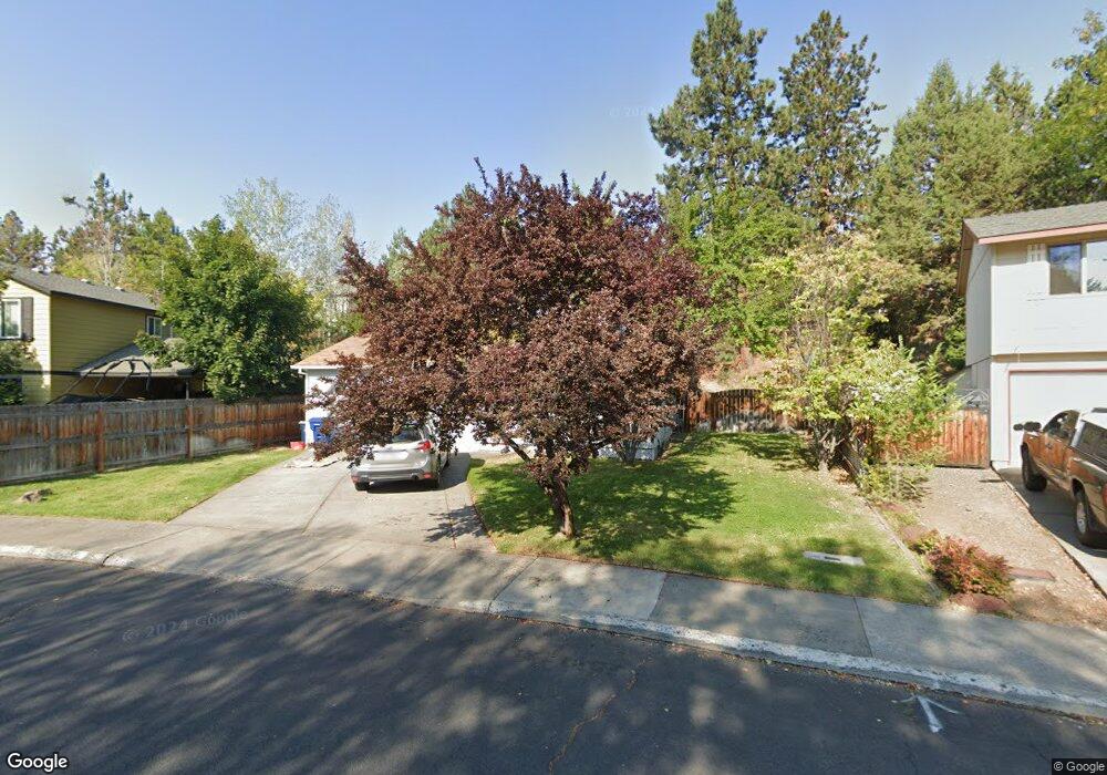
133 SE Dorrie Ct Bend, OR 97702
Larkspur NeighborhoodEstimated Value: $522,675 - $547,000
3
Beds
2
Baths
1,317
Sq Ft
$407/Sq Ft
Est. Value
About This Home
This home is located at 133 SE Dorrie Ct, Bend, OR 97702 and is currently estimated at $536,419, approximately $407 per square foot. 133 SE Dorrie Ct is a home located in Deschutes County with nearby schools including Bear Creek Elementary School, Bend Senior High School, and Eastmont Community School.
Ownership History
Date
Name
Owned For
Owner Type
Purchase Details
Closed on
Feb 5, 2009
Sold by
U S Bank National Association
Bought by
Love John and Love Cynthia
Current Estimated Value
Purchase Details
Closed on
Jan 21, 2009
Sold by
Schaff Norman D
Bought by
U S Bank National Association
Purchase Details
Closed on
Nov 22, 2005
Sold by
Newell Reta L
Bought by
Schaff Norman D
Home Financials for this Owner
Home Financials are based on the most recent Mortgage that was taken out on this home.
Original Mortgage
$192,000
Interest Rate
6%
Mortgage Type
Fannie Mae Freddie Mac
Purchase Details
Closed on
Apr 25, 2005
Sold by
Allison Lisa E
Bought by
Newell Reta L
Home Financials for this Owner
Home Financials are based on the most recent Mortgage that was taken out on this home.
Original Mortgage
$148,400
Interest Rate
6.5%
Mortgage Type
Fannie Mae Freddie Mac
Create a Home Valuation Report for This Property
The Home Valuation Report is an in-depth analysis detailing your home's value as well as a comparison with similar homes in the area
Home Values in the Area
Average Home Value in this Area
Purchase History
| Date | Buyer | Sale Price | Title Company |
|---|---|---|---|
| Love John | $130,100 | First American Title | |
| U S Bank National Association | $140,910 | Accommodation | |
| Schaff Norman D | $240,000 | Amerititle | |
| Newell Reta L | $185,500 | Deschutes County Title Co |
Source: Public Records
Mortgage History
| Date | Status | Borrower | Loan Amount |
|---|---|---|---|
| Previous Owner | Schaff Norman D | $192,000 | |
| Previous Owner | Newell Reta L | $148,400 | |
| Closed | Newell Reta L | $37,100 |
Source: Public Records
Tax History Compared to Growth
Tax History
| Year | Tax Paid | Tax Assessment Tax Assessment Total Assessment is a certain percentage of the fair market value that is determined by local assessors to be the total taxable value of land and additions on the property. | Land | Improvement |
|---|---|---|---|---|
| 2025 | $3,257 | $192,780 | -- | -- |
| 2024 | $3,134 | $187,170 | -- | -- |
| 2023 | $2,905 | $181,720 | $0 | $0 |
| 2022 | $2,710 | $171,300 | $0 | $0 |
| 2021 | $2,715 | $166,320 | $0 | $0 |
| 2020 | $2,576 | $166,320 | $0 | $0 |
| 2019 | $2,504 | $161,480 | $0 | $0 |
| 2018 | $2,433 | $156,780 | $0 | $0 |
| 2017 | $2,362 | $152,220 | $0 | $0 |
| 2016 | $2,252 | $147,790 | $0 | $0 |
| 2015 | $2,190 | $143,490 | $0 | $0 |
| 2014 | $2,117 | $139,320 | $0 | $0 |
Source: Public Records
Map
Nearby Homes
- 98 NE Telima Ln
- 62001 NE Nates Place
- 62025 NE Nate's Place
- 20960 Gardenia Ave
- 21019 Carl St
- 61635 Pettigrew Rd Unit 12
- 1033 SE Laurelwood Place
- 21035 Clairaway Ave
- 1001 SE 15th St Unit 56
- 1001 SE 15th St Unit 77
- 1001 SE 15th St Unit 110
- 1001 SE 15th St Unit 92
- 1001 SE 15th St Unit 109
- 1001 SE 15th St Unit 126
- 1001 SE 15th St Unit 137
- 61807 SE Rolo Ct
- 61839 Avonlea Cir
- 608 NE 10th St
- 1843 SE Moorwood Ct
- 61730 Joan Ct
- 145 SE Dorrie Ct
- 127 SE Dorrie Ct
- 121 SE Dorrie Ct
- 156 SE Windance Ct
- 151 SE Dorrie Ct
- 150 SE Windance Ct
- 126 SE Dorrie Ct
- 1701 SE Karena Ct
- 132 SE Dorrie Ct
- 162 SE Windance Ct
- 1733 SE Karena Ct
- 1665 SE Ramsay Rd
- 155 SE Windance Ct
- 171 SE Dorrie Ct
- 144 SE Dorrie Ct
- 162 SE Dorrie Ct
- 168 SE Windance Ct
- 1702 SE Karena Ct
- 133 SE Rice Way
- 1655 SE Ramsay Rd