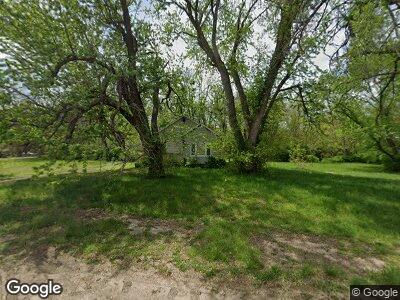
133 SE Gray St Topeka, KS 66607
East Topeka NeighborhoodEstimated Value: $63,000 - $74,000
3
Beds
1
Bath
1,037
Sq Ft
$67/Sq Ft
Est. Value
About This Home
This home is located at 133 SE Gray St, Topeka, KS 66607 and is currently estimated at $69,179, approximately $66 per square foot. 133 SE Gray St is a home located in Shawnee County with nearby schools including Scott Dual Language Magnet Elementary School, Chase Middle School, and Highland Park High School.
Ownership History
Date
Name
Owned For
Owner Type
Purchase Details
Closed on
Dec 10, 2024
Sold by
Epperson Maria and Martinez Maria M
Bought by
Herrick Steven R
Current Estimated Value
Purchase Details
Closed on
Sep 27, 2013
Sold by
Eppersion Wesley and Estate Of Nancy C Cochran
Bought by
Epperson Wesley and Epperson Maria
Home Financials for this Owner
Home Financials are based on the most recent Mortgage that was taken out on this home.
Original Mortgage
$10,000
Interest Rate
4.46%
Mortgage Type
Purchase Money Mortgage
Create a Home Valuation Report for This Property
The Home Valuation Report is an in-depth analysis detailing your home's value as well as a comparison with similar homes in the area
Home Values in the Area
Average Home Value in this Area
Purchase History
| Date | Buyer | Sale Price | Title Company |
|---|---|---|---|
| Herrick Steven R | -- | None Listed On Document | |
| Herrick Steven R | -- | None Listed On Document | |
| Epperson Wesley | $28,000 | Lawyers Title Of Topeka Inc |
Source: Public Records
Mortgage History
| Date | Status | Borrower | Loan Amount |
|---|---|---|---|
| Previous Owner | Epperson Wesley | $10,000 | |
| Previous Owner | Cochran Lester C | $1,770 |
Source: Public Records
Tax History Compared to Growth
Tax History
| Year | Tax Paid | Tax Assessment Tax Assessment Total Assessment is a certain percentage of the fair market value that is determined by local assessors to be the total taxable value of land and additions on the property. | Land | Improvement |
|---|---|---|---|---|
| 2023 | $684 | $5,009 | $0 | $0 |
| 2022 | $632 | $4,681 | $0 | $0 |
| 2021 | $635 | $4,255 | $0 | $0 |
| 2020 | $413 | $2,900 | $0 | $0 |
| 2019 | $407 | $2,843 | $0 | $0 |
| 2018 | $480 | $2,760 | $0 | $0 |
| 2017 | $395 | $2,760 | $0 | $0 |
| 2014 | $399 | $2,760 | $0 | $0 |
Source: Public Records
Map
Nearby Homes
- 1520 NE Atchison Ave
- 553 SE Golden Ave
- 127 NE Lime St
- 501 NE Grattan St
- 541 NE Grattan St
- 539 NE Scotland Ave
- 618 NE Twiss Ave
- 821 SE Sherman Ave
- 1017 SE Lawrence St
- 1400 NE Sardou Ave
- 821 SE Chandler St
- 733 NE Kellam Ave
- 545 NE Sardou Ave
- 1023 SE Hancock St
- 1142 NE Wabash Ave
- 1016 NE Quincy St
- 1220 SE Monroe St
- 214 SW Harrison St
- 1231 NE Strait Ave
- 1301 NE Arter Ave
- 133 SE Gray St
- 2400 SE 2nd St
- 2413 SE 2nd St
- 2412 SE 2nd St
- 2521 SE 2nd St
- 2401 SE 2nd St
- 2324 SE 2nd St
- 2520 SE 2nd St
- 2325 SE 2nd St
- 131 SE Golden Ave
- 2319 SE 2nd St
- 136 SE Davies St
- 126 SE Davies St
- 202 SE Davies St
- 216 SE Davies St
- 120 SE Golden Ave
- 201 SE Davies St
- 222 SE Davies St
- 226 SE Davies St
- 213 SE Davies St