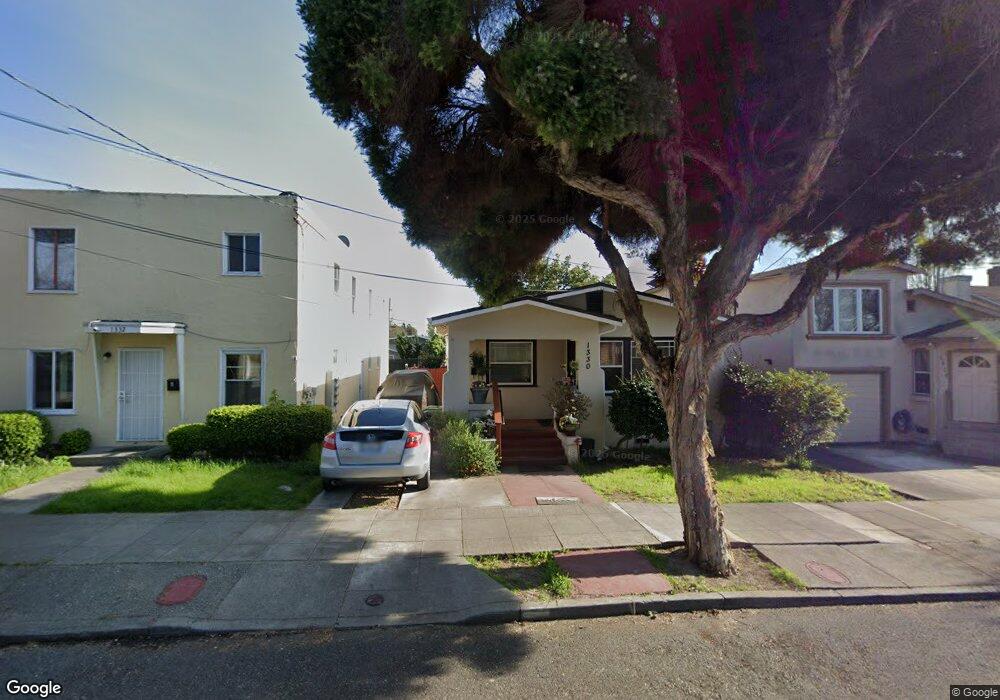
1330 Carrison St Berkeley, CA 94702
West Berkeley NeighborhoodEstimated Value: $964,944 - $1,252,000
2
Beds
1
Bath
1,338
Sq Ft
$804/Sq Ft
Est. Value
About This Home
This home is located at 1330 Carrison St, Berkeley, CA 94702 and is currently estimated at $1,075,236, approximately $803 per square foot. 1330 Carrison St is a home located in Alameda County with nearby schools including Malcolm X Elementary School, Washington Elementary School, and Oxford Elementary School.
Ownership History
Date
Name
Owned For
Owner Type
Purchase Details
Closed on
Mar 8, 2024
Sold by
Faris-Taylor Norma I
Bought by
Norma I Faris-Taylor Revocable Trust and Faris-Taylor
Current Estimated Value
Purchase Details
Closed on
Apr 17, 2002
Sold by
Faris Norma I
Bought by
Taylor Rafe and Faris Taylor Norma I
Home Financials for this Owner
Home Financials are based on the most recent Mortgage that was taken out on this home.
Original Mortgage
$266,875
Interest Rate
7.08%
Mortgage Type
Stand Alone First
Create a Home Valuation Report for This Property
The Home Valuation Report is an in-depth analysis detailing your home's value as well as a comparison with similar homes in the area
Home Values in the Area
Average Home Value in this Area
Purchase History
| Date | Buyer | Sale Price | Title Company |
|---|---|---|---|
| Norma I Faris-Taylor Revocable Trust | -- | None Listed On Document | |
| Taylor Rafe | -- | North American Title Co |
Source: Public Records
Mortgage History
| Date | Status | Borrower | Loan Amount |
|---|---|---|---|
| Previous Owner | Taylor Rafe | $266,875 |
Source: Public Records
Tax History
| Year | Tax Paid | Tax Assessment Tax Assessment Total Assessment is a certain percentage of the fair market value that is determined by local assessors to be the total taxable value of land and additions on the property. | Land | Improvement |
|---|---|---|---|---|
| 2025 | $4,329 | $87,293 | $35,856 | $51,437 |
| 2024 | $4,329 | $85,582 | $35,153 | $50,429 |
| 2023 | $4,166 | $83,904 | $34,464 | $49,440 |
| 2022 | $4,201 | $82,259 | $33,788 | $48,471 |
| 2021 | $4,176 | $80,646 | $33,126 | $47,520 |
| 2020 | $3,907 | $79,819 | $32,786 | $47,033 |
| 2019 | $3,680 | $78,254 | $32,143 | $46,111 |
| 2018 | $3,568 | $76,720 | $31,513 | $45,207 |
| 2017 | $3,412 | $75,216 | $30,895 | $44,321 |
| 2016 | $3,217 | $73,742 | $30,290 | $43,452 |
| 2015 | $3,148 | $72,634 | $29,835 | $42,799 |
| 2014 | $3,077 | $71,211 | $29,250 | $41,961 |
Source: Public Records
Map
Nearby Homes
- 3000 Acton St
- 1314 Ashby Ave
- 3032 Mabel St
- 2922 Stanton St
- 1507 Prince St
- 3101 Sacramento St
- 1080 67th St
- 1237 Ashby Ave
- 1525 Tyler St
- 1538 Ashby Ave
- 3138 California St
- 3224 Sacramento St
- 1046 Alcatraz Ave
- 6500 San Pablo Ave
- 6501 San Pablo Ave Unit 410
- 2790 Sacramento St
- 1126 Ocean Ave
- 2782 Sacramento St
- 2829 California St
- 2774 Sacramento St
- 1332 Carrison St
- 1328 Carrison St
- 1334 Carrison St
- 1324 Carrison St
- 1322 Carrison St
- 1336 Carrison St
- 1335 Haskell St
- 1327 Haskell St
- 1318 Carrison St
- 1337 Haskell St
- 1331 Haskell St
- 1321 Haskell St
- 1341 Haskell St
- 1316 Carrison St
- 3026 Acton St
- 3028 Acton St
- 1327 Carrison St
- 1325 Carrison St
- 3024 Acton St
- 1331 Carrison St
