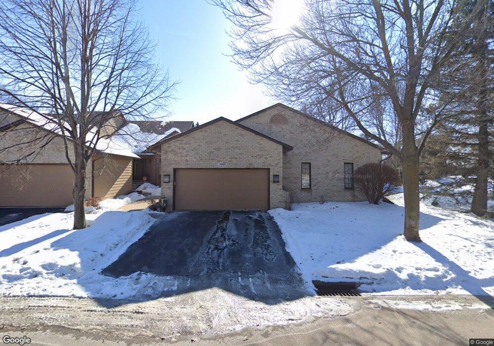
13309 Huntington Cir Saint Paul, MN 55124
Alimagnet NeighborhoodEstimated Value: $326,000 - $398,000
2
Beds
3
Baths
1,411
Sq Ft
$265/Sq Ft
Est. Value
About This Home
This home is located at 13309 Huntington Cir, Saint Paul, MN 55124 and is currently estimated at $373,428, approximately $264 per square foot. 13309 Huntington Cir is a home located in Dakota County with nearby schools including Westview Elementary School, Falcon Ridge Middle School, and Apple Valley Senior High School.
Ownership History
Date
Name
Owned For
Owner Type
Purchase Details
Closed on
Sep 4, 2019
Sold by
Bednar Dudley Mary and Bednar John Charles
Bought by
Rodriguez Richard and Rodriguez Jillian
Current Estimated Value
Home Financials for this Owner
Home Financials are based on the most recent Mortgage that was taken out on this home.
Original Mortgage
$224,000
Outstanding Balance
$196,207
Interest Rate
3.6%
Mortgage Type
New Conventional
Estimated Equity
$177,221
Purchase Details
Closed on
Aug 17, 2016
Sold by
Bednar Dudley Mary
Bought by
Bednar Dudley Mary and John Charles Bednar & Dudley Mary Bednar
Purchase Details
Closed on
Jul 29, 2016
Sold by
Arnold Doris H
Bought by
Bednar Dudley Mary
Purchase Details
Closed on
Aug 6, 2004
Sold by
Moe Roger A and Moe June M
Bought by
Arnold Doris H
Create a Home Valuation Report for This Property
The Home Valuation Report is an in-depth analysis detailing your home's value as well as a comparison with similar homes in the area
Home Values in the Area
Average Home Value in this Area
Purchase History
| Date | Buyer | Sale Price | Title Company |
|---|---|---|---|
| Rodriguez Richard | $280,000 | None Available | |
| Bednar Dudley Mary | -- | Attorney | |
| Bednar Dudley Mary | $254,900 | Home Title Inc | |
| Arnold Doris H | $230,000 | -- |
Source: Public Records
Mortgage History
| Date | Status | Borrower | Loan Amount |
|---|---|---|---|
| Open | Rodriguez Richard | $224,000 |
Source: Public Records
Tax History Compared to Growth
Tax History
| Year | Tax Paid | Tax Assessment Tax Assessment Total Assessment is a certain percentage of the fair market value that is determined by local assessors to be the total taxable value of land and additions on the property. | Land | Improvement |
|---|---|---|---|---|
| 2024 | $4,142 | $328,800 | $98,200 | $230,600 |
| 2023 | $4,142 | $368,000 | $96,100 | $271,900 |
| 2022 | $3,294 | $345,100 | $95,800 | $249,300 |
| 2021 | $3,496 | $290,800 | $83,300 | $207,500 |
| 2020 | $3,492 | $300,800 | $79,300 | $221,500 |
| 2019 | $3,009 | $292,100 | $75,500 | $216,600 |
| 2018 | $3,025 | $265,800 | $69,900 | $195,900 |
| 2017 | $3,192 | $256,400 | $64,800 | $191,600 |
| 2016 | $2,853 | $256,400 | $61,700 | $194,700 |
| 2015 | $2,545 | $213,024 | $56,132 | $156,892 |
| 2014 | -- | $190,788 | $50,889 | $139,899 |
| 2013 | -- | $161,249 | $44,363 | $116,886 |
Source: Public Records
Map
Nearby Homes
- 13306 Huntington Cir
- 13345 Huntington Cir
- 8776 134th St W
- 13591 Hollybrook Way
- 13101 Heritage Way
- 13599 Hollybrook Dr
- 13609 Hollybrook Dr
- 13613 Hollybrook Dr
- 13731 Hollybrook Cir
- 13727 Hollybrook Cir
- The Sophia Plan at Eagle Pointe - Townhomes
- The Amelia Plan at Eagle Pointe - Townhomes
- The Magnolia Plan at Eagle Pointe - Townhomes
- The Nolan Plan at Eagle Pointe - Townhomes
- 13751 Hollybrook Cir
- 13761 Hollybrook Cir
- 13820 Holyoke Path
- 451 Reflection Rd
- 1408 McAndrews Rd E Unit 8
- 14132 Heywood Path
- 13311 Huntington Cir
- 13307 Huntington Cir
- 13313 Huntington Cir
- 13305 Huntington Cir
- 13323 Huntington Cir
- 13303 Huntington Cir
- 13327 Huntington Cir
- 13314 Huntington Cir
- 13301 Huntington Cir
- 13306 Huntington Cir
- 13322 Huntington Cir
- 13331 Huntington Cir
- 13299 Huntington Dr
- 13298 Huntington Dr
- 13298 Huntington Dr
- 13335 Huntington Cir
- 13290 Huntington Dr
- 13330 Huntington Cir
- 13282 Huntington Dr
- 13338 Huntington Cir