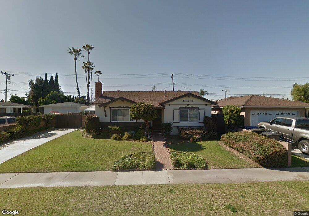
13311 Barney St Westminster, CA 92683
Estimated Value: $924,000 - $977,000
3
Beds
2
Baths
1,340
Sq Ft
$718/Sq Ft
Est. Value
About This Home
This home is located at 13311 Barney St, Westminster, CA 92683 and is currently estimated at $962,108, approximately $717 per square foot. 13311 Barney St is a home located in Orange County with nearby schools including Sequoia Elementary, Johnson Middle, and Westminster High School.
Ownership History
Date
Name
Owned For
Owner Type
Purchase Details
Closed on
Sep 27, 2001
Sold by
Bernsen Timothy P
Bought by
Nelson Danny N
Current Estimated Value
Home Financials for this Owner
Home Financials are based on the most recent Mortgage that was taken out on this home.
Original Mortgage
$219,900
Outstanding Balance
$78,892
Interest Rate
5.75%
Estimated Equity
$883,216
Purchase Details
Closed on
Feb 25, 1998
Sold by
Free Melvin L and Free Yoshiko S
Bought by
Free Melvin L and Free Yoshiko S
Create a Home Valuation Report for This Property
The Home Valuation Report is an in-depth analysis detailing your home's value as well as a comparison with similar homes in the area
Home Values in the Area
Average Home Value in this Area
Purchase History
| Date | Buyer | Sale Price | Title Company |
|---|---|---|---|
| Nelson Danny N | $275,000 | Southland Title Corporation | |
| Free Melvin L | -- | -- |
Source: Public Records
Mortgage History
| Date | Status | Borrower | Loan Amount |
|---|---|---|---|
| Open | Nelson Danny N | $219,900 |
Source: Public Records
Tax History Compared to Growth
Tax History
| Year | Tax Paid | Tax Assessment Tax Assessment Total Assessment is a certain percentage of the fair market value that is determined by local assessors to be the total taxable value of land and additions on the property. | Land | Improvement |
|---|---|---|---|---|
| 2025 | $1,661 | $95,642 | $25,992 | $69,650 |
| 2024 | $1,661 | $93,767 | $25,482 | $68,285 |
| 2023 | $1,605 | $91,929 | $24,982 | $66,947 |
| 2022 | $1,571 | $90,127 | $24,492 | $65,635 |
| 2021 | $1,521 | $88,360 | $24,011 | $64,349 |
| 2020 | $1,505 | $87,454 | $23,764 | $63,690 |
| 2019 | $1,493 | $85,740 | $23,298 | $62,442 |
| 2018 | $1,488 | $84,059 | $22,841 | $61,218 |
| 2017 | $1,446 | $82,411 | $22,393 | $60,018 |
| 2016 | $1,412 | $80,796 | $21,954 | $58,842 |
| 2015 | $1,391 | $79,583 | $21,624 | $57,959 |
| 2014 | $1,365 | $78,025 | $21,201 | $56,824 |
Source: Public Records
Map
Nearby Homes
- 13371 Springdale St
- 13100 Melanie Ln Unit 99
- 13562 Springdale St
- 13722 Hammon Place
- 5302 Clark Cir
- 5362 Vallecito Ave
- 13040 Springarden Ln
- 13036 Springarden Ln
- 13731 Springdale St
- 12871 Taylor St
- 13688 Eastbridge St
- 13392 Anawood Way
- 12586 George Reyburn Rd
- 13761 Ida Way
- 12581 George Reyburn Rd
- 12671 Saint Mark St
- 6532 Bestel Ave
- 5781 Westmoreland Cir
- 14208 Graham St
- 13472 Willamette Dr