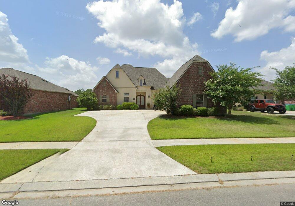
13314 Brookcrest Dr Walker, LA 70785
Estimated Value: $344,000 - $384,000
4
Beds
3
Baths
2,055
Sq Ft
$175/Sq Ft
Est. Value
About This Home
This home is located at 13314 Brookcrest Dr, Walker, LA 70785 and is currently estimated at $360,072, approximately $175 per square foot. 13314 Brookcrest Dr is a home located in Livingston Parish with nearby schools including Levi Milton Elementary School, North Corbin Junior High School, and Walker High School.
Ownership History
Date
Name
Owned For
Owner Type
Purchase Details
Closed on
Nov 1, 2011
Sold by
Frank Joshua R and Frank Sara E
Bought by
Womack William R and Womack Nancy M
Current Estimated Value
Home Financials for this Owner
Home Financials are based on the most recent Mortgage that was taken out on this home.
Original Mortgage
$175,000
Outstanding Balance
$119,160
Interest Rate
3.99%
Mortgage Type
New Conventional
Estimated Equity
$240,912
Purchase Details
Closed on
Mar 4, 2008
Sold by
Holland Herman B and Mcbeth Ernest Merele
Bought by
Frank Joshua Reuben and Frank Sara Elizabeth
Home Financials for this Owner
Home Financials are based on the most recent Mortgage that was taken out on this home.
Original Mortgage
$247,475
Interest Rate
5.67%
Mortgage Type
New Conventional
Create a Home Valuation Report for This Property
The Home Valuation Report is an in-depth analysis detailing your home's value as well as a comparison with similar homes in the area
Home Values in the Area
Average Home Value in this Area
Purchase History
| Date | Buyer | Sale Price | Title Company |
|---|---|---|---|
| Womack William R | $225,000 | Milestone Title Inc | |
| Frank Joshua Reuben | $260,500 | Milestone Title Inc |
Source: Public Records
Mortgage History
| Date | Status | Borrower | Loan Amount |
|---|---|---|---|
| Open | Womack William R | $175,000 | |
| Previous Owner | Frank Joshua Reuben | $247,475 |
Source: Public Records
Tax History
| Year | Tax Paid | Tax Assessment Tax Assessment Total Assessment is a certain percentage of the fair market value that is determined by local assessors to be the total taxable value of land and additions on the property. | Land | Improvement |
|---|---|---|---|---|
| 2024 | $3,401 | $32,592 | $4,110 | $28,482 |
| 2023 | $2,849 | $23,550 | $4,110 | $19,440 |
| 2022 | $2,869 | $23,550 | $4,110 | $19,440 |
| 2021 | $2,524 | $23,550 | $4,110 | $19,440 |
| 2020 | $2,511 | $23,550 | $4,110 | $19,440 |
| 2019 | $2,705 | $24,710 | $4,110 | $20,600 |
| 2018 | $2,729 | $24,710 | $4,110 | $20,600 |
| 2017 | $2,791 | $24,710 | $4,110 | $20,600 |
| 2015 | $1,725 | $22,310 | $4,110 | $18,200 |
| 2014 | $1,753 | $22,310 | $4,110 | $18,200 |
Source: Public Records
Map
Nearby Homes
- 13298 Brookcrest Dr
- 13366 Autumn Run Dr
- 13275 Brookcrest Dr
- 13417 Williamsburg Dr
- 13388 Williamsburg Dr
- 31019 Lake Spring Dr
- 31067 Autumn Lake Dr
- 30979 Ridgeway Dr
- 13361 David Lee Dr
- 13688 Alvin Sibley Rd
- 13515 Rose Dr
- TBD Pinkney Ln
- 13551 Rose Dr
- 30674 Corbin Ave
- 13267 Janet Ann Ln
- 13417 Meadow Crossing Dr
- 12514 Orchid Ln
- TBD Kathy's Cove
- TBD Weiss Rd
- 13563 S Trace Dr
- 13322 Brookcrest Dr
- 13330 Brookcrest Dr
- 13315 Brookcrest Dr
- 13307 Brookcrest Dr
- 13338 Brookcrest Dr
- 13290 Brookcrest Dr
- 13299 Brookcrest Dr
- 13287 Hollydale Dr
- 13331 Brookcrest Dr
- 13291 Brookcrest Dr
- 13339 Brookcrest Dr
- 30968 Cambridge Dr
- 72 Brookcrest Dr
- 75 Brookcrest Dr
- 77 Brookcrest Dr
- 78 Brookcrest Dr
- 79 Brookcrest Dr
- 80 Brookcrest Dr
- 81 Brookcrest Dr
- 84 Brookcrest Dr
Your Personal Tour Guide
Ask me questions while you tour the home.